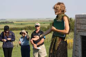
Our Vantage Points resources can easily be used in the classroom. We can create Resource Packages upon request. Email us at vantagepointsmb@gmail.com. We are happy to collaborate with teachers in accessing the substantial information on our website as well as assisting in finding additional resources.
Turtle Mountain and the Souris Plains – An Overview of Our History
Chapter 1: The Land
The Land in 1860
The dominant features of southwestern Manitoba were well known before the era of European settlement.
The first European fur traders and explorers created maps based on their observations, and information they received from the Aboriginal people who lived here.
The Hudson’s Bay and Northwest Companies employed cartographers to map the region.
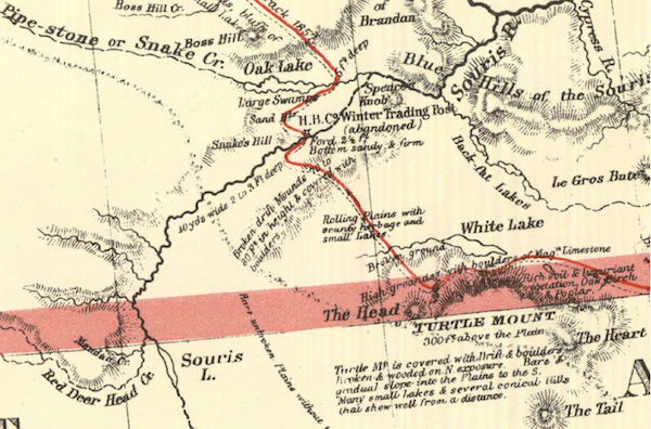
In the 1850’s and 60’s the governments of Canada and Great Britain sent expeditions to the west, hoping to prove that this land was suitable for agriculture. This map from about 1860 was produced by one of those expeditions.
Details of the features of Turtle Mountain, the Souris River and Whitewater Lake were shown.
Find Oak Lake – just under it is the notations “Large Swamps” & “Sand Hills” – indicating the range of sand hills that stretch south to the Souris River.
The only European “settlement” marked on this map is the “H.B.C. Winter Trading Post” near where Hartney is located today.
The only “road” is the “track” that runs from the top to Turtle Mountain.
The Land Today
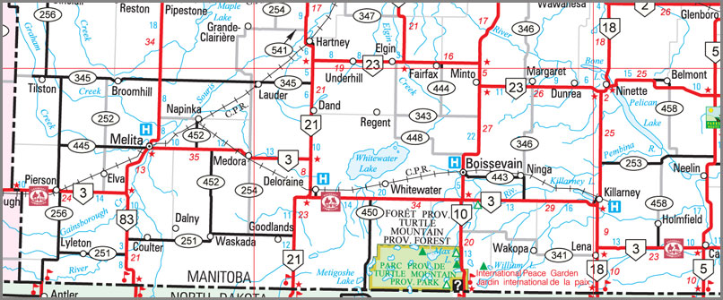
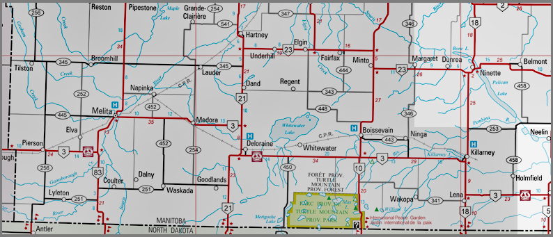
| After 150 years some of the names have changed – some remain. Some of the creeks flowing into the Souris River have been re-named. But the main features remain. In between the time of the “old” map and the modern map, many towns and villages have been created – some of those have disappeared. Many railway lines have been built – most of those have also been removed. And of course thousands of kilometers of roads have been built – only the main ones appear on most highway maps. |
Turtle Mountain
| About a hundred million years ago southwest Manitoba was part of the Western Interior Seaway. The climate was a lot warmer than today, and huge reptiles called mosasaurs were the toughest beasts around. Then, about 66 million years ago, an asteroid crashed into southern Mexico. The blast was so strong that the dust and debris blocked the sun and slowly cooled the climate. In a short period 75 percent of all species on earth became extinct, including most of the dinosaurs. About two million years ago we entered a series of Ice Ages. Giant glaciers covered the land, and then melted off. It was a long process and it created the landscape we know today There were long periods between the visits of the glaciers. We’re in one of them now. |
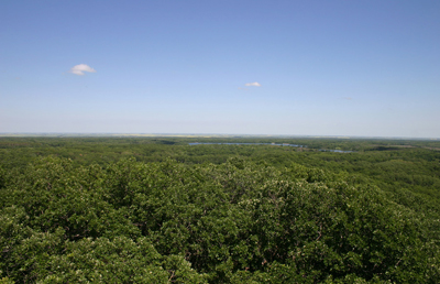
The view from a Lookout Tower on Turtle’s Back
| As the ice melted, material that was carried by the glaciers was deposited over Turtle Mountain. By about 12,800 years ago Turtle Mountain was free of ice. As the last glacier retreated it carved many shallow lakes and wetlands and shaped the hills. Many steep ravines were created by streams of run-off waters flowing from the high ground to the low plains. Turtle Mountain, surrounded by the flat prairie of the Souris Plains, was one of the first things travelers to this region noticed. What is known as the Turtle’s Head, at the western end of Turtle Mountain, is the second highest point in all of Manitoba. |

Turtle’s Back as viewed from the beach at William Lake.
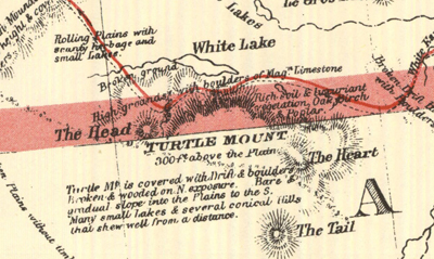
This map from 1860 shows the features of Turtle Mountain.
The Souris River
| A traveler to the Southwest Corner can see Turtle Mountain from quite a distance. Another important feature of the region, the Souris River, is often hidden in a deep valley and might not be noticed until you are overlooking it. Here in Manitoba we see only about a quarter of the Souris River drainage basin. It begins north of Weyburn, Saskatchewan. It travels through southeast Saskatchewan and northern North Dakota where it makes a giant U-turn (known as the Souris Loop) before entering Manitoba south of Melita. From the border to Souris the stream is gentle as it twists and turns its way through rolling hills. It then drops 480 meters in elevation by the time it empties into the Assiniboine River, picking up speed as it passes through a deep valley. On these wide-open dry plains, the river valley offered wood, water and shelter. Plains hunters camped on the banks. They trapped and hunted the animals that also took shelter there. |
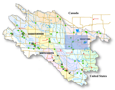
The full extent of the Souris River Basin is shown here.
The Turtle Mountain Souris Plains Region (Shaded) is a small part of the drainage area.
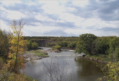
The Souris River from the old Riverside Bridge on Highway 10 north of Minto.
| In recent years, several dams have been built in an attempt to control the flooding tendencies of the Souris River but it has proven difficult to control. In recent years floods have caused a great deal of damage and expense. The Souris River is a commanding presence in Southwest Manitoba. Whether flowing mildly between its banks, or rising to threaten land and livelihood, it continues to be a central feature in the lives of those who live alongside it. |
The Lauder Sandhills
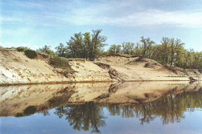
| About 10,000 years ago, when the glaciers from the last ice age were melting, huge lakes were formed. Glacial Lake Hind covered the area around present-day Hartney. Huge deposits of sand formed a delta where a river ran into the still body of Lake Hind. Today they are the Lauder Sandhills. |
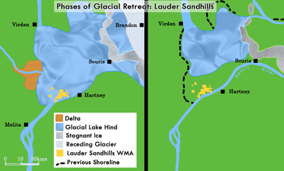
| As the climate kept changing, the land was at times marshes, lakes and sloughs, and at other times, sand dunes. The nearby Souris River and surrounding grasslands made the hills a good place for the bison and for hunters. |
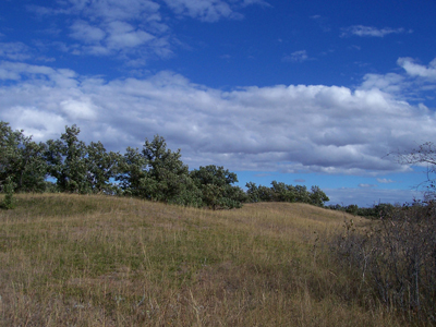
| Over time, trees and vegetation made this an attractive place to live. The Lauder Sandhills Wildlife Management Area was established in 1971, originally to protect the winter habitat of the white-tailed deer. |
Whitewater Lake
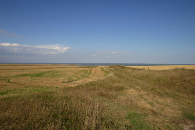
| When the glaciers that once covered all of Canada began to disappear about 12,000 years ago, they left huge lakes and rivers. Most of those lakes have disappeared, but Whitewater Lake is the last evidence of Lake Souris, which once covered the region between Turtle Mountain and the Souris River. It is large, about 20 kilometers long, but shallow. It is fed by creeks from Turtle Mountain during heavy rains and the spring run-off. Because it is shallow, a dry spell, or a few dry years, can really affect its size. It has gone dry on several occasions. In 1913 the lake dried up, and government engineers surveyed the land, reporting that it should be sold as farmland. But by the next spring it was a lake again! During the “Dirty Thirties” and the 1980’s the lake also disappeared and trails led across it as people made short-cuts. The plains around Whitewater Lake were well-known to the Nakota, and later, to the Métis as a good place to find bison. The last bison anyone saw in the Turtle Mountain area was spotted just to the east of Whitewater Lake in 1883. Fur-bearing animals, such as mink and muskrat, attracted trappers and traders to the region. The muskrat furs that came from Whitewater Lake were of especially good quality and fetched a good price. With the arrival of homesteaders the frozen lake served as a road. Teams of horses transported loads of grain from farms on the north side of the lake to Whitewater village on the southern shore. Firewood from Turtle Mountain was hauled in caravans of sleighs to homes north of the lake, and the road across the ice often became a very busy highway. Bird Sanctuary Whitewater Lake was the traditional nesting grounds for the whooping cranes until their near extinction around 1880. Though the number of birds on the lake in modern times does not come close to the numbers found during settler days, it remains an important stopping place during migrations. The south shore is a popular spot among birders. |
Grassland
| Grassland is the name of a municipality formed in 2015 when the Town of Hartney joined the Municipalities of Cameron and Whitewater. The name refers to the large prairie, between the Souris River and Turtle Mountain, that is another important geographic feature of Southwest Manitoba. These plains were a vital resource to Aboriginal Peoples, to Métis hunters and traders, to pioneer homesteaders, and now to modern and large-scale farmers. |
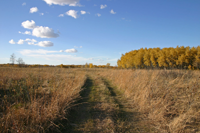
A grassland is a region where the average annual precipitation is enough to support grasses, but has few trees. Grasses can survive fires because they grow from the bottom instead of the top. Their stems grow again after being burned off.
Fires help certain plants by clearing ground cover, which helps the germination of seeds, and by nourishing the soil with freshly burnt vegetation.
Manitoba’s Mixed-Grass Prairie
This landscape developed from years of low precipitation and regular prairie fires. These fires kept trees from growing except along rivers and streams and allowed for the wide areas of prairie grasses that fed the huge bison herds. These herds provided the plains people with nearly everything they needed for a good life.
With the arrival of the European traders, the bison served an additional purpose as a trade good – the fuel of the fur-trade.
Breadbasket to the World
The land that was perfect for the bison was also good for growing grain and feeding livestock. The soil is deep and dark. The upper layers are the most fertile because of the buildup of many layers of dead branching stems and roots.
Farmers were able to adapt the land for agriculture.
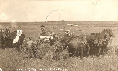
Harvesting in the good old days.
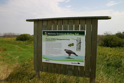
A Manitoba Grassland Birding Trail near Lyleton
A Home for the Birds
The grasslands of Southwestern Manitoba are known for their variety of birds. Trails and Wildlife Management Areas have been developed and visitors come from all over the world.
Killarney Lake
| In the early 1880’s Killarney Lake, then called Oak Lake, was attractive to a group of settlers from Ontario. A town quickly sprang up there and the residents have always made good use of the lake for boating, fishing and swimming. |

Chapter 2: The First People

The First Hunters
| After the most recent retreat of the glaciers, humans, who had alread populated most other parts of the world, made their way to Turtle Mountain. It was the first place in the region to be free of ice. It was soon home to both the hunter and the hunted. The Clovis Culture The first to arrive were a group we call the Clovis Culture. That was about 12000 years ago. 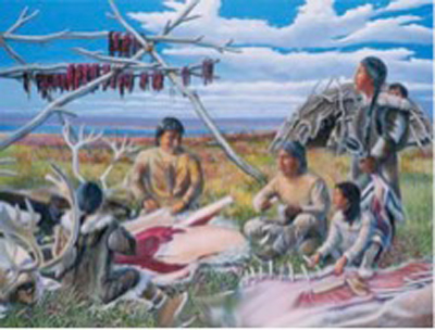 They came from the south, around New Mexico and Arizona, and would have moved north slowly as the climate warmed and the ice disappeared. We know little about them, but can identify them by the tools they left behind, especially the stone points they crafted for the tips of their weapons. Clovis points that have been found in Southwestern Manitoba were made of Knife River flint from southern North Dakota, and crafted into sharp points shaped like a willow leaf. Attached to sturdy spears, these points could be used to take down even the huge woolly mammoth. Taking down a mammoth would take skill, teamwork, courage and the best weapon you could get. These spear points would have been very valuable. 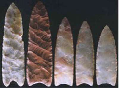 Folsom projectile points The next “settlers” were the Folsom people. Their spear points were smaller and thinner than the Clovis points. This may have been because they were hunting smaller animals. Mammoths had slowly become extinct. It was pre-historic buffalo that the Folsom hunters hunted. From about 10000 to 70000 years ago the Plano people hunted buffalo and pronghorn here. Pronghorn are the only large mammals in North America to survive the coming of man. But buffalo were becoming the most important prey. By about 6000 years ago, agriculture, which developed far to the south, had appeared in Manitoba.  The Pronghorn survived in Manitoba until about 1900, and now prefers the wide-open spaces of Saskatchewan and Alberta. |
Big Game

There was a time when mastodons, mammoths, camels, horses, and huge long-haired bison roamed the Souris Plains and sought shelter on Turtle Mountain. Traces of them start to disappear at about the end of the last ice age – about 12000 BC, and by 6000 BC two-thirds of the species of North American mammals that weighed more than 60 kilograms at maturity had become extinct. Could it have been that the climate was getting warmer and drier? The animals that travelled in large herds may have not been able to adapt. Or the warmer temperatures may have disrupted breeding cycles. If climate was the problem, why were the animals not able to move to a more suitable region? Another possibility is that these large mammals faced a new threat – humans. As the ice retreated, human hunters spread across the continent, continually improving and adapting their hunting practices. These humans, unlike the other predators, were able to organize and improvise. They were deadly enemies. Perhaps the climate may have weakened the populations and the humans finished them off. 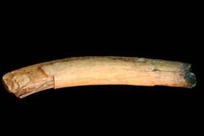 A mammoth tusk found in Southern Manitoba, on display at the Moncur Gallery in Boissevain 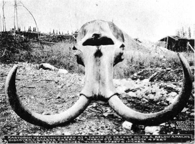 A mammoth skull |
The Bison People
| By about 4500 years ago the climate was similar to what we have today. In Southwestern Manitoba a series of cultures developed great skill in hunting and using the bison. When the first European traders and explorers came to this land they found that the people here depended on the bison for nearly everything. It was their main food. The hides gave them shelter and clothing. Tools were made from the bones and sinews. By drying the meat in strips and pounding in fat and they made pemmican – a food that was nutritious and would last a long time without spoiling. The lifestyle was developed over hundreds of years. The Oxbow culture were perhaps the first to stew or boil their meat by placing heated stones in a lined pit full of water, meat and bones. It was an especially good way of removing the rich marrow from cracked bison bones. They also left the first tepee rings, and they were the first to bury their dead. They lived in the region for a long time. The McKean people continued to perfect methods for killing, processing, and using the bison. A well-known kill and butchering site at Cherry Point on Oak Lake has yielded important artifacts left there over 2000 years ago. They would drive small herds into the marsh at the edge of the lake where some would get bogged down and hunters could kill them with spears. 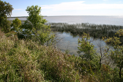 Cherry Point The Pelican Lake People may have been the first to think of killing bison by driving herds over steep cliffs. They also seem to have perfected the use of the Pound – herding animals into a fenced enclosure where they could kill them with spears. They traded widely to the south and east, and crafted ornaments from the shells and copper they obtained. The Besant-Sonata Culture was also a trading culture. Remains of their pottery have been found in dozens of sites throughout southern Manitoba, including sites along the Souris River, and at Clay Banks Buffalo Jump site near Cartwright. |
The Bison Lifestyle
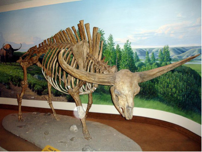
The bison you might see in a zoo today would weigh no more than 1,500 kg and have a maximum height of 1.80 metres. 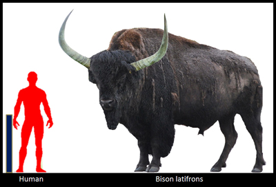 But its ancestors, who roamed the Souris Plains about 10000 years ago, were much bigger. Bison latifrons it was called. It was 2.5 meters high and his head held an antler more than 2.5 meters long. 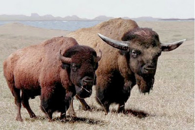 An artist has imagined what the modern and the Ice-Age animals might look like side by side. About 5000 years ago the bison cultures became the main residents of the plains. Vegetation and climate stabilized, evolving to what we know today. Hunting practices probably evolved along with the bison. From 1000 to 2000 years ago southwestern Manitoba was home to many seasonal camp and bison kill sites for hunter-gatherers. Elsewhere in North America during those times Inca, Mayan and Aztec civilizations of Central and South America had erected large cities. The Anasazi, or Ancient Pueblo Peoples were building cliff dwellings in Utah, Colorado, Arizona and New Mexico. To the east the Iroquois and Huron civilizations flourished in their large villages. The north-central plains were one spot in North America were agriculture wasn’t important. The climate wasn’t suitable and the huge bison herds provided nearly everything the people needed. Of course they took advantage of other available large game, they trapped small animals, and foraged for seeds and vegetables. They adapted to their surrounding. The hunter / gatherer lifestyle was the logical choice for the time and place. In other places, and at other times, other strategies were needed. |
The Hunt
| Over centuries the Plains People found hunting methods that worked for them in their region. If there were steep cliffs or valleys, they might create a jump, by herding the animals over the edge. If there were no hills they might build a pound – a fenced in area – and trap the animals inside where they could be shot by arrows. 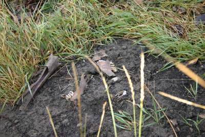 The Brockinton Site along the Souris River near Melita, has been carefully examined and is one of many kill sites in Southwestern Manitoba. The site was occupied by three different cultures over the last 1600 years. These occupations left behind valuable evidence about how the people lived. For instance, things like the type of pottery they used and the type of material they used for arrowheads tell us about where they traded, and how far they might have travelled. Bison bones can easily be found today along the banks of the Souris River. |
Weapons and Tools
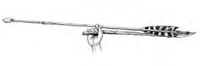 The Awesome Atlati The spear is used all across the world. The bow and arrow was created in Africa and the first people to arrive in North America brought them along. They also brought along the atlati – a powerful weapon capable of sending a projectile over 120 yards and killing a wooly mammoth. It was the first complex weapon system developed by humans. It originated in Europe over 30,000 years ago and spread wherever humans lived. The atlatl consists of two parts: the atlatl itself and the dart. The atlatl is held in the hand, and acts as a lever to propel the dart with more force. The atlatl can be made completely of wood, bone, or both and some may incorporate weights made from stone or shell. Projectile Points Numerous detachable tips that were used on weapons such as arrows or spears have been collected. Stone points may be unifacial (one cutting edge) or bifacial and may be manufactured by flaking or grinding. Projectile points are particularly useful time markers for the archaeologist because of members of a culture, often kept to a particular style. For example, three styles of projectile points are associated with the McKean culture: McKean, Duncan and Hanna. The McKean has a concave base with no side notching, the Duncan has a similar base but includes side-notching. The Hanna point has wider corner notches. 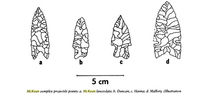 Scrapers Scrapers were also generally made of stone. They were used to scrape hides to remove hair and fat, and to soften skin. They were also used for cutting skin. 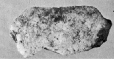 Scrapers are typically formed by chipping the end of a flake of stone in order to create one sharp side and to keep the rest of the sides dull so you could hang on to them. |
The First Nations
The Turtle Mountain – Souris Plains area has been home to many cultures, and was on trading routes that connected those cultures to others far distant from here. In the past 2000 years the people living here increased their dependence on immense herds of bison. The herds were always on the move and roamed a huge territory. To make use of them the hunters had to move with them. Permanent villages were not helpful. By the 1700’s when explorers from New France began showing an interest in this region, it was often visited by hunters from Nakota (Assiniboine), Dakota (Sioux), Cree, and Ojibway people. It was the Nakota, whom LaVerendrye encountered on his trips in 1838 and afterwards. Over the centuries various cultures developed better weapons and sharper tools. They learned to use all parts of a carcass to provide food, clothing, shelter and tools. They developed hunting methods, relying on stealth, marksmanship, camouflage, and finally the mass killing fields allowed by pounds and jumps. They got really good at harvesting and using the most readily available resource on the plains. A successful society is able to offer its people a fair chance at health and happiness. They were successful. The Plains People were originally from the east where they had lived in villages, and existed by hunting, gathering and growing crops. When they moved to the plains they had to be able to move with the bison. They developed portable houses called teepees. Today we refer to descendants of these groups of people as First Nations. Their ancestors have a long history in this land. Campsite and Villages The Souris River and its valley had resources that both animals and humans needed. It offered a reliable source of fresh water, shelter, game, wood and wild fruit. The river had been witness to the activities of the large-game hunting societies of the Clovis and Folsom people who closely followed the receding glaciers. These and later peoples left evidence of their travels and habitations in the area – tipi rings, fireplaces, medicine wheels, surface graves and stone circles are only some of the impressions that remain. Turtle Mountain also afforded shelter and resources for campsites, both short and long term. |
Territory Changes 1805 – 1877
In 1805 Southwest Manitoba was mainly Assiniboine territory. 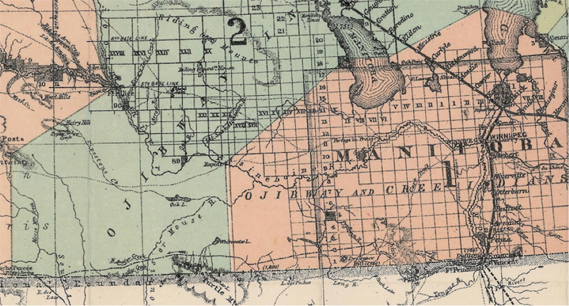 By 1877 when this map shows that the Ojibway were the main occupants of this land. The Assiniboine had moved west. |
The Assinibione (Nakota)
| Assiniboine (Nakota) Camp, Manitoba, July 17, 1874 In the summer of 1738 a group of about 100 Assiniboine lodges camped beside Cherry Creek (near present-day Boissevain) had an interesting visitor. A group of French traders led by Sieur de la Verendrye came to them with a request. He was looking for a route to what he referred to as a Western Sea. He knew of a tribe he called the Mandans who lived somewhere to the south. He wanted help in finding them. Several of the Assiniboine agreed to travel with him to show him the way to the Mandan villages on the Missouri River. The Assiniboine were good partners to the Europeans. They gained new trade goods, which made their work easier. In turn, the Assiniboine helped Europeans traders as middlemen, excellent horsemen, and providers of food to trading posts. From the Lake of the Woods region, the Assiniboine moved west sometime before 1680. It was here on the prairies that the Assiniboine discovered the bison . They wintered in places like Turtle Mountain where shelter and wildlife were plentiful. In the long run, the relationship with European traders had a devastating effect on the Assiniboine. Along with trade goods the newcomers brought whiskey, guns and disease – the guns proved useful but the whiskey and disease caused great damage. One-half to two-thirds of the population died in the smallpox epidemic of 1780-81, before being cut in half again in the 1819-20 epidemic of measles and whooping cough. By 1865, the Assiniboine were reduced to about one-tenth their original number. They migrated west and this once dominant nation were placed on reserves in Alberta, Saskatchewan and Montana. Manitoba has no Assiniboine reserves, only individual members living off-reserve. Only a few hundred remain today and are known by their original name – “Stoneys”. |
The Dakota
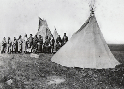
The Turtle Mountain Dakota. Chief H’Damani is seen here third from the right, 1870’s.
The Dakota people have deep roots in the Turtle Mountain – Souris Plains Region.
In the 1600 and 1700’s the Dakota lived in in territory that is now Ontario, Quebec and the north-eastern US states.
In 1851 the Dakota were forced to sign a treaty with the powerful American government. They were forced to surrender all of their land and move west.
In the summer of 1862 a minor confrontation led to a widespread armed revolt as some of the more desperate leaders tried to reclaim their lands, their lives, and a different future for their children.
The uprising failed, and soon after, about 1000 Dakota came to Manitoba. They arrived claiming that they had an historic right to be on British soil; that these lands were in fact part of their traditional territory.
The Canadian government allowed the Dakota to stay but never did sign a Treaty with them.
Turtle Mountain Reserve (IR#60)
In 1862 a Dakota Santee band led by Chief H’damani claimed to have bought the land referred to as “Turtle Mountain” from the Ojibway and requested a reserve for his people.
At first the Manitoba Government declined, but H’Damani was determined to provide for his people. When he refused to move to the Oak Lake Reserve when it opened in 1877, the government finally gave in and the Turtle Mountain Reserve was established. It became the smallest reserve in Canada, measuring only one square mile.
Later H’damani and a few others turned down a $200 government pay-off to relocate to a reserve near Pipestone. By 1909, only H’damani, his grandson Chaske (later known as Sitting Eagle) and a few others remained.
Chapter 3: The Fur Trade
Page 19: The Hartney – Lauder Posts
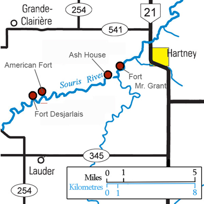 The fur trade in Manitoba began with the establishment of the Hudson’s Bay Company in 1670, and for nearly a century Aboriginal traders made the long trip to the shores of Hudson’s Bay to exchange furs for European trade goods shipped in from Britain. In the 1870’s independent traders, and the Northwest Company from Montreal, started to trade in what used to be HBC territory. The HBC had to move out from Hudson’s Bay to compete. For a time, Souris Mouth, where the Souris River empties into the Assiniboine, was an important centre with up to five trading posts operating within a few kilometres. Starting in 1795, traders were building trading posts farther west, along the Souris River. Between Hartney and Lauder, four important posts have been identified. These posts were along the river and close to the grazing grounds of the bison. The production and supply of pemmican, was a big part of their business. Fort Ash (Fort de la Freniere) The first fur post established on the river was Fort Ash. Canadian explorer David Thompson spent about two days in the region in December of 1797, on his way south to Mandan country. He recalled passing by “the old trading post called the Ash House from the plenty of those fine trees. It had to be given up from it being too open to the incursions of the Sioux.” The American Fort On the north bank of the Souris, almost straight north of Lauder, is a site locals referred to as the American Fort, likely built by the American Fur Company in about 1810. The size of its chimney mounds indicates that it was in operation for some time, but few records have been found to tell us more. Fort Mr. Grant In 1824 Cuthbert Grant built Fort Grant on the Souris River, about two miles south west of Hartney. He was encouraged in this venture by HBC boss, Governor Simpson, who expected Grant to keep American and independent traders out of the Souris Valley. It is on the north bank of the river, perhaps fifty yards from the water. The cellars and chimney mounds were still visible in 1948. Fort Grant operated from 1824-1861, part of this time as a winter fort only. |
Page 20: Fort Desjarlais
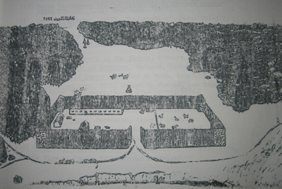
A sketch from the “Souris Valley Plains” by Hartney teacher and historian Larry Clarke.
| Fort Desjarlais, built in 1836 by Joseph Desjarlais, was located on the north bank of the Souris, north of Lauder and very close to the American Fort. It featured a sturdy oak palisade surrounding a long log building and several smaller ones. The Souris River ran past the south wall. As the site was in the territory frequented by Dakota war parties it was well protected. At its peak there would often be over seventy men at the fort. It operated for about twenty years, and was likely destroyed in the great prairie fire that swept the region in 1856. The fort was serviced mainly by Red River carts using the Yellow Quill Trail, which ran from near Fort Garry (Winnipeg), up the Assiniboine and Souris Rivers. It is believed that Desjarlais and his men were also bison hunters – trading buffalo robes and selling pemmican to the Hudson Bay Company. A Changing Economy Around 1850 the fur trade was becoming a less important part of the economy of our country. By 1874 the boundary between Canada and the United States was marked and both countries began surveying the land and dividing it into the section-township-range system – for use as farms. |
The Desjarlais site in 2016.
Page 21: The Turtle Mountain & Souris River Posts
| In addition to the clusters of posts at Souris Mouth and in the Hartney-Lauder area, there were several other attempts to reach out to suppliers. Lena House In the fall of 1801, John McKay of Brandon House sent Henry Lena with seven men and supplies to Turtle Mountain along with instructions to “cut off every independent” fur trader in that area. Lena House is one of two fur trading posts located near Turtle Mountain. It was close to the southeastern shore of Whitewater Lake and some distance east of Turtlehead Creek. It operated from about 1801 until 1802 but was not very successful in its aim of closing down rival trade in the area. The XY Company set up a trading post about a kilometre away, placing themselves directly on the path that the Assiniboine First Nations would take were they to cross Turtle Mountain to trade. In 1846, Governor Simpson of the HBC informed the Company head office in London that a new post was being established on Turtle Mountain. This fort seems to have operated from 1846 to 1855. Lena House wasn’t a big success. It did survive long enough, though, to provide the name for one of southwestern Manitoba’s small hamlets. Although there is little left of Lena the village, it is also the name of an international port of entry south of Killarney. Sourisford Area A total of 18 posts grew and faded from the Souris River between present-day Souris, Manitoba and Minot, North Dakota. Almost all traces have been erased and few records remain, but we do know that an American Fur Company Trading Post was located near where North Antler Creek enters the Souris. There is also a record of a post near Melita operated by Peter Garrioch, established in 1843, and at least one other independent operation in the Melita – Napinka area. |
Page 22: The Metis Hunting Grounds
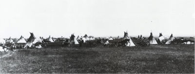
Metis Hunting Camp
| Beginning around 1820, large hunting expeditions from the Red River Settlement set out twice a year to supply the settlers and the Hudson’s Bay Company with pemmican and hides. The hunt was very important to the food supply of the HBC and the settlers at Red River (now known as Winnipeg). The hunt got bigger each year until about 1840, when 1,210 carts were used. The larger hunt took place in summer and a smaller one in autumn. Wintering Communities In some cases Metis hunting communities located on the plains in temporary villages. Some were only several families large, while others could have 1000 people. The villages were made up of roughly-built sturdy huts. It often took no longer than a day or two to construct such a hut with the aid of a single axe and a knife. A wintering community generally consisted of hunters, their families and a few fur traders. 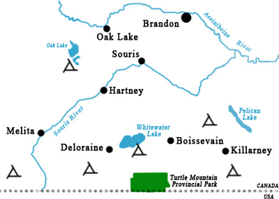 The general locations of the some of the wintering communities that existed in southwest Manitoba. The general locations of the some of the wintering communities that existed in southwest Manitoba.Buildings were usually constructed in late fall in preparation for winter and abandoned in early spring. Sites of past communities were not generally returned to year after year because of changes in bison wintering ranges, and also due to the fact that rival First Nations would often burn the buildings to the ground as soon as they were unoccupied. As the bison disappeared in the late 1870s, wintering communities were not needed and most of them simply disappeared from the prairies. Some Métis hunters and their families did stay and become the first homesteaders in the region. |
Chapter 4: Transition
Page 23: Preparing the Way
| In 1870 Canada made a deal with the Hudson’s Bay Company, and gained control of territory that included most of what today is Manitoba, Saskatchewan and Alberta. The era of the Fur Trade was over. The plan was to open up this huge new territory for farming. In 1876 the territory west of Boissevain wasn’t surveyed. Before that could happen there were several questions to answer. First: Who really owned this land? Canada purchased it from the Hudson’s Bay Company – but what about the First Nations people, the Ojibway, the Cree, and the Nakota and Dakota who had been living on this land for centuries? Wasn’t it really their land? Second: Were these dry open lands in the west even suitable for agriculture? Some thought it was too dry and that the growing season was too short. Others felt that it would be perfect for growing wheat – the most important crop of the time. No one was really sure how farming would work here. Third: How were these thousands of new farmers going to get there – across the thousands of kilometres of the rocky terrain of the Canadian Shield? In 1870 it was a difficult journey of several weeks. And even if they got here and grew crops, how would they get those crops back east where they could be sold? Fourth: Would Ontario and British settlers really want to come to this cold and unknown land? It would mean leaving family and friends behind. It would mean taking a big chance. |
Page 24: Treaties
| Who owned the Prairies? The Government of Canada bought this huge parcel of land from the Hudson’s Bay Company. The HBC had been granted the use of the land by the British Government in 1670 for the purpose of trading in furs. The intent was to populate the land with farmers. But what about the Aboriginal people who lived here? The solution was to make deals called Treaties. The First Nations communities knew that their old way of life was gone. The bison herds were gone. They were interested in securing a more certain future for themselves and generations to come. Treaty 1 which covered the central and eastern parts of Manitoba, was signed on August 3rd 1871. In exchange for certain payments and guarantees of services, the First Nations agreed to give up the use of all of their land except for reserves. They pledged that they and their people would “maintain peace between themselves and Her Majesty’s white subjects, and not interfere with the property or in any way molest the persons of Her Majesty’s subjects.” Treaty 2, which included almost all of the Turtle Mountain – Souris Plains Region was signed on the 21st of August 1871. Two other separate arrangements where made with the Dakota in the region. A small reserve (IR #60) was set aside on Turtle Mountain for a group of Dakota families. Today most people would agree that the deals made with both the First Nations and Metis communities were not fair, and that the First Nations didn’t have a lot of choice in the matter. |
The boundary between Treaty 1 and Treaty 2 land is close to where Boissevain is today.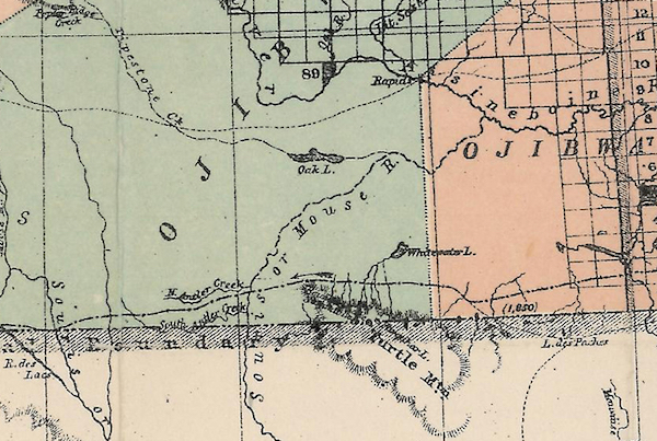 The Numbered Treaties, in addition to the passage of the Indian Act in 1876, marked the beginning of a new relationship between western First Nations and the Canadian government. The Numbered Treaties, in addition to the passage of the Indian Act in 1876, marked the beginning of a new relationship between western First Nations and the Canadian government.Questions arose about whether the deals were fair and whether the Government of Canada was keeping its promises surfaced soon after the Treaties were signed, and in recent decades a series of official apologies, hard fought battles for reparations, and Supreme Court decisions have resulted from a determined effort by First Nations to correct a series of wrongs. Reconciliation is the aim. |
Page 25: The Metis Claim
| In 1869, the area we now call Manitoba would likely have become part of the District of Assiniboia – a large district that would include present day Saskatchewan and Alberta as well. It would have been administered by a Governor and Council, it might well have been some time before it became a province. Alberta and Saskatchewan had to wait until 1905. What the government overlooked was that there were already people here. The Metis people who had lived here for decades in well-established communities, quite naturally objected when surveyors arrived who seemed determined to re-draw the maps as if they weren’t even there. For several generations the Metis made up the majority of the population in Red River. The Resistance in 1869 and the North West Resistance of 1885 uprooted Métis families from their homesteads and scattered them in all directions. The Government promised that each Metis family would get a farm, but the way it was done has caused disagreements to this day, and many people feel that promises were not kept. The Turtle Mountain Connection 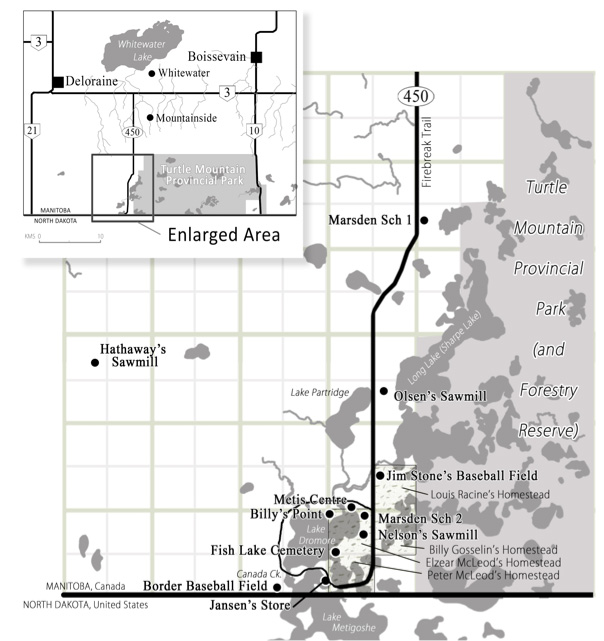 The Métis have a long history of interaction with the landform known as Turtle Mountain. Turtle Mountain and Whitewater Lake to the north were prime hunting grounds. During the summer and fall hunting seasons the Métis grew familiar with the plains surrounding Turtle Mountain. Turtle Mountain provided resources from which temporary winter camps could be built: construction materials for simple cabins, firewood, and shelter from the stiff winter winds. The first permanent Métis settlers moved to Turtle Mountain in 1908. The first group were descendants of the Red River Métis and came north from Belcourt, North Dakota. The following decades saw more families move into the bush land surrounding Lake Metigoshe, Lake Dromore and Sharpe Lake (at the time known as Long Lake). Some European settlers married into Métis families and the community grew. |
Page 26: Farming on The Prairies
| It is a common perception that most plains Aboriginal peoples were all nomadic wanderers who existed without the use of agriculture. Though this was true of some First Nations, we know that agricultural activities in Southwestern Manitoba did not begin with European settlers. However the constant movement of the buffalo hunting societies made agriculture difficult, and the abundance provided by those animals made it unnecessary. The first European “settlements” or communities in western Manitoba were fur trade posts. We also know that they tried to supplement their provisions with some form of agriculture – and reported some success. But could people make a living on these plains through farming alone? The Canadian government sent Professor Henry Youle Hind, a Toronto geologist, to explore the region and answer that question. During the summer of 1859 he and his party of 13 men explored southwestern Manitoba. They noted the lack of timber, but found what they were looking for – fertile land. In 1859 a British expeditions by Capt. Palliser also explored the Northwest Territories to examine the suitability of the region for agricultural settlement. He was impressed with the parkland along the Saskatchewan River but defined the large area south of that, including much of southwestern Manitoba as near-desert, unsuited for settlement. His opinion was contradicted by a later report by John Macoun that essentially predicted that the prairie grassland would be the breadbasket to the world. |
Page 27: Transportation
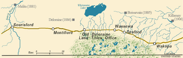
The first highway to Southwestern Manitoba.
Crossing the Souris River at Sourisford, 1874
| The Boundary Commission Trail In 1873, the British and United States Boundary Commissioners followed a route along the 49th Parallel as they marked the boundary between the U.S. and Canada. |
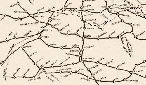
| By 1920 rail lines crossed southern Manitoba. The National Dream The Conservative government led by John A. MacDonald had a long-time dream of building a railway that would span the country from coast to coast. The settling of the west and the establishment of farms would depend on having this modern fast method of travel. |
Page 28: Why They Came
For the first settlers, it was a long slow journey.
| The Government of Canada negotiated Treaties with the First Nations. They had reason to believe that this land was suitable for farming, and had arranged a transportation system that would get people here and get farm produce to market. One issue remained. Would the settlers come? Would large numbers of people leave their home and travel to an unknown land? There were reasons to believe that many would take the step, There were circumstances in Europe and Upper Canada that might cause people to want to leave their communities and consider Manitoba as an option. Poor employment opportunities and shortage of good farm land might cause some settlers to leave established communities like those in Ontario. In other parts of the world these reasons might also apply, while famine, war, disease, and a desire for political change might also be good reason to leave a place. Some might just have had an “adventurous spirit” or ambition. I’m Hearing Good Reports….. There were also some good reports from people who had visited and thought the place was great. The most famous of those was “The Great Lone Land” How could one resist the land described as follows? “The great ocean itself does not present more infinite variety than does the prairie ocean of which we speak. In winter, a dazzling surface of purest snow; in early summer, a vast expanse of grass and pale pink roses; in autumn, too often a wild sea of raging fire. No ocean of water in the world can vie with its gorgeous sunsets; no solitude can equal the loneliness of a night-shadowed prairie: one feels the stillness and hears the silence, the wail of the prowling wolf makes the voice of solitude audible, the stars look down through infinite silence upon a silence almost as intense…” William Francis Butler had visited in 1870 and he was impressed. Many people in Ontario and in Britain read his book. Others writing in newspapers gave first hand accounts of the great opportunities available in the new west. |
Chapter 5: Pioneers
Page 29: A Good Decision – The Mooneys Come West
In 1880 John and Letitia Mooney and their family came west to a farm near Wawanesa. Their six-year old daughter, whom we now know as Nellie McClung, wrote a good account of her family’s journey from their comfortable Ontario farm house to the Manitoba frontier. 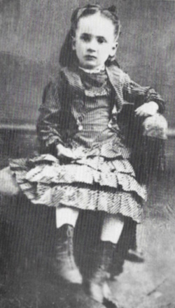 This photo of Nellie Mooney was taken the day before her family left Ontario for their new home in Manitoba. This photo of Nellie Mooney was taken the day before her family left Ontario for their new home in Manitoba.It started when their son Will told the family about a book he read called “The Great Lone Land” which told tales of the adventure and the beauty to be found in the west. The family also saw newspaper stories that spoke of the wide open spaces out west. A visitor who had been to the west told of, “wild strawberries … so thick that they stained the feet of the oxen red.” It sounded great. The Mooneys were a large family and only had a small farm. There was no future where they lived. Nellie remembers her mom saying, “We have to go somewhere, “John, there’s nothing here for our three boys. What can we do with one hundred and fifty stony acres? The boys will be hired men all their lives, or clerks in a store.” Will knew people who had been west and talked of, “a plain a hundred miles wide, and not a tree or stone in sight.” Stones and trees had made establishing these Ontario farms quite an effort. The bald prairie would be easy to plow. Of course, they also wondered if it was all too good to be true. John wondered about the cold, about whether apple trees would grow, about mosquitoes and stories about the Aboriginal people who lived there. Would it be dangerous? Would they miss the comforts of their home? They decided to give it a try. The Trip The Mooneys’ trip also followed a well-known pattern. The quickest, easiest way to Manitoba in 1880 was by boat across the Great Lakes to Duluth, then by train to Winnipeg. From there settlers had the option of riverboat or ox-cart trail depending on their destination. Often there was a stay in Winnipeg while the husband or son scouted for a suitable homestead. Then on the trail there would often be a stop – perhaps at Portage for supplies. Almost all accounts mention both hospitality and hardship as swamps, creeks, mud roads and equipment failure made the trip interesting. |
Page 30: Mrs. Weightman Makes a Fresh Start
| Mrs. Elizabeth Weightman, a widow from northern England, and her children, arrived at their homestead in the spring of 1882 after a fifty-six day journey from Edinburgh, Scotland. They crossed the ocean on a crowded ship, then took the train to Lake Huron, where they caught a steamboat to Duluth, and another train to Brandon. At Brandon they bought the usual homestead supplies; oxen, a wagon, a plow, a tin stove, a tent and two cows. They decided to search for land and headed south from Brandon with a few other newcomers. On the second day out, news reached the party about land recently opened for homesteading, so a delegation sped ahead on a horse-drawn wagon towards the Land Titles Office in Deloraine. The rest continued with the oxen and supplies. High creeks and wet ground slowed them down – on a particularly bad day they travelled just five kilometers. |
| The reward came when the group returned from the Land Titles Office with the papers entitling them each to a homestead. Two long days later the Weightmans found their plot of land. They were home. As quickly as possible they broke some land and planted a few acres of oats and some potatoes. A sod barn was erected and a modest frame house was built – not quite finished for the coming of the first blizzard, but quite an improvement over the tents that had provided their only shelter so far. |
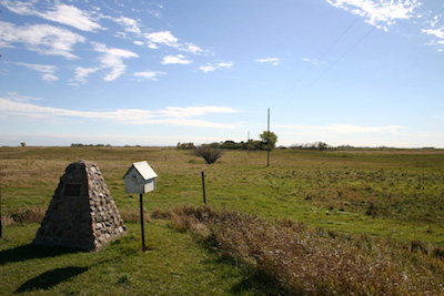
A school, also called West Hall was built on the Weightman property. Their original
farm yard is not occupied, but visible in the background.
Page 31: How to Build a “Soddy”.
| Most of the first settlers started their homesteading life in a sod hut. Trees were scarce and wood was expensive. Getting that first crop planted was the priority. “Soddies” as they were called, provided quick shelter until a better house could be built. Here’s how to build one: Pick a little rise of land with good drainage to build your home. Find a bit of lower land, a soggy slough bottom perhaps, where the grass roots are thick and tough – that’s where to find the best sod. Use a plow to cut a smooth furrow 30 or 40 cm wide, then cut the sod into 50 cm lengths. Start by laying two tiers of sod side by side, making sure the ends aren’t lined up. , Then lay a second course crossways, this hold it all wall together. 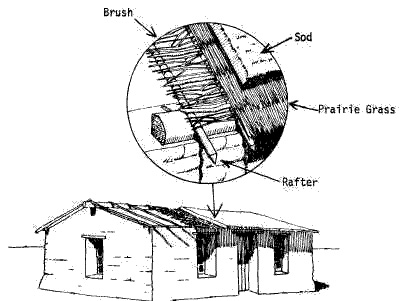 Try to include a few windows and a door by using planks as frames, when the wall reaches the proper height. One door is plenty and glass for windows might be hard to come by. The Roof Place strong poles down the centre of the building to support a ridge pole. Place rafters of poles from the ridge pole to the walls. Start with a layer of willow (hay could be used if necessary), then top with sod. If lumber is available, a wood floor is nice, if not, packed dirt will have to do for now. Interior walls can be smoothed and even coated with whitewash or plastered with clay. Heavy cotton can be stretched over ceilings and wall to give it that cozy, finished look. |
The finished product
Most people used their sod huts for just a few years before upgrading to wood.
Page 32: The Half-Way House

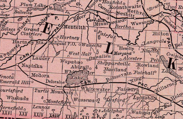
This map shows some of the popular Stopping Places
| Today a trip from Hartney to Brandon takes less than an hour. In 1882 it could take over a day. Travellers needed places to stop for the night. There were few towns and no hotels, so some settlers who happened to be on well-travelled trails would turn their home into a Stopping Place or Halfway House. Mrs. E. Weightman, at Westhall, must have noticed that she was about half way between Brandon and the busy Land Titles Office at Deloraine. It was a natural place for a Halfway House. Often regular travellers to Brandon would plan their trips around the location of the stopping houses. Even after decades had passed, an early resident of Deloraine remembered Mrs. Fox’s stopping house on the trail from Emerson to Boissevain as having especially good food. Reservations were not required and there was always a way to squeeze one more in – even if the hayloft had to be used. Halfway Houses were a combination; restaurant, motel, and livery stable. It was like a bed and breakfast with an extra meal thrown in – plus a gas station to fuel up your horse! The first stopping place known to operate in southwestern Manitoba was at “Old Wakopa” where Bernard LaRiviere had set up shop in an abandoned Boundary Commission building. The shack erected by Elliott and Gould, the first settlers at Sourisford (further west along that Boundary Commission Trail), was soon recognized as a stopping place, as was the home of William Walker in the Lyleton district. The John Renton home, within a mile of the Land Titles Office, was a natural place for a stopping place. It was also a natural place to hold church services – guests arriving on a Saturday night would likely have appreciated that. The earliest stopping houses also acted as informal postal outlets until a proper post office could be applied for and established. They had everything the traveller needed. |
Page 33: The Mailman
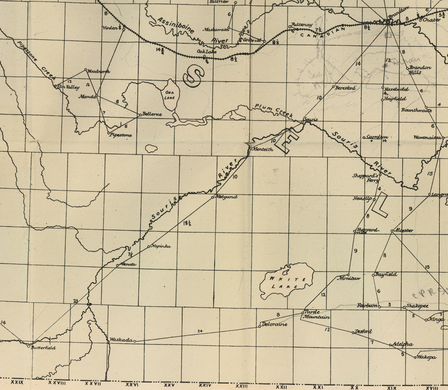
| In the early 1880’s the main road from Old Deloraine to Brandon was the Heaslip Trail named for Sam Heaslip who established the trail and used it to deliver the mail. Each week he picked up the mail in Brandon. His first stop after crossing the Souris River would be his own home, the site of a post office named after him. The home also served as a stopping house and store. Sheppardvillle owned by Robert Sheppard was the next stop. From there it was on to Nimitaw where Mr. James Rae was Postmaster. Turtle Mountain, the main settlement in what would become the RM of Morton would be the next stop – a busy one at that. Heaslip’s route ended at Old Deloraine where mail for more distant spots was picked up by others. Some called the service a stagecoach, which probably meant Sam didn’t mind taking along a passenger or two. The other main mail route ran from Souris, along the Souris River to Butterfield, stopping at Melgund, Napinka, Menota on the way. Few of these stops were even the beginnings of villages – just farm homes that had a post office. |
Chapter 6: Communities
Page 34: Wakopa – The first “Stopping Place” for settlers heading west
Wakopa was the first of the villages that were to pop up in the first few years of European settlement – before the arrival of the railway. |
Finlay Young’s first house NE 20-1-18 |
Page 35: “Old” Desford.
| An Englishman named Barneby did a tour of the North American in 1883. He passed through Brandon and then went south. In the book he published he mentioned one of little villages that came and went in those early days. “On our route we passed a store named Desford, where we watered our horses; but the water was bad. A road comes in here from Brandon. The Turtle Mountains are still to the south.” That’s about all he had to say. |
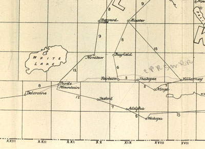
This map shows post offices in 1884. The Desford community began in the late 1870’s along the Old Commission Trail about 12 kilometres south-southwest of Boissevain, and was, like Wakopa, one of the first trading centres in the area. People living where Boissevain would soon be located would do their shopping at Desford. Sunday Church service was held at a local home. Fox’s sawmill served the district in the early 1880’s and produced most of the lumber that was used for the first buildings in the region. Like nearby Wakopa, Desford seemed ready to become an important town if only the railway would pass through. That didn’t happen. The railway passed to the north and the town of Boissevain became the centre of the region. But the Desford story wasn’t over. In 1906 the Great Northern Railway was put down through the area and a small village, also called Desford, sprang to life. In 1908 the hamlet consisted of the water tower for the trains, the Railway Station, elevator, section house, bunkhouse, the Methodist Church, the blacksmith shop, a Community Hall, a General Store and a few houses. 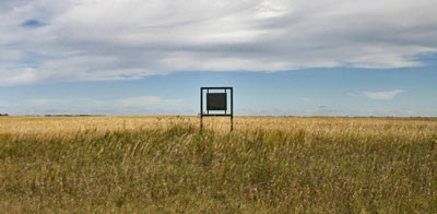 All traces of Desford, once located in this field, are gone. This sign, placed in 1970, is left to remind us All traces of Desford, once located in this field, are gone. This sign, placed in 1970, is left to remind us |
Page 36: The Cheese King
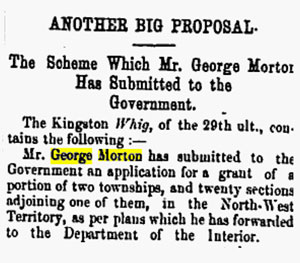 From the Winnipeg Times – May 5, 1881 In 1881 George Morton from Kingston Ontario applied to the government for a huge land grant on the north side of Whitewater Lake under the condition that he settle at least 75 families on the land. His plan was to create 108 dairy farms, 36 stock farms and a cheddar cheese factory. By 1882 The Morton Dairy Farming and Colonization Company, had about fifty men employed on the farm and everything was said to be progressing as planned He acquired a sawmill recently established at Max Lake, and built a store at the new community of Waubeesh. Before long equipment and cattle were making their way westward. Mr. Morton had a very good plan – on paper. As so often happened throughout the west, the railway didn’t come through with its promise; it actually built south of the lake, and not until 1885. By that time the dairy operation was long gone, for the first harsh winter killed most of his stock, and it was downhill from there. The city newspapers which had devoted so many paragraph to the great plans, summed up the end result in one sentence  From the Winnipeg Daily Sun – May 31, 1883 From the Winnipeg Daily Sun – May 31, 1883 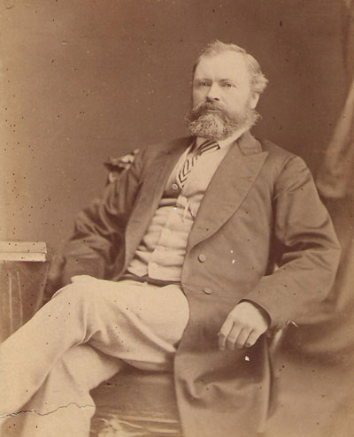 George Morton Mr. Morton however proceeded with his other businesses (stores, sawmills, and elevators) and did very well. The Municipality of Morton is named after him. 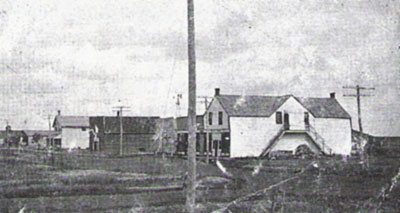 George Morton built this store in Whitewater and owned several businesses in Boissevain. |
Page 37: Turtle Mountain City & Waubeesh
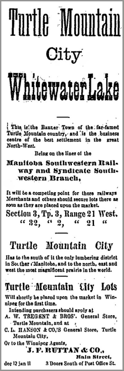
Winnipeg Times January 7, 1881
| Ads like this one ran in Winnipeg newspapers regularly in 1881 and 1882. It was a time called the Manitoba Boom. Everyone wanted to get rich by buying land and hoping that the price would keep going up. Then they could sell at a big profit. These “cities” had several things in common. They all claimed they were going to be the main town of a region. They all claimed that the railways would pass nearby. They all simply lied about what was there. An early settler was quick to have one such city surveyed on his land. He called it “Turtle Mountain City” and claimed it was “The Banner town of the far-famed Turtle Mountain country” Turtle Mountain City actually consisted of a store, a post office and a Stopping Place. |
| By the time the railway arrived in 1885, Turtle Mountain as it was then called was just a post office. The railway passed to the north and the new town of Whitewater was created. Waubeesh Nearby an actual village called Waubeesh had been started with stores, a blacksmith shop and even a church. But even with those services, it couldn’t survive when the railway passed it by. George Morton had a store there, and as soon as the railway came to Boissevain he moved it to the new town. |
Page 38: Old Deloraine
In 1880 the Dominion government established a Land Titles Office south of Turtle Mountain along the Commission Trail. It was a considerable convenience to settlers and a sure sign that many settlers were expected. George Newcombe came to establish the office, bringing with him his family, a governess, and the first piano to find its way into the area. Before long, in February of 1881, he was father to the first white baby (Louise) to be born there.  Today we call the location Newcombe’s Hollow. Today we call the location Newcombe’s Hollow. |
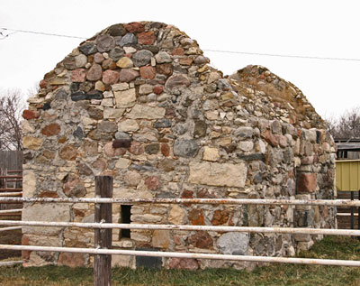
| All that remains of “Old Deloraine” is this stone bank vault. The rest of the village’s buildings were quickly moved to the new rail line a few kilometres away. The location of the Land Titles Office, led, almost overnight, to the creation of a village nearby called Deloraine and before long it had “ two agricultural implement dealers, one general store, a grist mill, two blacksmiths, two ministers, agents of various kinds, a law office and a school.” When the settlers chose to build their village near Turtle Head Creek they had been assured by the Canadian Pacific Railway that they could expect a railway soon. But the CPR changed its plans and built the line a bit to the north. The arrival of the first mixed train into what was called “Track End” on November 8, 1886, meant the end of the original Deloraine. Merchants, implement dealers, blacksmiths and millers all moved to take lots on the new townsite. But they did decide to keep the same name. 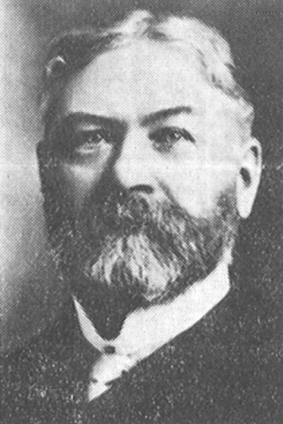 James Cavers was the first Postmaster in both “Old” and “New” Deloraine. He named the village after his old home in Scotland. |
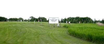
The Deloraine Pioneer Cemetery – still in use.
Page 39: Melgund & Hartney
| Southwest of Hartney on Melgund Road, there is a small cemetery at a crossroads. Established in 1887, it was the first graveyard in the region. Across the road, a cairn helps to mark the spot that was home for many people over many years. Early in 1881 Samuel Long and John Fee came from Ontario to this area. The sod shack they erected that first season, soon known as “The Shanty” or “The Orphan’s Home”, was a stopping place and temporary home to many settlers over the next two years. 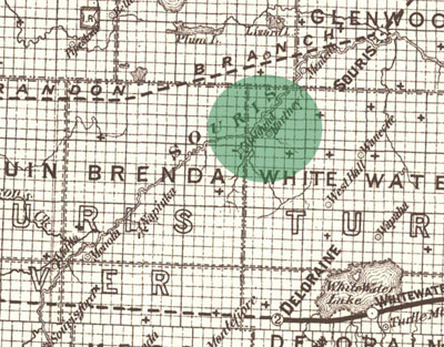 Both Melgund and Hartney appear on this map from 1887. There were no towns as yet – the map shows post office locations. It would be nine years before the railway entered the district and the town of Hartney would be created. In the meantime it was Melgund that seemed to be where things were happening. The name Melgund first appears as a Post Office opened in 1882 in the home of W.J. Higgins. Rose School opened in, 1884, one of the first in the area. It was also used as a church before the Melgund Methodist Church was built across the road. 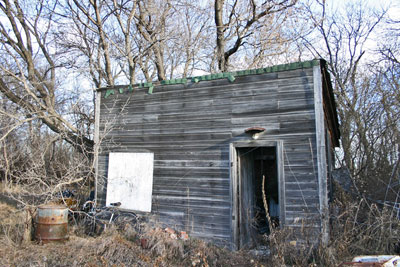 This small building served as the Melgund Post Office – and likely as a residence for a time as well. 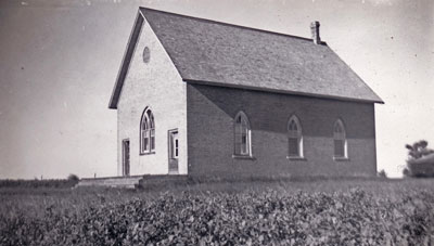 Melgund Methodist Church, taken in 1946 Melgund Methodist Church, taken in 1946When the first settlers arrived they had to build some shelter, break some sod, and plant some grain and vegetables. Before long they would get together and build a school. They might build a church, and then, perhaps, a general store or a blacksmith shop might open for business. But most such settlements never did become towns as we know them, with rows of houses and a main street for stores and shops. |
Page 40: Grande Clairiere
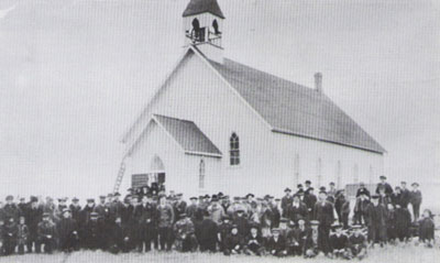
In 1885, a 30-year-old priest named Jean Gaire decided to leave France for Canada and help others move to this new country. By 1888, homesteaders from Eastern Canada, Great Britain and Europe had settled much of the land along the Souris River. Father Gaire, arrived at Oak Lake Parish on July 10, 1888 and set off in a southwesterly direction, in search of a suitable location to start a new community. They found a large clearing that pleased the young priest. A few Metis families lived nearby. Father Gaire applied for a homestead. He decided to settle and called the place “Grande Clairiere.” He described his first church service in his memoirs: “At 9 o’clock my three Metis families were there – six adults and ten children. I have neither choir nor children to serve Mass; I say a low Mass, all the time admiring the simple, open piety of these brave people.” Soon his new community had a few more Metis families and some settlers from Loire in France. The population tripled in three months! By April 1889 settlers began to arrive. There were now 43 homes and close to 150 people!! During the winter of 1889-1890, Father Gaire returned to France for a month as an “Immigration Agent” for the Canadian Government. On March 23, 1890, forty French and Belgian immigrants came to Grande Clairiere. By 1893, the community had a post office, a church and rectory; and had started building a school. Father Gaire’s dream was to have more than an ordinary school; he wanted a boarding school where children from distant missions, that had no educational facilities, could be accommodated. In the spring of 1898, construction began on the first convent. The sisters arrived in Grande Clairiere on August 11, and the school opened on August 18 with 20 pupils registered. In 1903, his dreams in Grande Clairiere fulfilled, Father Gaire requested a transfer to a new mission in Wauchope, Saskatchewan. |
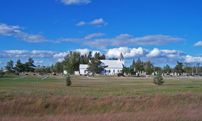
Grande Clariere
Page 41: Sourisford
| It all started with a river crossing. About ten kilometers north of where the Souris River crosses the US border, a gravel ridge in the river bed forms a natural crossing that has been used for centuries. Bison herds in their yearly migrations, Aboriginal Peoples on their hunting trips, fur traders and Metis pemmican brigades, each used the site. |
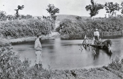
The Boundary Commission Trail Modern use of the trail began in 1873. The British and United States Boundary Commissioners followed a route along the 49th Parallel in their trek across the plains to mark the boundary between the U.S. and Canada. Sourisford The crossing at Sourisford was the obvious place for a village. Soon T.B. Gerry set up a blacksmith shop – a necessity for a farming community. The Gould – Elliott Stopping House, was also a store and post office. Another store was operated briefly out of a tent by Warren & Snider. R. N. Graham, already established in Melita, established a branch store at Sourisford. If the railway line that connected Brandon with southeastern Saskatchewan in1890 had crossed the Souris River here instead of Melita, a major town would have grown and Melita would have faded. But Sourisford became a rural community with just a post office and store rather than a full village. In 1901 when another CPR branch stretched westward from Waskada and established Coulter a few kilometres away, Sourisford became one of dozens of Westman communities that had served its purpose and was no longer needed as a commercial centre. 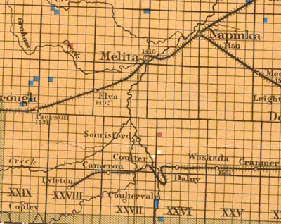 |
Page 42: Manchester to Melita
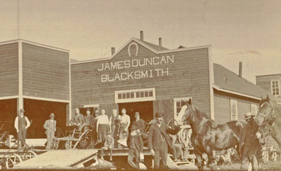
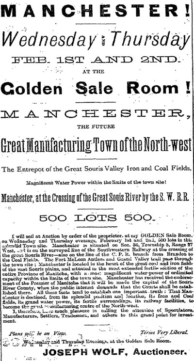 Melita is one of many Manitoba towns that had its original location abandoned when a nearby site was chosen by a railway company. In this case, the town of Melita had only a short way to travel. By 1882 three identifiable communities developed within a few miles of the current site of Melita. Sourisford at the old Boundary Commission Crossing, Menota, a store & post office to the east of where Melita would later be, and Manchester just west of the current town. In 1881, homesteader Dr. Sinclair had a quarter section of his land on the west side of the Souris River surveyed as a town site. Lots were sold to buyers as far away as Winnipeg. In 1883 R. N. Graham started a store, which was quickly followed by another one, a blacksmith shop, an implement agency and a public school. 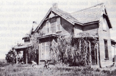 This house was the original school and church in Manchester. The problem was the name they had chosen, “Manchester”. In 1884 when the townsfolk put together a petition to open a post office, they were informed that Manchester had already been adopted by a settlement in Ontario. They got together and chose Melita. And so the town was born, and as usual the business owners and residents were content to move a kilometre or so east to be alongside the new rail line when it arrived. Melita pioneer James Duncan started his first Blacksmith Shop in Manchester. He quickly moved to the new location when the railway arrived nearby. |
Page 43: Dobbyn City
The “Manitoba Boom” hits the Southwest Corner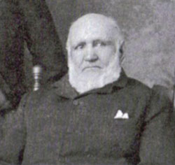 John Dobbyn – Melita Pioneer and Businessman John Dobbyn – Melita Pioneer and BusinessmanPioneer John Dobbyn had selected a homestead along the Souris River near where Melita would later be located. He, and many of the other settlers expected that a railway line would pass nearby, and that his land would be a good spot for a town. If that happened the land would be valuable. Across the province there were many people speculating in land. They hoped to buy land that was now empty, but would later be a town, and be worth much more. They hoped to get rich. Knowing this, Mr. Dobbyn had “Dobbyn City” surveyed and marketed. It was a typical example of the paper city. The ads were just believable enough to be sold, but full of wishful thinking and outright lies. Apparently they worked… for a while. In March of 1882, The Winnipeg Daily Sun reported the sale of 80 lots at an average of $30 each. How much, if any, of that money made its way into Mr. Dobbyn’s hands, no one knows. Have a look at the ad from the Winnipeg Daily Sun, March 9, 1882. People in Winnipeg or back east had no way of knowing that no railway would be built for another eight years, or that no real businesses or houses yet existed in Dobbyn City. It didn’t matter – they just hoped it would happen and their $30 lots would be worth ten times that much. 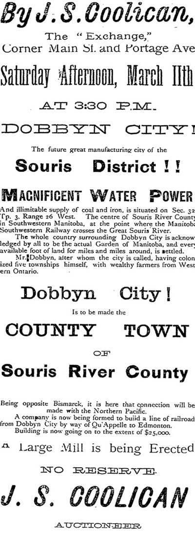 Winnipeg Daily Sun – March 9, 1 882 Winnipeg Daily Sun – March 9, 1 882The railway did eventually come in 1890, but Dobbyn City was long forgotten and the river was crossed about a mile further downstream. Mr. Dobbyn had long since focused on his farm, and became a leading citizen of the new town of Melita. |
Page 44: Butterfield

Butterfield, a Post Office and Stopping Place on the Boundary Commission Trail, was one of the first “places” in the southwest corner to appear on any map. Until recently, in a pasture a few kilometres southwest of Pierson, one could still see the remains of an old sod building by an old rutted trail. Before the railway arrived in the southwestern tip of Manitoba, before Pierson was established, the mail came to Butterfield. The first post office was in a sod hut built by Dr. Joseph Dann, on his farm along the Boundary Commission Trail, and operated by his brother Henry’s family. As often happened the Post Office was a likely spot for a Stopping Place and being on the well-used trail made the location even more convenient. Butterfield received its mail by stage coach. Before the post office was opened in 1884, one of the settlers near Sourisford used to go to Brandon with an ox team about twice a month for everyone’s mail and supplies. The exact location of the buildings is hard to find now, and the trails have been worn away by time. 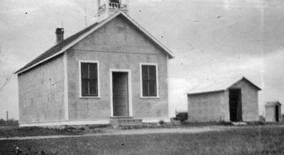 The name Butterfield lives on as the name of the school built nearby. The name Butterfield lives on as the name of the school built nearby.Page 45: Tisdale The CPR had surveyed their line through this district, and every one expected to have a townsite of their own, little else was talked about. But it was the Cameron Bros; who did more than talk, they, with the help of T. P. Murray, real estate man of Winnipeg, surveyed the town site of Tisdale on the west half of section 2-4-16, and things developed quickly. A large house of logs appeared. A portable saw mill was brought from Brandon, a Mr. Thomas, of Millford opened up a large general store.T. J. Lawlor also built a frame two-storey store, in which one could buy almost anything from a “needle to an anchor.” E. Machon built a house and shop in which he carried on a blacksmith’s business for some time. The proprietors of this site didn’t overlooked the comfort and necessity of the present and future generations, seven acres were surveyed and laid out for a public park and recreation ground. 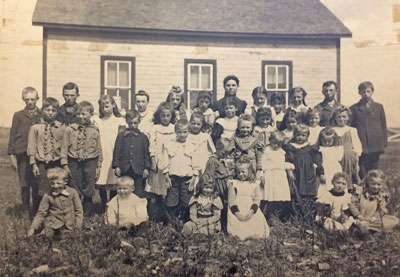 Tisdale School Tisdale SchoolDuring the winter of 1883 rumors began to circulate that the CPR had changed their plans, and would take a more southerly route. Sure enough they soon began to grade the present line from Manitou, which had been the end of the track since 1882, the steel was laid through Killarney the fall of 1885 and Deloraine the next fall. From this time the town of Tisdale began to fade and the boom was over. T. J. Lawlor dismantled his building and moved it to Killarney. 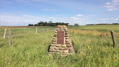 A cairn marks the location of Tisdale Church A cairn marks the location of Tisdale Church |
Chapter 7: Railway Towns
Page 46: Holmfield
The village of Holmfield is on SE 24-2-16, the quarter homesteaded in 1881 by Thomas Young. The townsite was established in 1882. With the arrivai of the Canadian Pacific Railway, the village grew rapidly. The first train arrived in the fall of 1885. The CPR station was burned in 1890 and a new one was built in 1900 with Mr J. Cavan as agent.
The Harrison Bros built the first grain elevators in 1885 in Holmfield and Killarney and later leased elevators in Cartwright and Mather. In 1897 they erected the grist mill.
By 1905 the Canadian National reached Holmfield. Both railways supplied freight and mail to the small settlement.
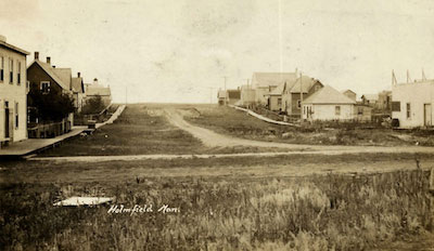
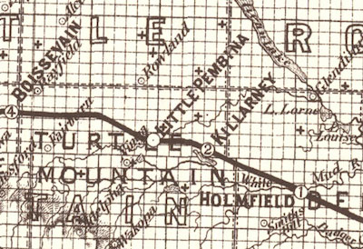
Page 47: Killarney
The original name was Oak Lake, the present name was the result of a conversation jokingly carried on between three pioneers, one of whom was the late John Sidney O’Brien, Land Guide, and which ended by one party saying to Mr. O’Brien, “I suppose you would like to call it ‘Killarney’, after the lakes in Ireland,” so, Killarney it has been ever since. That would be in about 1882.
In 1885 the CPR branch from Rosenfelt to Manitou was continued west passing through Killarney in December and reaching Boissevain January 1st, 1886.
Canadian and United States investors had obtained a charter, known as the Manitoba South-Western Railway. The route, was to run north of Rock Lake, cross the vally at the norhern tip of Pelican Lake an d come out of on prairie at Tisdale. The survey continued westward to the Height, or Rowland district, about north of Ninga. Between 1882 and the fall of 1885, the CPR acquired the charter, and instead of building north of the Lakes, they continued their Rosenfeldt – Manitou branch, via La Riviere, Crystal City, Killarney and Boissevain.
On January 2nd, 1886, T. J. Lawlor arrived at Killarney station with a car load of general merchandise and building material. In the meantime, he had arranged to have his store in Tisdale taken down and brought over to the new town.
While saying that a town sprang up “overnight” might be a bit of an exaggeration, it’s hard to imagine just how quickly Killarney went from beings a few scattered lakeside shacks with a nearby school and post office, to a busy commercial centre with a street lined with shops and services.
By the end of that first year, the region’s homesteaders, who had endured long trips to buy supplies and market their crops, could simply come to town – where they could get almost anything they needed.
Rhodes Siding, located about eight miles west of Killarney. A water tank had been built in 1885 at the point where a 202 foot trestle bridge crossed a gorge in the Pembina River. Water was pumped to this tank by a 10 hp gasoline engine and the pump. The nearest farmer was hired to keep the pot-bellied stove going and Bernard Turner had this position for over thirty years.
Page 48: Ninga
The Ninga townsite was surveyed in 1887 following the opening of Twp 3 to homesteaders in 1881, after which the first claims were filed by Charles and William Willoughby in 1882. Among the first residents in Ninga were Charles W. Seefield and his two cousins, Emma and Minnie Zickrick.
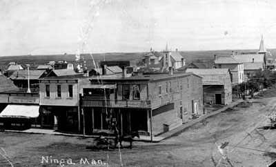
Ninga became a thriving centre, and for a time its business section was larger than Boissevain’s and it had
more footage of cement sidewalk than Killarney. After a series of disastrous fires, it began to decline in
late 1920’s for a variety of reasons.
Page 49: Boissevain
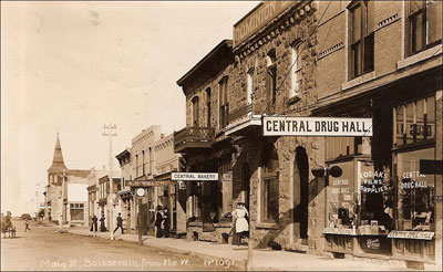
The railway line that now serves Boissevain was put into operation on January 3,1886. When the line approached the spot then known as Cherry Creek, the CPR announced that they would erect a station there and a town appeared almost overnight. Local businessman George Morton, quickly moved his general store from the earlier location of Wabeesh, in the Whitewater area, to the new town of Boissevain, where other buildings, stores and houses, were springing up. 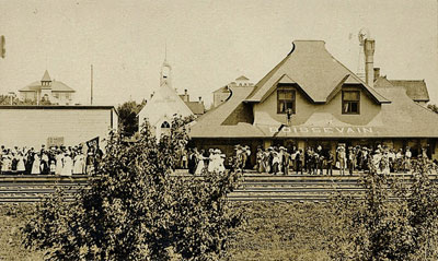 The Boissevain CPR Station |
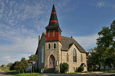
Within a few short years the new town of Boissevain grew into the town we would recognize today.
Three churches, St. Andrew’s Presbyterian (1887), St. Matthew’s Anglican (1889),
and St. Paul’s Methodist (1893) survive today.
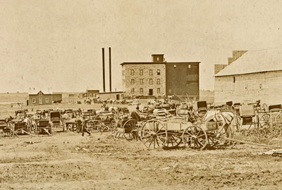
| Preston and McKay built a large Flour Mill in 1889, which proved to be an important boost to the local economy. In 1906 the Brandon, Saskatchewan and Hudson Bay Railway, which linked Brandon with the Great Northern Railway system in the United States provided competition for the CPR and additional service. The CPR also provided additional service when it completed its Boissevain-Lauder extension in 1913. |
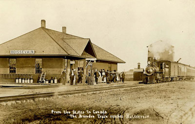
The Boissevain Great Northern Station
Page 50: Whitewater
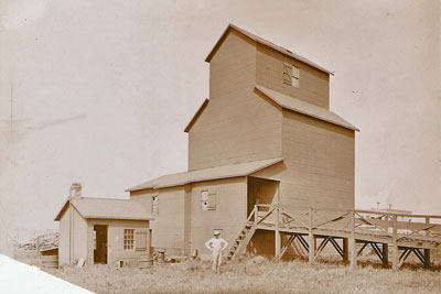
| In 1886, the new CPR line bypassed the established community of Waubeesh and created the new village of Whitewater. The boxcar railroad station that had been established to service Waubeesh became the beginning of Whitewater village. Pioneer businessman George Morton built an elevator in 1888 along with a large general store and boarding house, using lumber cut by the Lake Max Sawmill. 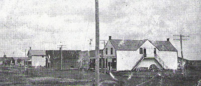 The elevator was the first of five that came to spring up in the town, making Whitewater a very important grain-handling centre. |
Until 1894, the children of Whitewater attended Mountainside School, which was about 7.5 km to the south. In 1894 a schoolroom was set up above the general store in Whitewater. Petersburg School was built the following spring at the south end of the community.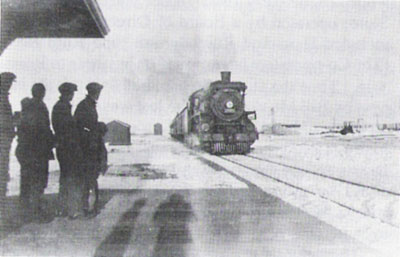 The train pulls into Whitewater Station. A brickyard started up in the late 1880s about a mile northeast of Whitewater which employed between 30 and 40 men. The bricks made from Whitewater Lake clay were of very high quality, and they were used for many buildings in the nearby town, including the Petersburg School. 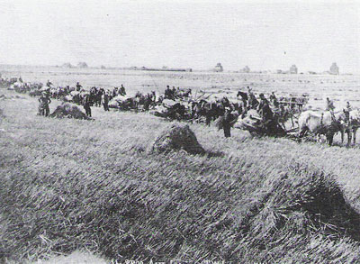 By the early 1900s the village had a butcher shop, harness-making shop, livery, carpenter, and draftsman. There was also an open-air skating rink complete with a warm-up shack. Rail service was provided regularly by the CPR, with daily passenger and mail traffic. |
Page 51: Deloraine
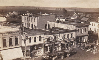
| When the first pioneers came and selected homesteads and village sites they considered several factors. Available wood and water and suitable drainage were important. The railway companies were often more interested in finding a good level route. Towns were located based on the distance between stations. In 1885, the railroad reached Cherry Creek (Boissevain) and began the last stretch of the line. Instead of angling southwards towards the bustling community of Deloraine they headed almost straight west. The route across flat prairie was certainly easier to build than the path through the hills and valleys where Deloraine was located. So a “new” Deloraine was created. |
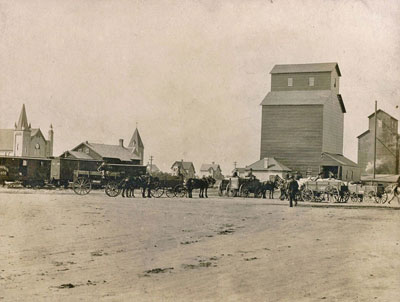
| Deloraine immediately replaced Boissevain as the grain shipping centre of the Southwestern plains, receiving wheat for the next four years from as far as Pierson and Hartney. The sites that pioneers chose near water and trees where often quite scenic. But the railway often selected sites on a treeless prairie. In Deloraine it was Dr. Thornton, whose love of nature, and wide knowledge of horticulture, made him perfectly suited to the task of planting tress and creating parks. |
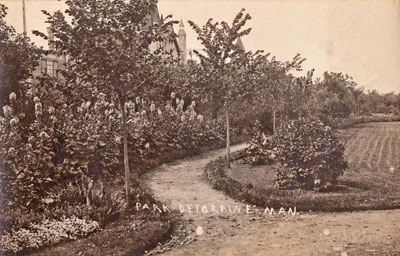
Deloraine Park – Designed by Dr. Thornton
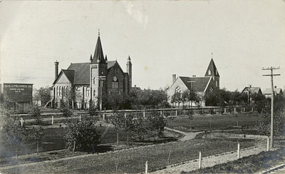 Both the Presbyterian and Methodist Congregations built fine large churches. However in 1917 they united their congregations and only need one building. Both were still standing in 2917 with the Presbyterian Church having served many other purposes. |
Page 52: Hartney
| The railway companies usually put towns wherever they needed them. But in 1889 local farmers heard that the CPR was going to build a town to the northeast of where Hartney is today, settlers protested. They insisted that the new town should be near where James Hartney had established a post office and store on his farm. Mr. Hartney moved to the area in 1882 with his family. He imported a carload of Red Fife wheat from Minnesota and soon had a good wheat crop. This gave the district a reputation as a first-class wheat producing area. His success attracted more settlers and Hartney’s farm became the centre of a new community. The post office, which he named after himself, and a store, were first operated out of his home. He brought men into the community to operate this business as well as a blacksmith shop that he later established. When the surveyors did appear they selected a spot within a mile of the Hartney farm and, the settlers, were happy. When the C.P.R named the town Airdrie they made another request. They wanted the new place named Hartney already in use for the post office. Once again, the CPR made the change. |
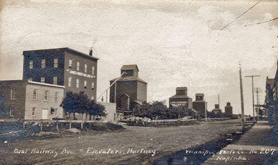
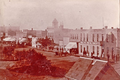
| Hartney grew quickly on each side of the new railway track. The Mill and Elevators were important services. When the train whistle sounded for the first train on Christmas Day 1890, there were already two elevators, a boarding house, a store and post office. Dr. Frank McEown had set up a practice and started work on a drug store. As the town grew, two brickyards, a flour mill, and a sash & door factory contributed to the economy. In 1902 A.E. Hill built the two-story brick block that still stands on the corner of Poplar and East Railway. 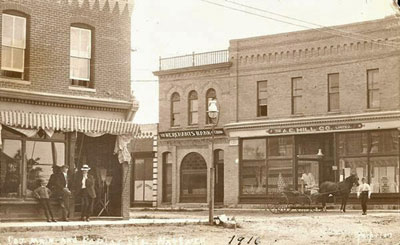 The A.E. Hill store. A second railway, the Canadian Northern connected Hartney to Virden to the west in 1900. By 1904, in addition to being the home of eight operating elevators and 10 clergy members, 51 businesses were listed in the town newspaper. |
Page 53: Lauder
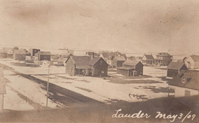
| Until the railway passed through Hartney on a path to Melita, Melgund was where residents in the Lauder area got their mail. It had a school and church as well. With the railway came the new towns of Lauder and Napinka. As soon as town sites were laid out there were people on hand eager to set up places of business and Lauder was no exception. Before the end of 1892 there were numerous buildings and businesses. In 1893 records for the town show seven married couples, fifteen boys and ten girls, with ten children in school. 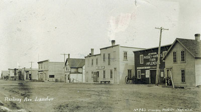 As was common in all too many of these new towns, there were setbacks. A fire in 1894 did a lot of damage. The residents didn’t waste any time – they rebuilt. By 1895 the town layout was firmly established. It had a rink and tennis courts, and its curlers and tennis players were well known in neighboring towns as were its baseball and hockey teams. There was a literary society and a bicycle club. Dances were held in Hamelin’s hall. Another typical business venture in many new towns was the “Cheese Factory”. In 1895 the farmers of the area met to make plans. General approval was received and the factory was located just north of town. The rise in the road at this point was known for years as the “Cheese Factory Hill”. The milk was gathered daily in large barrels and the whey returned to the farmers for feeding pigs. Henderson Directory 1897 lists W. Brigden as manager. It did not last too long – probably not more than year. 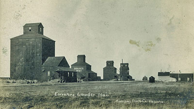 Other enterprises included a mill and a lime kiln just north of Grand Bend School. |
Page 54: Napinka
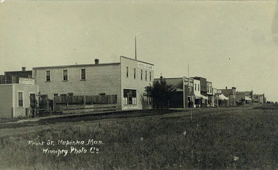
| In 1892 Napinka was a boom town located at the junction of two busy CPR branch lines. The first building appeared in July of 1891 before the tracks were laid through the area, and before the townsite had even been surveyed. A year later after the first railway line (from Brandon to Pierson) created the town, the line from Deloraine was finished to Napinka. Nearby Melita, had sent a delegation to Winnipeg to argue for the junction to be placed in their town but Napinka won. Trains came in every day from Brandon, Winnipeg, Estevan and the many small towns along the line. To service the trains, the CRP built a water tower and pumped water from behind a dam the railway built on the Souris River. A coal dock, tool shop, roundhouse and bunkhouse were also built to serve the CPR. The passengers and crew on the trips that stopped overnight in Napinka used the hotels and stores built along Railway Avenue. In 1892, an article in the Brandon Sun mentioned Napinka having “…two general stores, three hardware stores, two butcher shops, one flour and feed store, one watchmaker, two dressmakers, builders, coal and wood dealers, one elevator, two lumber yards, a drug store and a barber shop…” It also had boarding houses, two hotels, two banks, a blacksmith, doctors, a Massey-Harris dealership, and eventually, with the arrival of the automobile, two garages. A beautiful two-story stone school now a designated Heritage Site, was built in 1900. 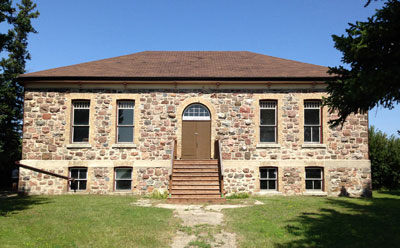 Sports teams, social clubs, and women’s organizations were set up. An open air skating and curling rink was built in 1896, while a newer curling facility was built in 1906, and curlers from Napinka achieved great success in bonspiels across Manitoba. |
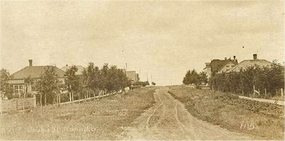
Page 55: Melita
| By the time the current town of Melita appeared in 1890, the region itself had a long and interesting history. Three communities existed within a few kilometres. Sourisford lives on as a location and a part of our heritage. Dobbyn City never really got started, and the district of Menota lives on as a school site. Manchester, renamed Melita, moved to be along a new rail line, and became the commercial centre of the region. Before the first train whistle sounded, Mr. G.L.Dodds had moved his Hardware & General Store to the site of the new town and everyone else followed. |
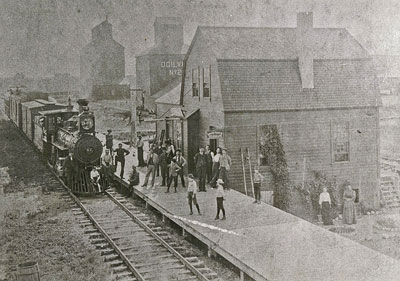
Melita’s first CPR Station More buildings were built quickly from materials readily available via the new rail line. Within a few years they were replaced by more ambitious structures such as the Northern Bank, the I.O.O.F Hall and the Crerar Law Office; all of which are still in use. By 1892 numerous business blocks lined Main and Front Streets. As early as 1892, sidewalks were to be laid on Main Street. By 1898 Melita had a population of over 500 people. 1905 saw street lighting by gasoline lamps. In 1916 permission was granted to R. N. Wyatt to place gasoline tanks at business on Front Street. Garages were replacing Livery Stables. As the town grew, its selection of businesses attracted customers from some distance 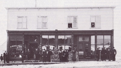 C.P. Holden’s Furniture Store |
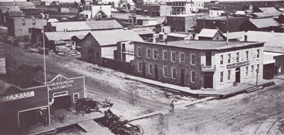
The Grand Union Hotel
Page 56: Elva
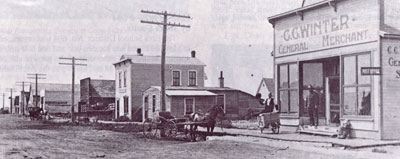
The view down Elva’s Railway Avenue in 1940.
| One of the first homesteaders in what came to be known as the district of Elva was H. J. Archibald and his family. They settled northwest of where Elva was later built. Archibald established a post office out of his home, which received the mail once a week from Brandon. In 1891 James Skelton agreed to sell some of his land to the Canadian Pacific Railway, which was looking to continue the line west from Melita. An unincorporated village grew on a corner of Skelton’s land. The community was later named after the first baby to be born in the district: Elva, the daughter of James Modeland and his wife. Elva continued to grow, and by 1904 it had a population of 100 people. Four years later the numbers had grown to 150 people. Elva seemed to be on the road to becoming a very important town—its elevators serviced farmers as far south as the United States boundary. |
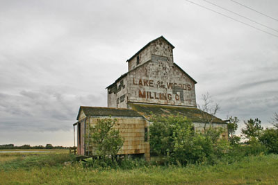
This elevator in Elva (the oldest still standing in Canada untill it was torn down in 2022) was built over a century ago. The Lake of the Woods elevator was built sometime between 1892 and 1899. Before the turn of the century, the Lake of the Woods Milling Co was one of Manitoba’s top companies in the grain industry. Their elevator shared the business with three other elevators, all built near the turn of the century and operated by different companies. 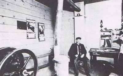 Matt Pedden, Lake of the Woods agent in 1912 |
Page 57: Pierson
| The CPR laid tracks through what would be the village of Pierson in 1891 and surveyed a town site. Merchants Alfred Gould and David Elliot from Sourisford were the first to buy lots. They established Pierson’s first business, a grocery store Pierson quickly became the service centre for the southwest corner. February of 1892 saw the first train rumble down the tracks. In short order, three grain elevators were built beside the tracks by different companies. In 1900 this number had risen to four. The usual assortment of services followed in a building boom that provided the shops and businesses necessary to make the community flourish: a blacksmith shop, millinery shop, wheelwright, livery barn, butcher shop, lumberyard, drug store, jewellery store, bank, barbershop, and café, among others. Around 1900, the businessmen of Pierson, especially J. F. Dandy, saw a need for more accommodations for the travelling public. Dandy owned the first hardware, furniture and lumber businesses. In 1900 Dandy financed the building of the Leland Hotel, which catered to travelling businessmen, doctors, dentists and incoming settlers. 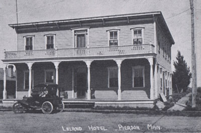 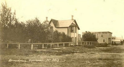 In the fall of 1891 Sherriff’s and Company built a large warehouse, with the lower part housing machinery, sleighs, cream separators, parts and feed and the upper part was used as a hall. Today it is a private home. |
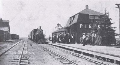
The Pierson train station in 1915.
Chapter 8: Expansion
Page 58: Minto
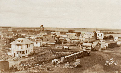
| Minto got its start when the Canadian Northern Railway came through in 1898 and it grew quickly. Farmers were now able to ship their grain and livestock closer to home instead of hauling to Boissevain or Hartney. The town soon had all the shops that a community needed to thrive. These shops included everything from a butcher shop to a Chinese laundry. In 1906 a second rail line from the North Dakota to Brandon made Minto and even busier place. 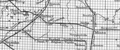 |
| On October 14, 1930, this booming town met a harsh reality that many communities had to face in those days. A huge fire swept through the business section and razed everything in its path. Like all small towns in the 1930’s, some of the businesses that had been very important in the early days, were no longer needed. People could take their cars to nearby larger towns to shop. So many of the businesses didn’t rebuild and Minto’s “downtown” was no longer as busy. It did however keep its basic services and continues to serve the local people today. |
Page 59: Highway 23
| Fairfax In 1899, after the railway was built, a survey was made of the village of Fairfax and building lots were sold. The first general store was built in 1900 was operated by Mr. J. L. Hettle, who also became postmaster and Justice of the Peace. Three grain companies were quick to build elevators. Fairfax school was established in August 1902. It became the Fairfax consolidated school in 1913 when it merged with Crown, St. Luke, and Plainville schools. Underhill 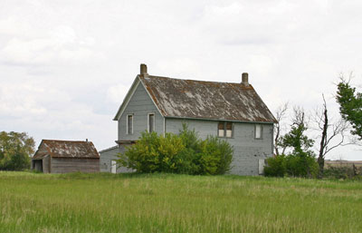 The A.E. Hill Store in 2016 The A.E. Hill Store in 2016The ghost community of Underhill took its name from Mr. John Underhill who arrived during the rush of settlement to this part of the prairies in the early 1880s. Three elevators were swiftly erected with the arrival of the railway. Mr. A. E. Hill, who operated a store in nearby Hartney, opened a general store in Underhill in 1897. The first school in the area was called the Berber School and was constructed over a kilometre south of the village in 1886. In 1909 it was moved into the village where it stood until 1928. A new school was built on the same site and used until the district consolidated into the Souris Valley School Division. The school building was always a social centre for the district. Activities such as amateur plays, Sunday School, card games and dances were held. Passenger service to the Underhill station was discontinued in 1954. Soon the railway line was abandonned and rural schools were consolidated further, shifting the focus from the small community to the larger surrounding centres. Argue Argue was known as the “Trackend” for a year as it was the most westerly station on the Winnipeg-Cameron-Hartney Branch of the Canadian National Railway until 1900 when the line continued to Hartney and Virden. 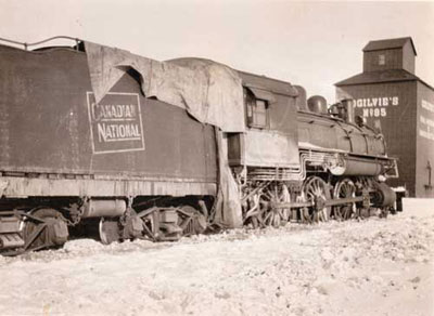 The community was named after pioneer John Argue. The community was named after pioneer John Argue. |
Page 60: Elgin
Elgin is another story of rapid growth. In 1898 when the railway came through, there was not a building on the present site. By 1900 the population of the village was about 400, and there were many more families in the district than at present. By 1913, as progress continued, Elgin had a school, four churches, an active band, and 34 places of business. 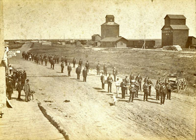 Most communities – even small ones, had a community band. In 1912, Elgin Consolidated School was formed when the local school, started in 1884, joined with Alice, Gilead, Maguire, and Millerway Schools. In 1951 a new modern school was built. That school closed in 1986 and a monument now commemorates it. |
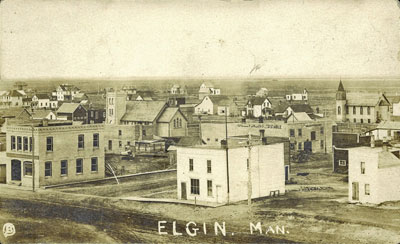
| Built in 1904 this Canadian Imperial Bank of Commerce building, to the left in this photo, was originally two stories high, providing accommodation for the bank manager. The second level was removed in the 1950s. After the bank closed in 1995, it became the Elgin and District Museum. |
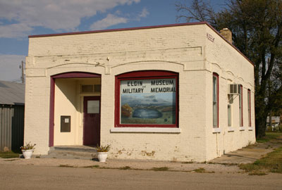
Page 61: Grande Clairiere
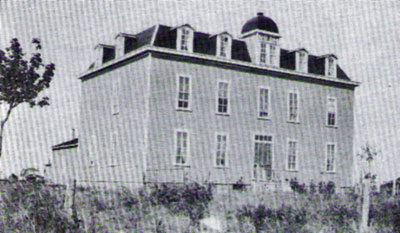
| The three-story convent in Grande Clairiere was built in 1906. The Grande Clairiere community, which was established in 1888, got a new look when the Canadian Northern line from Hartney to Virden passed through in 1906. The train brought better mail service and better delivery of supplies. Already known for its large church, and convent, it now became a village with stores, garages and even a bank. 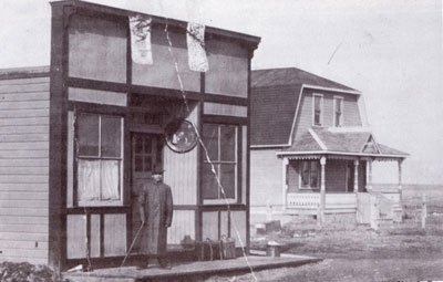 Store operated by Claude Rey and Marcel Martine. 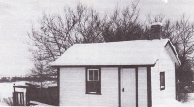 The Bank of Hochelaga opened as “la Banque Nationale” by Father Pierquin and originally located in the Rectory. Later changed to La Banque d’Hochelaga. The Bank of Hochelaga opened as “la Banque Nationale” by Father Pierquin and originally located in the Rectory. Later changed to La Banque d’Hochelaga.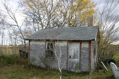 The Bank of Hochelaga has been preserved on a local farm. 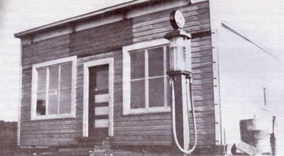 The gas station |
Page 63: Goodlands
Settlers in the area of Waskada and Goodlands in southwestern Manitoba waited in great anticipation for a branch line to be built through their communities. It arrived in 1900.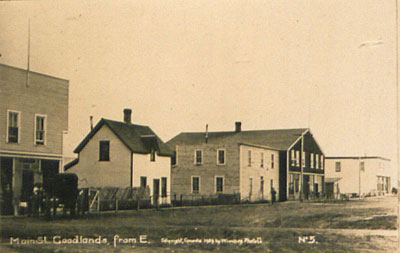 Goodlands GoodlandsThe town of Goodlands was first started in 1899 by Bert and Ernest Goodlands who built the first store. In that same year a lumber yard, boarding house and blacksmith shop were established. 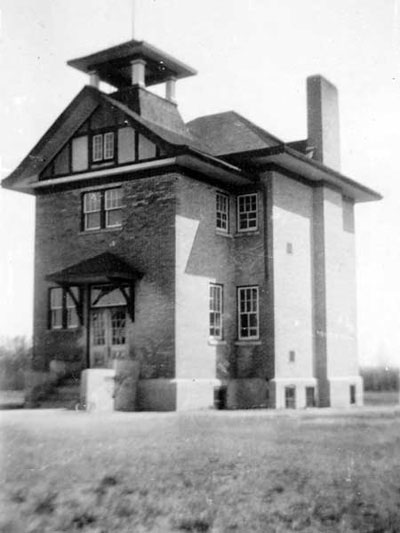 The local school was called Lennox School – it had existed long before the town was created. Cranmer In 1928 Cranmer made the news when one of its elevators collapsed. Workers had heard the building creaking and groaning and evacuated in time. No one was hurt. 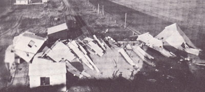 When a new rail line was built into a region the plan was to have a town about every fourteen kilometres. But as years went by those farmers between Deloraine and Goodlands who still had some distance to haul their grain started wondering if perhaps service couldn’t be better. In 1906 an extra stop, called a siding, was built, at about the midway point and in 1913 the first of two elevators was open for business. The U.G.G. elevator collapsed in 1928 and was rebuilt. Both elevators continued to serve the grain trade as well as being depots for the sale of coal. The loading platform was also used for other shipping needs, notably the shipping of cream to creameries. Farmers to the north and south of the new Cranmer siding appreciated the shorter trips to deliver grain. |
Page 64: Waskada
| A Post Office named Waskada was opened in 1883 a few kilometres south of where the town is today. When it was confirmed in 1899 that a rail line was coming nearby and that a new town to be was being surveyed they decided to keep the name. Until this time businesses such as stores, post offices, blacksmith shops and gristmills were operated on the individual properties of homesteaders. The railway brought the creation of towns, and towns then became the most logical place to do business. When Charles Sankey arrived in Waskada in the fall of October 1899, the townsite was bare prairie. Sankey was a dedicated community worker, and in fact appointed by the municipality to look after general public interests in the town. 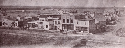 Waskada quickly became the commercial centre for the region. On a walk south of the townsite one day, a vision presented itself to Sankey: a recreational park, surrounded by trees, with space for sports activities and community events. From this initial dream, a combination of hard work, determination and good lick accident brought the Waskada Park into being. 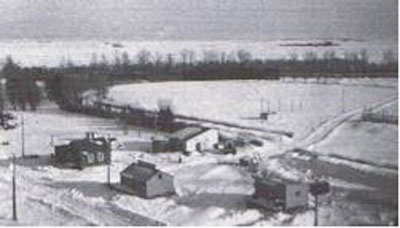 The Waskada Park in 1946, looking southwest. Over the next two years funds were being gathered for the purchase of trees. In the meantime Chambers planted potatoes and other vegetables in the strips of land. He did an excellent job, and left the soil in good condition for receiving trees. 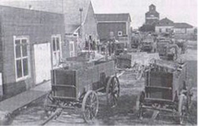 The first version of the blacksmith shop, now featured in the Waskada Museum is visible on the left side of this photo from around 1909. |
Page 65: Stops on the Lyleton Branch
| Dalny Dalny was the first stop after the train headed west out of Waskada. Soon two elevators were doing a thriving business and a third was added in 1925. 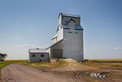 Coulter Coulter was the next stop and it did become a busy little village with a school, a church and a large general store. The Coulter School was built in 1915. 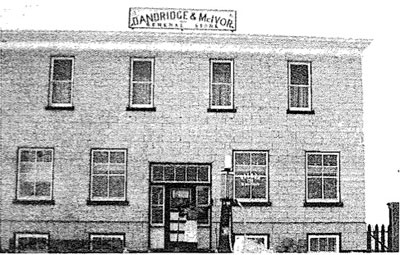 The General Store built by pioneer Alfred Gould. 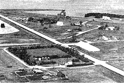 Coulter in 1959 |
Cameron
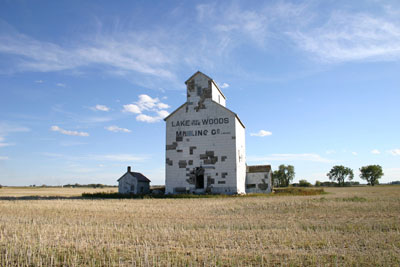
| This elevator, now in the middle of a field is all that is left of Cameron Siding. There were once three elevators and a store here. |
Page 66: Lyleton
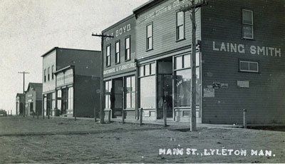
In 1902, when the railway branch finally arrived near the Lyleton Post Office, close to the US border south of Melita, another new town was created. In fact that was what they called it at first, “The New Town”. The streets were placed on what had been a field of grain just two months before. Andrew Lyle’s farm home was the first post office; because of this, the district had been known as Lyleton for some time. Soon the town took that name as well. A comfortable station was provided by the Canadian Pacific Railroad Before long the town was booming with all the stores and services the region needed. The foundation of the new Presbyterian Church, which still existed in 2017, was laid and the main street was lined with businesses. 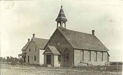 Little towns like Lyleton owed their existence to the homesteads around them and a shopping trip to town was something the whole family would appreciate. Fire was the enemy of these new towns, and Lyleton had its share. On August 19, 1904, the entire business section portion of Lyleton was wiped out by fire, caused by lightning. And like other towns before – they set out to rebuild. 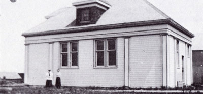 The Home Bank The Home BankA visitor to Lyleton today might find it hard to believe that it once had a thriving bank and a busy hotel. Fire was to strike Lyleton again in 1910 and again large portion of the business section was destroyed. The fire fighting equipment of the day could do very little to check its progress. The improvement in transportation and communication brought large towns of Melita and Brandon closer. There was already less of a need for some businesses. The store, school, church, elevators, post office, garages and lumber yard continued to serve the village for some time. Much of the community life continued to revolve around the church, school, hall and rink. |
Page 67: Wakopa and West
| Wakopa In 1886 the CPR railroad reached Killarney and Boissevain, and Old Wakopa began to fade. Then in 1905 the Canadian Northern from the east gave it new life. 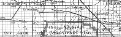 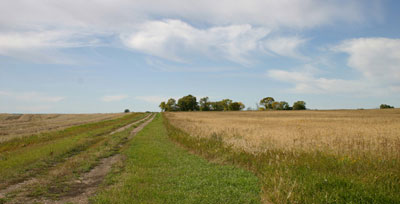 The Wakopa Village site in 2010 – the village was relocated here when the “Wakopa Branch” of the C.P.R. was build from Greenway in 1904. Adelpha Adelpha originated as a post office in the home of an early homesteader, John A. Hurt who settled just to the north of the Turtle Mountain Forestry Reserve, right next to the Boundary Commission Trail. In 1905, the Canadian National Railway built a rail line heading southwest from Greenway. The rail passed just to the northwest of Hurt’s home. Construction stopped there and the train station was named Adelpha. Since Adelpha was the “end of the line”, it became busy place for a time. A “wye” was built at for turning trains around so that they could head back east. In 1914 the Canadian National Railways extended their Greenway Branch to reach Deloraine and other villages attracted the business. Mountainside In 2017, the Mountainside Store – now used as a house, stands as a reminder of the little village that once served the needs of the surrounding district. At one time, in addition to the store there were nine houses, the school and two elevators in town. 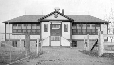 They had church in the school and there was also a public dance hall in the basement. |
Page 68: The Wakopa Extension
Around 1900 a branch of the Canadian Northern Pacific line that had established the towns of Baldur, Belmont and Wawanesa would connect to that line near Greenway and proceed southwest to the Wakopa region.In 1903, the work began on the Wakopa Subdivision, known locally as simply the “Wakopa Line” or just “The Wakopa”. The rails were laid to Wakopa by 1906, and regular service began.
Holmfield
By 1905 the Canadian National reached Holmfield. Both railways supplied freight and mail to the small settlement.
Enterprise
Enterprise was surveyed as a townsite but really was never much more than an elevator, store and post office.A grain elevator was built in the early 20th century by the Young Grain Company, and later taken over by Paterson. The original 30,000-bushel capacity was increased to 62,000 bushels with a wooden annex. The elevator closed in the 1960s and was sold to a consortium of local farmers who moved it to Killarney.Barry Daun Colter was one of the last grain buyers (1938-1990)A local house served as a boarding house for twenty men when the elevator was built. They also boarded the grain buyers, and teachers who taught at Enterprise school. Before a Post Office, named Smith’s Hill, was opened, someone from Enterprise would drive to Holmfield with horse and buggy to get the telegrams of grain prices and deliver them to the grain buyers at Enterprise and Lena.
Lena
With the coming of the railway in 1904, the village of Lena (NE 27-1-17) came into being. The post office, operated for 13 years by Fred Burrows one mile south was moved to Lena. The name was the result of a contest run by the post office. James W. Johnston submitted the name ‘Lena’, that being the name of his daughter.The first store operated by AB Langenfeld was 40′ x 60′ with living quarters above.The Young Elevator came into existence shortly after the railway came through.
Page 69: Bannermanand The Great Northern
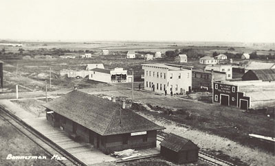
| In 1906 the Brandon, Saskatchewan and Hudson’s Bay Railway, a part of the Great Northern Railway from the U.S., began service from Brandon to the small North Dakota town of St. John’s, where it made connections to destinations across the United States. The line was important to several communities south of Brandon. Anything that would reduce the length of those trips to the elevator was welcomed by farmers. A Ride on the Great Northern The train departed from St. John’s, North Dakota, just a few kilometers south on the Manitoba / US border. Charlie Bryant, long time conductor, well-known to folks all along the line, was a man who wouldn’t hesitate to make an unscheduled stop or other accommodation for a good customer. Before long it reached the border and four kilometers past that was the new village of Bannerman. Of all the newly created villages along the line, the rise and fall of Bannerman was the most dramatic. In 1905 it was a field. In 1906 it was a brand new village. Soon a hotel with large dining room and bar encouraged visitors. A feed and livery barn and a lumberyard were open for business. A poolroom and barbershop, a store and post office, a blacksmith shop, a harness and shoe repair shop, all were built. Soon a second grocery store and additional blacksmith shop were needed, along with two dealerships for the fast growing farm implement business. Because it was the first stop in Canada it was an official Port of Entry with a Customs and Immigration Office. When the railway line closed in 1936 Bannerman became a town without a purpose. There were several other towns nearby that till had rail lines. It faded away quickly and is now back to being a field. | 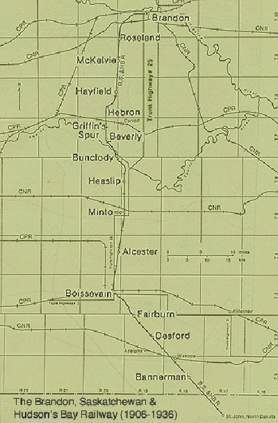 |
Page 70: North to Minto
| Desford In 1908 the hamlet of Desford consisted of the water tower for the trains, the Railway Station, elevator, section house, bunk house, the Methodist Church, the blacksmith shop, a Community Hall, a General Store and a few houses. The population exploded to near thirty. A few kilometres out of Desford is to Fairburn. These “sidings” as they were called were put in place to accommodate local farmers, and were never intended to become villages. 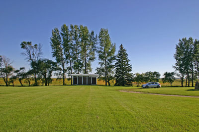 The site of Fairburn School, now a park alongside Highway 3. The site of Fairburn School, now a park alongside Highway 3.To us in modern times It may seem odd that a place like Fairburn was even on the map. It was just a lone elevator on the open prairie. But although it had no stores or streets it was a community. A Post Office had existed nearby for many years. Boissevain & Minto By 1906 Boissevain and Minto were already well-established and already each had one railway line. The new line gave them a direct route to Brandon and another elevator to choose from. |
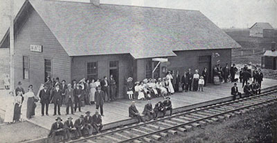
Eagerly awaiting the train at the Minto Great Northern Station for an excursion to Brandon Fair, 1917
Any town would welcome a new connection to the outside world.
It was exciting, as Sylvia Sprott indicates in her memoir in the Minto History;
“A trip to Brandon on the Great Northern train was indeed an event to remember.”
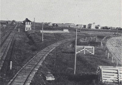
The GN line crossed the CN line at Minto, a tower overlooked the crossing.
Page 71: Railway Construction – Heaslip & Beyond
Crossing a ravine between Heaslip and Bunclody
Healslip had existed as a post office since the earliest pioneer days. It got a big boost when the Great Northern began operations in 1906 and the Heaslip community developed into the beginnings of a village, with a station and general store. A Big Project Just past Heaslip, the line angled north-westward to Bunclody. Along the way it had to cross two deep ravines that ran into the river from the west. They built temporary trestles and dumped in earth to create a road-level earth dam, complete with huge pipes designed to let the runoff through. The pipes soon had to be replaced with concrete tunnels two metres square – still quite visible today. Local childhood adventures often included a dare to go through these tunnels. 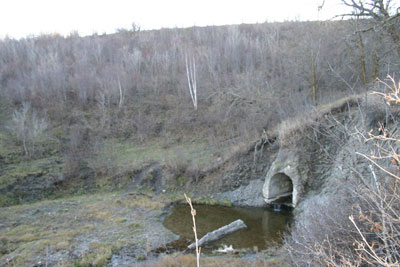 A concrete tunnel under the crossing. |
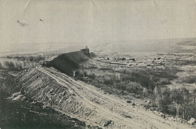
The bridge over the Souris at Bunclody was the biggest undertaking.
The End of The Line
The line closed in 1936. It just wasn’t needed. People travelled by cars and the mail and freight service could
easily be handled by existing lines and by truck.The line is credited with ending the rural isolation felt by many Westman settlers and offered them an important
time-saving travel option. Daytime shopping trips to Brandon were a treat, and students at university could get
home for weekends. But the car and the improved road conditions offered a new sense of freedom to rural residents,
and the line, though remembered fondly by old-timers, was just not needed any longer.
Page 72: West From Lauder – Bernice & Bede
Bernice School
| Bernice ln I902, the The Canadian Pacific rail line from Lauder to Tilston was surveyed and in about 1905, the townsite of Bernice was established. In its prime, Bernice had a large general store with a basement hall in which fowl suppers and community gatherings were held. The store also contained the post office. The town also had a lumber yard, a blacksmith’s shop, implement agency and machine shop, a C.P.R. (boxcar) station, a section house, a railway water tank, an open air skating rink, a church, and at least three homes. Bede 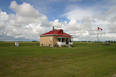 Bede School Bede School The rail line continued from Bernice westward. The next siding that sprang up was named Ruth and it remained with that name until the Canadian Pacific changed it to Bede in 1925. The village consisted of an elevator, a school, and a store. The elevator closed in the late forties. The cemetery, along busy Highway #83, is still in use. |
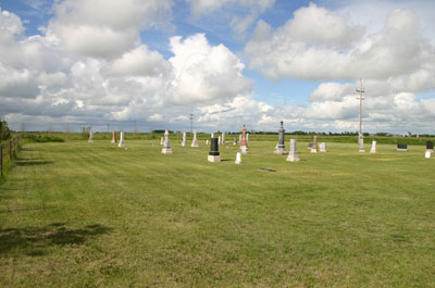
Page 73: West From Lauder – Broomhill & Tilston
| Broomhill The tiny village of Broomhill never did get very big. This large old concrete block building in Broomhill might make you wonder: Why such a large building in a tiny village? 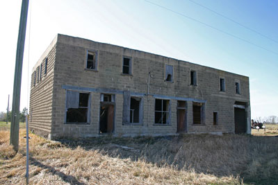 Kilkenny’s General Store – Broomhill, 2011 Perhaps when local Postmaster William Kilkenny and his brother John built it in 1908, they expected the village to grow, or maybe they were just ahead of their time. The Broomhill post office had been established in 1892 on the Kilkenny homestead. When the CPR arrived nearby they moved to the new townsite and build their store. It was more than a store – more like a shopping centre with a post office, a garage, gas station, and even implement dealership. Tilston The first settlers to the region had chosen a site roughly two miles east of the present village of Tilston and established a community they called Eagleton. When the C.P.R. brought the railway through in 1907, they established the town at the current location, and the new name was chosen. Soon, more settlers arrived and among the early buildings was a boarding house, a hardware, a blacksmith shop, a small school building, and a box car for a station. 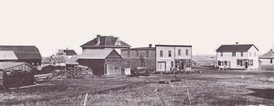 Railway Avenue, Tilston 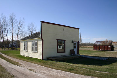 This small building is the former R.M. of Albert Municipal Office. Tilston is now in the Municipality of Two Borders. |
Page 74: The Boissevain – Lauder Branch Part 1
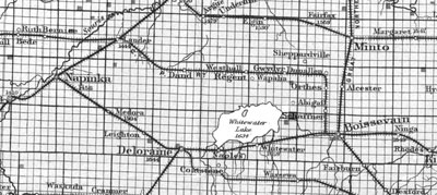 In November 1913 the first train followed the route from Boissevain through stations at Sanger, Schaffner, Orthez, Croll, Regent, Hathaway and Dand before reaching Lauder. The Blue Flea, as it was called, ran a passenger service connected small communities with the big passenger trains out of Winnipeg. The trains also transported hay, grain, milk or whatever was needed. Sanger, Schaffner, Orthez and Hathaway were sidings with elevators and they never did become villages. Croll had just an elevator and a store while Regent and Dand had a few other services. 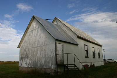 Dand United Church was originally the Chain Lake Quaker Meeting House. The Regent Store and the home of the owners. 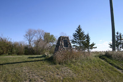 A Cairn marks the location of Croll |
Page 75: The Boissevain – Lauder Branch Part 2
Croll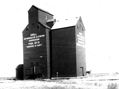 Croll School wasn’t in the village. It was over three kilometres away, where it had been for many years before the village was started. Regent 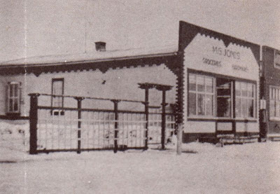 Of the many small railway villages that came and went, Regent’s just might be the only one that was named by mistake. The CPR bought the original homestead of John Riley for the town they were creating and proposed that Riley would be the name. Someone along the way made a mistake and Regent was the name used. As Riley was long gone, the locals appeared quite OK with that. Soon a large store, Post Office, Imperial Oil Dealership, hardware store, blacksmith shop/garage, poolroom, and barber shop were open for business A Presbyterian congregation used the school for services and built a Manse for the Minister. Later, in 1957 a United Church was built in the village. West Hall / Hathaway 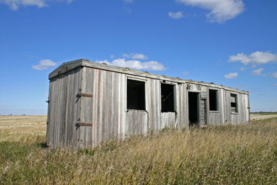 Back in 1912, it was important for farmers that they have an elevator nearby. Many were still using horse-drawn wagons to deliver grain and each trip took up valuable time. The railway and elevator companies tried to provide the service every 6 – 8 kilometres. There was no real need for towns at every stop. Places like Hathaway, in between the village of Regent and Dand, just had one elevator and used an old railway car as a station. Dand The station at Dand was at first known as “Landmark” before it was renamed to honour the Dand family’s role in getting the railway to come through the region. Thomas Dand found hauling grain to the distant rail line was quite a job, often made worse by blizzards in winter and heat and mosquitoes in summer. He asked his friends from his former employer, the CPR, to build a railway line that would connect Lauder with Boissevain and the CPR agreed. They were having trouble deciding exactly where to place the route so Mr. Dand, who had experience with railways, walked a line from Lauder to Boissevain and the CPR followed his path. The End of the Line After the railway stopped in the early 1960’s, the communities lost much of their purpose. Before long schools, churches, stores and grain elevators began to disappear. |
Chapter 9: Diversity
Page 69: The Metigoshe Metis Community
| Except for Grand Clarieire, of most of the new communities in Southwestern Manitoba were British in nature for the first twenty years. After 1900, that began to change as people from other cultures moved here. The first permanent Métis settlers moved to Turtle Mountain in 1908. Descendants of the Red River Métis came from North Dakota and settled just north of the USA-Canada border on the western end of Turtle Mountain. The following decades saw more families move into the bush land surrounding Lake Metigoshe, Lake Dromore and Sharpe Lake. Some European settlers married into Métis families and the community grew. The Metigoshe community was a tight-knit group of people. The relatively isolated location of the community meant that neighbours lived, worked and played together. They pitched in and helped each other in times of need. They created a lifestyle that did not require much money, and many children grew up not knowing, or caring, that they weren’t well off. They made use of what the land provided, hunting, fishing, harvesting wood, trapping, gardening and farming. The children of early Metis families around Lake Metigoshe were faced with a trip of up to eight kilometres to Marsden School, which had been established in 1908. In 1938 a second Marsden School, operated by the same board was built to accommodate them. Student at Marsden School #2 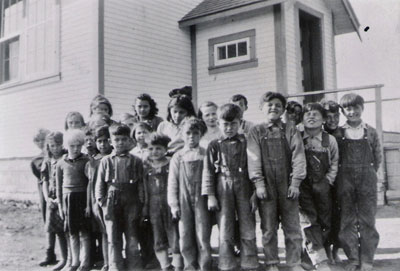 Marsden School #2 While children of European settlers living on the level farmland to the north attended Marsden No. 1, Marsden No. 2 served Métis children living closer to the border. The school, which also served as a community centre, helped local people affirm their heritage. |
\
Page 70: Belgian Community
The first immigrants from Belgium arrived in Southwestern Manitoba in the two decades before the First World War, reaching over 2000 a year by 1906. Lack of opportunity in their overcrowded European homeland, and the devastation of Belgium by the invading German armies in World War I caused many more to leave their homeland.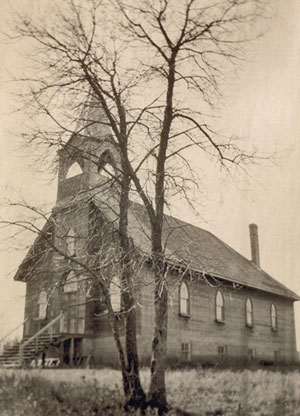 St. Paul’s Catholic Church St. Paul’s Catholic ChurchMost of the settlers in Southwestern Manitoba were of Flemish descendent, while the French-speaking Walloons were more likely to settle in Quebec or St. Boniface where they could continue to speak French. For the newly arrived immigrants, language was always an issue. Many of the men that arrived learned both English, and how to farm on the Canadian prairies, from already established farmers. The children of Belgian immigrants would be taught English in small, one-room schools that dotted the landscape, most of which at the time had very few natural English speakers besides the teacher. Many of the Belgian immigrants would become farmers in Southwestern Manitoba, and would become important members of the community, working with many organizations and community endeavors. They mostly settled around Deloraine and Medora 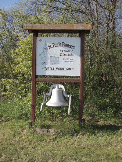 In the spring of 1917 the Belgian community living on the slopes of Turtle Mountain and their priest, Father P. E. Halde decided to build themselves a church wherein they could pursue their worship of the Catholic faith. The spot they chose was high up on the mountain where it could be seen for miles and miles. |
Page 71: The Whitewater Mennonite Community
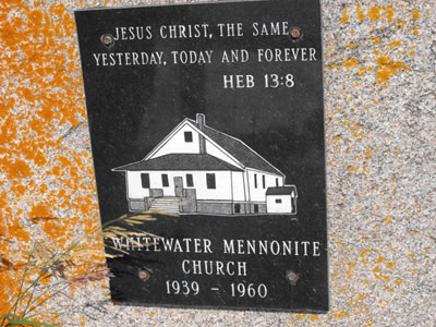 Whitewater Mennonite Church, located by the Cemetery, was built in 1939. Mennonites are a pacifist group of Christians. Before World War One, the Mennonite colonies in Russia were quite well-to-do with beautiful homes and gardens, plentiful orchards, and rich land upon which they produced good crops. After the war the Soviet Revolution brought imprisonment, plundering, mistreatment and murder upon the Mennonite people. This was followed by famine and then the new communist government began to tax the Mennonites very heavily and further harass them. Groups of refugees were eager to find new lives on the Canadian prairies. 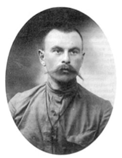 Herman Lohrenz – a teacher from Russia, was one of the first Mennonites to arrive in the Whitewater District. Some came to southwest Manitoba near Whitewater Lake. Many arrived with nothing but the clothes on their backs and Bibles in their hands. Though they had no money to speak of, they managed to secure tens of thousands of acres of land including essential start-up goods without making so much as a down payment. Instead, they promised half of their gross annual income until the purchase price and interest were covered. 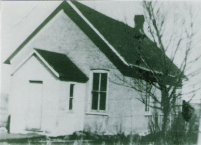 Petersburg School – Whitewater Petersburg School – WhitewaterSchooling was very important and two schools in the region, Petersburg and Strathallan were soon filled with children who knew little English. It was a challenge to find teachers who were trained for such a situation. In their new communities, the Mennonites took pains to preserve their own culture and religious heritage. Church was the hub of the Mennonite community. |
Page 72: Chinese Immigration
The Chinese were unlike any settlers the prairies had seen. They were single men who came into towns and villages in small numbers to run the local laundry or set up a restaurant. They spoke a markedly different language their customs were unfamiliar to the other settlers.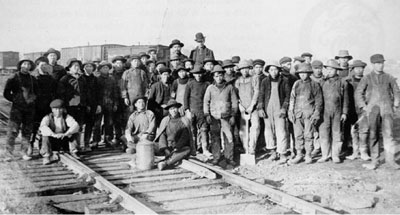 CPR Workers – 1883. When the Canadian Pacific Railway was being built between 1881 and 1885, Chinese men were encouraged to immigrate to work on the project. As soon as the railway was completed, however, the Canadian government wanted nothing more to do with them and moved to restrict Chinese immigration by imposing a $50 head tax. No other group in the history of Canada has been forced to pay such a tax. Chinese men continued to immigrate regardless of the head tax. They often faced poverty at home. China had too many people. For many years the Chinese Immigration Act prevented men already living and working in Canada from bringing their families from China to live with them. Chinese first began settling in Winnipeg around 1870. Soon afterwards Brandon and rural prairie towns saw Chinese men in their communities as well. Many worked in the laundry or restaurant business. Those with higher levels of education and better English skills could work as travelling salesmen. In rural Manitoba, the restaurant is most commonly associated with the Chinese as an occupation. They learned English to make friends with their customers and others in the community. Yet the hard work and long hours made little time available for socializing. Most towns in western Manitoba had a Chinese restaurant at least until the 1950s. They made important contributions to rural Manitoba and fostered fond feelings among their customers and neighbours. 1 |
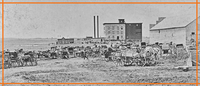

Grist Mills, Brickyards, Cheese Factories & More…..
A research project in two parts, presented by…
  |  The Turtle Mountain – Souris Plains Heritage Association |
With the generous support of the Manitoba Heritage Grants Program
Website By:
Sources and Additional Information….
| The first European settlers in southwestern Manitoba were here ahead of the railways that would link us to the wider world. Because of the great distances between the pioneer farmer and the market, one priority was to find ways to convert local raw materials into essential products. The settlers brought with them a host of skills and experiences, which served them well. They knew how flour mills, sawmills, cheese factories, lime kilns, and brickyards operated. Some even came to the region with the expressed purpose of starting industrial operations, others responded to needs and opportunities. Their efforts were a feature of many of the first communities. Like the communities they served, many, even most, of these first industrial endeavours were short-lived. That doesn’t mean they weren’t important. In rural Manitoba in the 1880’s things were moving quickly. In the southwest corner in particular there was a constant shifting as the railway companies considered options, and speculators tried to predict where growth would occur. Towns sprang up, business enterprises opened, buildings were built. Then they closed or moved. In presenting the story of pioneer industry, a natural divide is evident. The first efforts, notably flour or grist mills, coincided with the formation of those first villages. The villages, by their very nature, were speculative. Having a service such as a flour mill was one element of making a village viable. The second wave of industrial effort came with the creation of the railway towns. These weren’t speculative. They were intentional, created by the decision of a railway company to build a station, which would immediately attract and elevator, which would guarantee traffic, as the region’s farmers needed a market for what they were producing. These towns wanted business enterprises of all kinds. Every new service gave them a competitive advantage over the next town down the line. From the late 1870’s until the ultimate expansion of rail networks around 1910, local production was essential to growth. Industries By Location: An Alphabetical List  Boissevain & Area Boissevain & AreaFlour Mills Preston & McKay: 1889 – 1902 Turtle Mountain Milling Co. Ltd. : 1906 – 1920 Sawmills Max Lake Fox Sawmill Lime Kilns: Johnstone, Hicks (Ninga) & McRuer Cheese & Butter Factories The Morton Dairy Carriage Maker: Butler and Frith Concrete Block Maker Deloraine & Area Flour Mills Old Deloraine: William and Thomas Sheppard: 1882 – 1887 Ontario Milling Company:1897 – 1906 W. R. David: 1894 W. Barker – Whitewater: ca. 1890 Carriage Maker: The Deloraine Carriage Factory: Mr. B. Steele: 1894 Elgin – Minto Area Lime Kilns: Bunclody & Riverside Flour Mill: Gregory’s Mill: 1882 – 1894 Brickyard: Souris City: Freek and Coupland: 1882 Flour Mill: Souris City Hartney & Area Flour Mills Hammond and Leckie: 1894 – 1911 Lauder Flour Mill: Giddens and Campbell Flour Mill: 1894 Brickyards Payne, (1895) Sackville (1898) & Kirkland (1901) Pump Factory: H. C. Pierce 1893 Sash and Door Factory: Alex Mains: 1900 Carriage Makers: Edouard Isabey: Victor Duchesneau Clothing: Edwards Sisters / A.E. Hill Co. Cheese Factory: Lauder: Hobert Sibald: 1895 Lime Kiln: Lauder Melita & Area Flour Mill: Melita Milling Co. – 1892 Brickyard: The Melita Brick Co. 1905 Concrete Blocks Manufacturing: Antler River Steel Works – Coulter Millford Flour Mill: R.Z. Rogers: 1881 – 1885 Sawmill: R.Z. Rogers: 1881 – 1885 Napinka Flour Mill: Roblin & Armitage: 1893 Carriage Maker Lime Kiln: L.J. Phinney Plum Creek and Souris Flour Mill: G. McCulloch and William Herriot: 1882 Pierson & Area Lime Kiln: Robert Fanning and Andy Lyle Concrete Blocks: Lyleton Wakopa Flour Mills: Harrison: 1878 – 1887 Sawmills: Harrison Brothers: 1878 / The Fox Sawmill – 1880 Cheese Factory: Hettle: 1885 Waskada / Goodlands Area Line Kiln: William McGill Poole and Harry Morningstar Concrete Block Making |
Flour Mills
| Introduction First… a word from wikipedia… A gristmill (also: grist mill, corn mill, flour mill, feed mill or feedmill) grinds cereal grain into flour and middlings. The term can refer to either the grinding mechanism or the building that holds it. Grist is grain that has been separated from its chaff in preparation for grinding. We will use the terms gristmill, grist mill and flour mill interchangeably because al three are used in the source material. The European settlement of Southwestern Manitoba followed a process that had already been established elsewhere, across North America. People were here before services, before roads, before stores and towns They really were starting from scratch. Slow transportation and long distances made self-sufficiency a must. They came to farm, and they already knew that wheat and other grains were to be the primary crops. The prairies were opened to agricultural settlement for one main purpose – to grow wheat. The problem with that was that it was so far to market that there was little profit to be made. That was okay, they all knew that. Eventually rail lines would cross the land and everything would fall into place. In the meantime, subsistence was a starting point. Having a gristmill nearby, where one could at least exchange wheat for flour was a crucial advantage in making a homestead sustainable until a railway would arrive. Turning wheat into flour represented Manitoba’s first step in becoming an industrialized society. Flour milling was practised by the province’s aboriginal peoples long before Lord Selkirk’s settlers engaged in the activity. When Manitoba gained provincial status in 1870, most flour mills were concentrated in the vicinity of the rapidly emerging city of Winnipeg. Flour mills supplied flour for the practical consumer needs of the district residents. The early mills operated on the millstone process, utilizing wind and water as a power source, with steam power being introduced around the time Manitoba became a province. The development of the gradual reduction process, using chilled iron rollers, revolutionized the milling industry in the world and in Manitoba. By 1890, a roller-process flour mill was considered an essential asset for the continued growth of every community, serving as a tangible symbol of new-found prosperity and progress. To increase their chances of becoming the service centre for their district, many villages and towns offered bonuses to millers to establish plants in their locale. A Trip to Gregory’s Mill This excerpt from a letter to the Manitoba Review by Cartwright pioneer, A.E. Steel, takes to back to those days. Our first grist of wheat was taken to the flour mill at Glenora and a farmer got his own wheat ground into flour and got all the flour, bran and shorts that he owned. After that we went to Wakopa flour mill owned by Harrision Bros., and again I havemade a number of trips to the Souris mill. The mill was equipped with the Hungarian Patent process and made an excellent grade of flour. Each round trip took four long days to go and return with oxen. The mill was kept running day and night, and if we were fortunate our gristing was done right away and we would be able to start for home without losing any time. The mill was owned by a man by the name of Gregory, and anyone that had to stay overnight was accommodated at his house. He had plenty of stable room and feed for the teams and the charge for man and beast was very reasonable. I remember Bob Blackwell and myself going with our grists to the Souris mill with the oxen and wagon after the freeze-up. The weather was lovely so we travelled until quite late the first day and then camped out for the night. We had plenty of with which to keep us warm. The next morning we hitched up early and got to Dunlop’s for breakfast. (The town, Dunrea, is situated on that place now, or at least part of it). The townsite is on part of two farms that were owned by Dunlop and Ray so the town was named after the two farmers. Leaving Dunlop’s, we entered Lang’s Valley and travelled it for a few miles, then crossed up the other side and the next valley we entered was the Souris and then on across the river to the mill. This time there were a lot of grists ahead of us and that meant staying at the mill two nights instead of one. We could get our meals at the house but there wasn’t sleeping accom- modation for all, so a number of us slept at the mill above the engine room which was nice and warm. 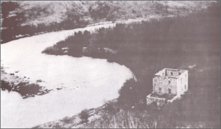 Gregory’s Mill – along the Souris River between Margaret & Wawanesa We got loaded up and started for home before daylight on Saturday morning and travelled a good distance be- fore we stopped to feed our teams. After giving them a good feed we got going again. Bob said he intended to stay that night at a friend’s and he would not resume the journey until Monday morning, but I decided to go on home after feeding and resting the oxen. I passed through the north end of Killarney late at night, and after a while began to feel sleepy so I wrapped a quilt about me and lay between the bags. I knew the oxen would keep to the trail so I dropped off to sleep. I don’t know how long I slept, but when I awoke, I found the oxen both laying down. I got them going again and finally reached home before daylight on Sunday morning. *Cartwright & District History Committee, Memories Along the Badger Revisited, 1985 p4 The First Mills In a sense the early mills were services that hoped to become towns. Places like Wakopa, Old Deloraine, and Plum Creek had mills very early, some time before the railway. With the coming of the railway links we saw the creation of more lasting towns. These towns wanted a gristmill and would often offer what was called a Mill Bonus to attract such a business. Interestingly the second wave of railway town, those on the second and third branch lines, like Waskada, Medora and Minto didn’t have establish flour mills, or many other industries for that matter. The first wave of town had those services and more. Some flout mills in the larger towns had already closed. There was no need. The period from 1881 and 1882, known as the “Manitoba Boom”, saw intense speculation in land sale – especially in town lots. Everyone knew that the population of rural western Manitoba was going to explode. Towns would be built, businesses established, and money would be made. The problem was that nobody was sure where all these new towns would be located. It all depended on where the railway lines would run, and where the railway company would decide to put a station. Although some railway surveys had been undertaken and some lines had been planned, no one knew where the stations would be. So some enterprising landowners decided that a piece of land they owned might just be a good spot for a town. Speculating in town lots was a bit like participating in a gold rush. You stake a claim and hope it pays. Exaggerations and outright lies were the tools of that trade. To sell the lots the promoter had to assure prospective buyers that the rail line was a sure thing. Another selling point was having a mill. 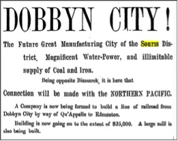 Winnipeg Times, March 9, 1882 The claims made in the following story could easily have been set to rest by checking with any local resident. 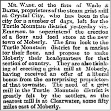 Winnipeg Daily Sun, Dec 23, 1881 There never was a building of any sort at Moberly, and the “nearest Mill” was indeed much closer than Clearwater. The mill at Wakopa in fact, had been up and running for some time. Flour Mill Locations 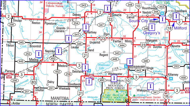 Pre- Railway Sites Wakopa In 1878 Matthew Harrison built a flour mill in the settlement that would soon become Wakopa.This historic industry was the first in Turtle Mountain municipality. To accommodate the settlers who brought their wheat from afar by oxen to be ground into flour, the family built a boarding house and large livery barn. Later the Harrisons built a gristmill at Holmfield that would serve the area for over a century. On the second floor of that historic building one can still see the rough cut 2 by 6’s that were sawn at the old Wakopa for the Harrison’s next enterprise. Millford The town northeast of Wawanesa, was the brainchild of a Major R.Z. Rogers from Grafton, Ontario. In 1881, His gristmill, which was once described as a “small portable” one, was up and running, and farmers were hauling their grain to him. Souris City At its birth, Souris City, just south of Wawanesa, was one of many speculative “cities” that came with the Manitoba Land Boom of 1881-82. The gristmill, which was steam powered, was located along the river on the east side of the flats. Waubeesh Another casualty of the Manitoba Boom was the settlement of Waubeesh, west of Boissevain. A gristmill, whose wheel was to be turned by the water from Waubeesh Creek, was built by Robert John Hurt, and a huge celebration was held at its completion. Local histories tell us that, for unknown reasons the mill never ground a kernel of grain. Gregory’s Mill John Gregory’s built a mill on the Souris River about 12 kilometres south if Wawanesa in 1883. It was the most important mill south of the Souris River for over a decade. Fortunately, enough evidence of the site remains for one to visualize the whole operation. And we have a few photos. Plum Creek and Souris In 1880 William Henry Sowden, Thomas Gillespie Kells and John Nesbitt Kirchhoffer, members of the Millbrook Colonization Syndicate, acquired the property on Plum Creek near where it enters the Souris River. They did this because of its suitability for a mill site. The mill would justify the establishment of a settlement at what is now the Town of Souris. Old Deloraine In 1880, when the government decided to place a Land Titles Office along the Boundary Commission Trail in the Turtle Mountain district, it put the new village of Deloraine on the map. In November 1882 brothers William and Thomas Sheppard built one along Turtlehead Creek adjacent to the new and growing village. Railway Towns Boissevain In 1889 Preston and McKay built a substantial structure of local sandstone on the west side of Mill Road just south of the CPR track. In 1902, when the operation was consumed by fire there was no hesitation. By May of 1905 the Turtle Mountain Milling Co. Ltd., a consortium of local businessmen, had purchased the site and was beginning to erect a new building. Melita The establishment of the Melita Mill was voted on December 17, 1891, and first annual meeting of the Melita Milling Co. was held on January 26, 1892. The building was 36′ x 48′ in size and was four stories high. The engine house, also 36′ x 48′ was a solid structure to be lighted with electricity and fitted with all modern conveniences. Deloraine When Old Deloraine’s buildings were moved to the railhead, it was proposed to move Sheppard’s mill as well. The lack of an adequate water supply there, however, made this plan unfeasible. A new mill was built by the Ontario Milling Company in 1897. Hartney Hammond and Leckie, who operated a successful lumber yard and grain elevator in Hartney, entered the flour milling business. A substantial structure was erected, machinery installed and by 1894 it was in full operation. Coal from Estevan and water drawn by tank from the river, provided the steampower. Napinka In 1892 the booming town of Napinka offered a $5000 bonus to start a mill. Someone took the offer, built the mill then skipped town. (Sun April 26, 1975) Lauder May of 1892 a meeting of ratepayers took place to vote on the issue of bonds to raise money to assist the establishment of a mill. In 1893 an agreement was signed between the Municipality of Winchester and Giddens and Campbell of the London Engine Supply Company. This agreement called for a fifty-barrel mill that was to run full time and be operational by September 15, 1893. Conclusions The establishment of the rural milling industry was a direct result of the confidence demonstrated by those entrepreneurs and farmers who invested their fortunes, toil, and tears in the development of the province’s agricultural resources. The conversion of wheat into flour for practical consumer purposes provided evidence to investors that the region was worthy of future development. The agricultural sector provided the engine for the growth of the entire province. Four milling played an important role in this achievement. Even though many settlers had milling experience, and there was a definite need for the service, they weren’t prepared for the seasonal nature of prairie rivers and soon learned that water power wasn’t reliably available. Thus it was more costly here than in the east, and making a profit was more difficult. The decline and extinction of small independent flour mills across Manitoba can be largely attributed to the uncompetitive position in which these mills were placed by the large milling companies after the first World War. Consumers of flour gravitated toward the more inexpensive product produced by the large mills. Lack of business suffocated the independent millers and most were driven out of the business. The large milling concerns could not only undercut the price of flour that independent millers offered, but they operated at a distinct advantage because of their large reserves of capital. The large mills also had greater funds at their disposal for advertising. Over the course of the twentieth century, Manitoba’s rural population base began to decline; rural residents migrated to urban centres. All these factors played a part. Although the flour milling industry in rural Manitoba faced its perhaps inevitable decline, the role it played in that short period of transition to an agriculture based economy was both important and interesting. |
Sawmills
| Even if standing timber was available, no area in Manitoba could be successfully logged for commercial use unless it lay near a waterway system, or later, a railway. Therefore tracking the chronology of the development of lumbering in the various regions of Manitoba is relatively simple: follow the lakes and railways systems. In the southwest corner, however, there was also the fact that timber was scarce. There was a reason that so many homesteaders began their farming life in a sod hut. The scarcity of trees meant that the open prairie was easy convert into productive cropland. The downside was it was a long way even to get firewood, let alone building materials. Turtle Mountain was one place that was well wooded. That allowed early settlers in that vicinity the option of using locally sourced wood. The era of locally milled lumber in the southwest corner was short, as rail service allowed for an easily accessible supply of milled lumber in most areas. Some local sawmills continued to make use of Turtle Mountain timber for rough lumber, even after most building materials were shipped from elsewhere. Locations 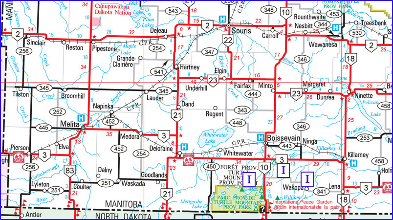 Wakopa Wakopa was the first village in the region and home to the first sawmill. The Harrison Brothers and Mr. Williams built a sawmill in Wakopa in 1878 or 79. It was on the banks of Long River, where a dam was constructed to make use water power. The Fox Sawmill In 1880 the Fox family acme to the Wakopa area. Thomas and his oldest son Alfred set up a sawmill two miles northeast of Lake Max. People came from many miles around to use the lumber that was produced from this mill. Private Operations It was not uncommon for a farmer to own a small portable mill. Such operations continue to this day. In the Mountainside area, Sam Smith had a steam sawmill operating In the fall of 1882. Mr. Morton’s Mill The Max Lake Sawmill also known as the Bolton Sawmill, it was built on Lake Max in 1881. It was bought by George Morton, then later owned by Hugh McCorquodale and then Bill Harvey. The mill sat on the northern end of the lake, just west of a stream that flowed into the lake from a slough a couple hundred metres back from the shore. Conclusion The Max Lake sawmill was an exception in that most sawmills only operated for a short time when settlement preceded railway links. The supply of timber on Turtle Mountain meant that locally produced lumber, rough cut for farm use, was marketable into the modern era, |
Cheese Factories
| In the same way that grist mills or flour mills were an obvious way to convert local product into food, butter and cheese factories were an early attempt to process milk locally. Most of these were small operations focusing on the local market. The Morton Dairy The most notable effort however was much more than that. George Morton was dreaming big when he purchased a large tract of land north of Whitewater Lake. He had his eye on a national market. He came with the right experience. He had earned the title Cheese King of Canada while working as a cheese factory owner in Kingston, Ontario. When he came to the Turtle Mountain area in 1878 he saw the potential for large-scale cheese production in this the rich hay land that borders the shoreline of the lake. Locations 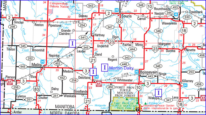 Wakopa A more modest attempt to process milk into a value-added form was also short-lived. John Hettle came from Ontario. After starting a successful farming operation he formed a company in 1885 with T. A. Sharpe and the Young brothers to operate a steam-powered butter and cheese factory on Sharpe’s Creek near Wakopa. HettIe brought the dairy herd from Ontario. Later the herd had to be destroyed because of disease and the factory was dismantled. Lauder In 1895 the farmers of the Lauder area met to discuss the idea of a cheese factory. June 1 was set for the start of cheesemaking. The factory was located just east of the village. Deloraine Not much is known about the Deloraine Cheese Factory, but an item in the local paper in 1894 notes that: “5100 lbs. of milk were received at Deloraine Cheese factory on one day. Deloraine cheese was shown at the Winnipeg fair.” Conclusion It would appear that cheese making, which appeared to be a logical was to add value to local products, and which had seemed to work well in the Ontario homeland, was not a winning idea the southwest corner. |
Brickyards
Some time ago, while visiting at one of Hartney’s fine brick homes, I was shown a portion of the wall that clearly displayed the paw print of a cat. The owner explained that the bricks came from a small local brickyard, and, yes, the owner’s cat must have roamed the facility during the early stages of the brick-making process. Only in Hartney – cat’s paw bricks! Limited edition. Manitoba is geologically blessed with thousands of clay deposits, hundreds of which have been exploited over the past 150 years for brick manufacture. The “Golden Age” of this aspect of Manitoba’s building history was from 1880 to 1912. There were about 60 major clay sites and about 175 brick manufacturing plants that provided the billions of bricks that were required for Manitoba’s major building boom of the late 19th and early 20th centuries. The details of industrial operations were not often covered in local newspapers and so it is only possible to provide a sense of typical operations. The work was hard and the days were long. The pay was modest, about $2 a day, but it was steady, at least for the duration of the season, usually from May (when the frost left) till August or September. Even small yards had up-to-date technologies such as steam-power. A typical operation featured the large covered drying sheds that new bricks were laid into. It was the final stage of the brick-making operation that usually distinguished a major from a minor yard: whether the brick was fired in a scove or beehive kiln. The scove kiln. Most likely used in most operations in the southwest corner, was a less sophisticated technology, but one that was still effective enough to produce good quality brick. Burnings lasted about seven to eight days, and when the outer shell of bricks on a scove kiln was removed, workers discarded the disfigured and discoloured bricks nearer the fire source. The Brick House The first settlers often built a sod hut for those first few years. Logs were hard to find on the open prairie, but those living along the Souris River or in the vicinity of Turtle Mountain might start with a log house. If logs were available someone might set up a sawmill, but otherwise milled lumber was expensive and involved some difficult hauling. Settlers who arrived with a bit of cash in hand might opt to bring in building supplies, but many had to wait for that first frame dwelling. Brick was desirable as a building material, but was even more expensive to ship than milled lumber, so it was some time before brick buildings became popular. What helped that process along was the fact that some of those new settlers came with some experience making bricks, and they kept an eye out for deposits of clay that would serve that purpose. Locations 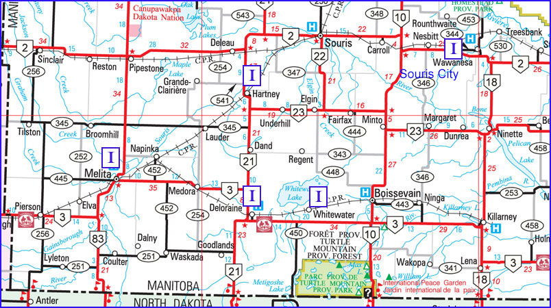 Souris City Souris CityThe first bricks made in the southwest corner were likely produced by at Souris City, the village that preceded Wawanesa. A brickyard was established there by Mssrs. Freek and Coupland. It produced a low quality type of brick used for the lining of wells. Whitewater / Deloraine Perhaps the earliest brickyard in the Turtle Mountain region was located a near Whitewater, on the N.W. quarter of. 17-3-21. In 1894 the factory was sold to W. R. David and the brick machine moved to Deloraine next to the Racetrack. Hartney The most extensive brick-making operations in the southwest corner were located in Hartney and involved three enterprises. The most important practitioner was William Kirkland. At the height of his ten years of brick-making, in 1913, he was firing bricks for the new Saskatchewan Legislative Building. Harry Payne and George Sackville each had moderately successful operations in the 1890’s The Melita Brick Co. In 1905 Mr. John Dobbyn (80 years of age) discovered a red brick clay just west of the river and south of today’s #3 highway. He purchased the land (31-3-26) and ordered a modern brick making plant. The Melita Brick and Tile Co. was formed in April 1905. Conclusion Virtually all brickyards in southwestern Manitoba ceased operations before or during the First World War. In some cases brickyards functioned until the deposit of clay ran out, in other cases competition and declining demand were factors. By 1910 most productive land had been taken and the building boom was over. |
Manufacturing
| The story of manufacturing in Manitoba’s small towns is story of individuals starting by meeting a local need. A surprising number of products that, in our modern world would tend to be coming from far away, were made right here at home. The fact that there was a local need for products that, other wise would have to be shipped from some distance and at some significant expense, spurred efforts to improvise and create. The good news was that the people coming to these new communities brought with them an array of skills. Many had worked in factories and trades and gained skills that could be readily out to use in this new context. In the history of Souris City, one of the first villages in the Southwest Corner we learn that, “A Mr. John Harris found his niche in the manufacture of axe and hammer handles.” Why not? How complicated could that be? Locations 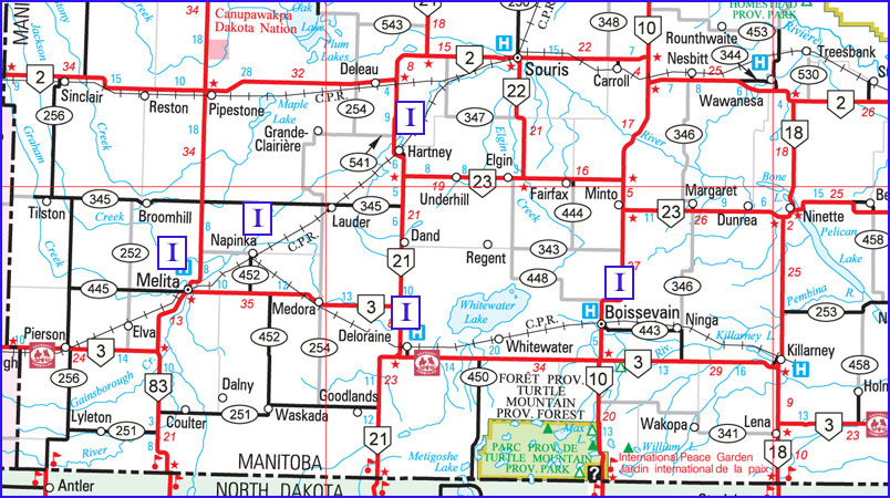 Hartney HartneyAs towns grew, both the demand for goods and thus the possibilities for industry expanded. In 1893, when H. C. Pierce began making pumps, he quickly supplied one thousand pumps for the local market. But soon everyone had a pump, and business slowed down pretty quickly. Alex Mains, and his brother set up a Sash and Door Factory, in 1900, and added a planing mill to provided materials for the many new homes which were built in this and other communities, the need for such materials was a little more ongoing. Another common example of small town manufacturing focused on another vital need. Victor Duchesneau arrived in Hartney about 1901 and in 1904, along with his blacksmith business, he started a carriage and wagon factory. He could turn out “buggies, wagons, carriages and all fine lumber work with city style and finish.” Edouard Isabey who opened a small machine shop in about 1893, also made and repaired carriages. In a listing of Hartney’s early businesses we also find an entry for “Shore and Co. carriage makers.” Deloraine The Deloraine Carriage Factory run by Mr. B. Steele was for a short time “ one of the largest of its kind in the Province. Six men are employed, four blacksmiths, a woodworker and a painter. Melita In 1891 when the town of Melita started, Mr. Richardson built a carriage shop which he sold two years later. Also in Melita, George Lea, was a carriage maker, and D. Lamont’s shop build buggy wheels among other things. The Holden Furniture and Funeral business had a glass paneled hearse on wheels, which could be changed to specially built sleighs for winter use. It was built by a carriage maker in Napinka some time before 1910. Elsewhere In Boissevain, Butler and Frith were carriage-makers and blacksmiths. |
Lime Kilns
| Some years ago, while walking along the high riverbank overlooking the Souris River near Bunclody, I found what appeared to be an old well lined with fieldstones. I gave it little thought until I learned about the small lime kilns that settlers often constructed to make mortar for the many stone buildings that dot the southwestern corner. They are another example of small, local, do-it yourself, prairie enterprises. 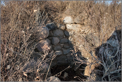 The remains of a kiln, near Bunclody Early settlers used it to purify and freshen damp basements, in the henhouse, in cement and plaster and for whitewashing walls and ceilings. Part of the spring housecleaning ritual was the whitewashing of the interior of the little building with the half moon cut in the door. The only “accessory” in that little building was a nail and string to hold the previous year’s Eaton’s catalogue, which was used to the very last page. Locations 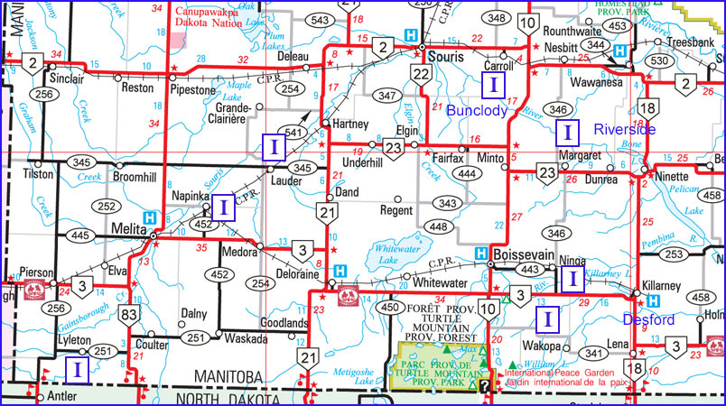 Angus McRuer describes one located near his Desford-area farm… “This kiln was on a rise of land sloped to the north. A hole eight feet deep by ten feet across was made at the top of the slope. A trench three feet wide by thirty feet long was dug, starting at the bottom of the hill, up into the bottom of the big hole. It was like a big clay pipe. The trench acted as a damper.” To prepare for a burn, stones were placed in the kiln leaving an arch at the bottom to hold the fire. The process took three days to reduce the limestone to powder. In addition to using it for making mortar, people used it to purify and freshen damp basements, and in cement and plaster and for whitewashing walls and ceilings. There were several of these small local enterprises in our region. Many are small and barely recognizable. They are usually on the side of a creek bed or hill to allow access to one side of the kiln to feed the fire and to provide the necessary draft to create a hot and steady burn. Like so many of these local initiatives, with the improved train service, the availability of a reliable and ready source of products in the local lumberyard saved local builders a lot of time. Most kilns had ceased operations by about 1900. |
Concrete Blocks
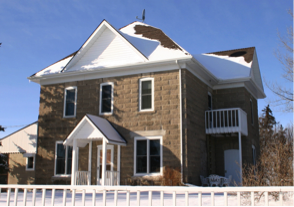 At first glance this attractive house on a farm near Boissevain looks like it might be one of the many fieldstone homes in the region. A closer look tells us that those building blocks are concrete. For a few years in the early 20th century, many buildings in southern Manitoba were built with locally cast concrete blocks. Much larger than bricks, the blocks were hollow, and were typically flat on the interior face but variously patterned on the exterior face. Because these blocks did not require high-temperature firing like bricks, there was no need for the substantial infrastructure used in conventional brick-making. They could be made on the building site with portable equipment. 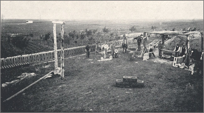 Cement Block Manufacturing on the farm of W.J. McKinney, 1904 – Photo courtesy Mrs. Ina McKinney Beckoning Hills, page 73. Cement Block Manufacturing on the farm of W.J. McKinney, 1904 – Photo courtesy Mrs. Ina McKinney Beckoning Hills, page 73.It all began with the patent in 1900 for H.M. Palmer’s block machine. Within a few years, this new technology really caught on. It appears that the firm of Laird & McGarvey of Deloraine were one of the first in the region to purchase a machine to make the bricks. Aside from the advantage of making your building material on site with locally available materials, by using a variety of molds one could produce an attractive and durable exterior. By altering the type of sand used you can get a bit of variety in colour and texture.  Some builders used unique designs for effect and emphasis. How Blocks Are Made The cement is poured into a mold arranged with the outside surface (in various patterns) at the bottom. Depressed end pieces are put in to make the blocks partly hollow. When the mold is half filled, a metal block known as the “core” is placed in position. The mold is then filled to the top and tamped. It hardens quickly under the pressure and may be taken from the mold at once. The “core” is then removed, leaving the blocks hollow. 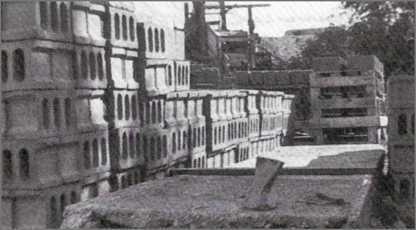 A supply of Concrete Blocks in Napinka. Many of the buildings are still standing and looking good in towns across our region. They range from fine heritage homes, old schools, and commercial buildings like this one in Lyleton.  An example in Lyleton Historians aren’t sure why the use of concrete blocks was popular only for a short while, with most examples being from 1904 to 1910. Perhaps with improved rail access, the availability and quality of both wood siding and bricks were a more attractive option? Perhaps the uniform grey colour was not as appealing? 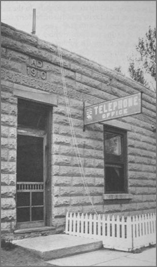 Note the date stone on this Telephone Office in Waskada. Although there are examples of concrete block buildings from later in the century, they are rare. More ExamplesIf we take a look at how so many of these buildings have survived in good shape we can see it was a good practical choice for the times.So if you are passing though our southwestern Manitoba towns, look for these examples. 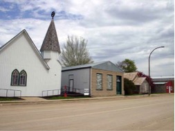 Union Bank Building in Waskada – built 1906 Union Bank Building in Waskada – built 1906 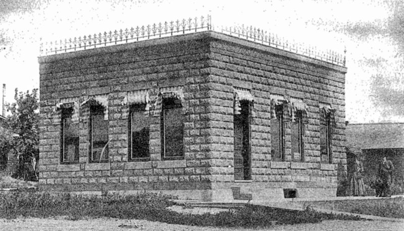 The Crerar Law Office in Melita, as it appeared in 1904 when it was built. Still used today. 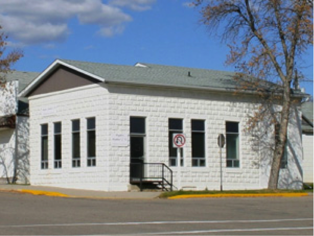 |
Pre-Railway Communities / Wakopa
| Wakopa The development of the grain business began in Wakopa long before the railway was built through Boissevain and Killarney. In 1878 Matthew Harrison built a flour mill in the settlement that would soon become Wakopa. It was powered by a water wheel and used grinding stones brought from France. George Bennett, freighted those stones from Emerson to Wakopa with a team of oxen. These stones are very heavy and are in various places. One is in the Cairn at Wakopa and one is in the museum in Boissevain. This historic industry was the first in Turtle Mountain municipality. To accommodate the settlers who brought their wheat from afar by oxen to be ground into flour, the family built a boarding house and large livery barn. In 1881 Bill Harrison joined his brother, and in 1882 another brother George came west and joined the company. These businesses, along with B.B. Lariviere’s Store and Stopping Place established Wakopa as an important place. People came to Wakopa, bringing grain to be ground into flour, or buying lumber at the sawmill. Meals were served at the Harrison home, at La Riviere’s, and at Mrs. J. Melville’s boarding house. Fire destroyed that mill in 1883. The Northwest Farmer reported that “Williams and Harrison Bros., who ran an extensive grist and saw mill business…., at Wakopa, have had the misfortune to lose their mills by fire. A quantity of grain was burned.” “It is estimated that the loss by the burning of the mills at Wakopa will amount to at least $8,000.”  Winnipeg Daily Sun, April 28, 1884 The mill was re-built but functioned for only a short time. In May 1887, The Northwest Farmer reported that. “Wm. Harrison, proprietor of the grist mills at Wakopa, Man., will put in roller process machinery.” The coming of the railway to Killarney and Boissevain doomed this busy centre. The mill ceased operation; buildings were taken down or moved away, until other than a few basements, the site once more became part of the original landscape. Later the Harrisons built a gristmill at Holmfield that would serve the area for over a century. On the second floor of that historic building one can still see the rough cut 2 by 6’s that were sawn at the old Wakopa for the Harrison’s next enterprise. A visitor to the Turtle Mountain Flywheel Club Museum in Killarney can see the machinery from the original Wakopa gristmill on display. Harrison Sawmill There are, or were, two Wakopas. Many people refer to the first one as Old Wakopa. The first entrepreneur in the Turtle Mountain district was a fur trader, Bernard B La Rivière. The story of “Old Wakopa” begins with Mr. La Rivière who, in 1878, established a store and stopping place on the Boundary Commission Trail near the east shelf of Turtle Mountain. Surveyors and travellers already venturing westward and soon there would be to a steady stream of homesteaders. There would be many of them and they would need supplies. It became the first village in the region. It was home to the first sawmill. The Harrison Brothers and Mr. Williams built a sawmill in Wakopa in 1878 or 79. It was on the banks of Long River, where a dam was constructed to make use water power. Soon the first sod and log homes gave way to buildings of milled lumber. The first frame house in the Turtle Mountain area was built in 1880. It operated for only a short time, but it was an important service and helped make Wakopa an important village. The Fox Sawmill In 1880 the Fox family acme to the Wakopa area. Thomas and his oldest son Alfred set up a sawmill two miles northeast of Lake Max. People came from many miles around to use the lumber that was produced from this mill. In 1881 Tom decided to take a homestead nearby and settled (on 10-2-19) several miles west of Wakopa in the Adelpha area. In 1884 Tom moved his sawmill west where it was used to cut lumber for the growing CPR. The mill was dismantled and hauled to Brandon where it was shipped to Calgary. Tom went along with his mill while his family stayed behind and his son Frank took over the homestead. A more modest attempt to process milk into a value-added form was also short-lived. The Hettle Cheese Factory John Hettle came from Ontario. After starting a successful farming operation he formed a company in 1885 with T. A. Sharpe and the Young brothers to operate a steam-powered butter and cheese factory on Sharpe’s Creek near Wakopa. HettIe brought the dairy herd from Ontario. Later the herd had to be destroyed because of disease and the factory was dismantled. |
Pre-Railway Communities / Turtle Mountain
| Old Deloraine In 1880, when the government decided to place a Land Titles Office along the Boundary Commission Trail in the Turtle Mountain district, it put the new village of Deloraine on the map. Settlers seeking homestead in a huge area we might now call Southwest Manitoba had to travel there to get title to their new homes. A village quickly grew and as was common with all new settlements, settlers soon wanted a mill. In November 1882 brothers William and Thomas Sheppard built one along Turtlehead Creek adjacent to the new and growing village. It also made use of a Gouldie-McCulloch steam engine. This enterprise supplied the flour and feed needs of both local and North Dakota residents. 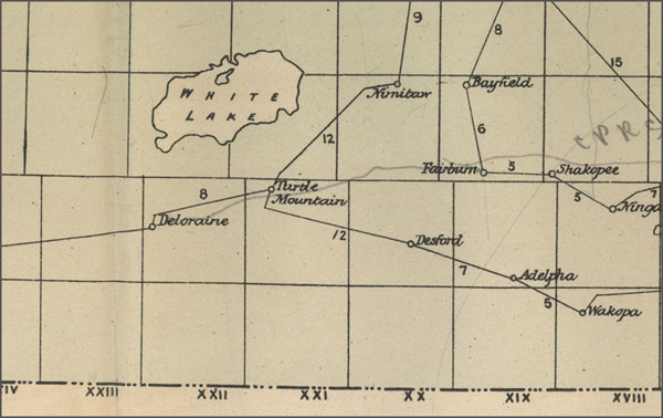 The region in 1884, with Postal and Stage routes. Waubeesh Another casualty of the Manitoba Boom was the settlement of Waubeesh, west of Boissevain. Settlers had big plans. A gristmill, whose wheel was to be turned by the water from Waubeesh Creek, was built by Robert John Hurt, and a huge celebration was held at its completion. Local histories tell us that, for unknown reasons the mill never ground a kernel of grain. A special edition of Northwest Farmer from 1883 indicates that: “The new grist mill at Waubeesh, Turtle Mountain, owned by Messrs. Brondgeest & Hurt, started up on the 19th of March, and is now in full operation. The mill structure in 36 x 64 feet, two storeys high, two run of stones, and is run by a twenty horse power engine.” (S: Nwfmm, Special Ed., 1883, p.20.) As often happened, especially in the era of the Manitoba Boom, the press tended to relate positive settlement stories, while lacking the resources, and sometimes the inclination, to fact check. We know for sure that the mill didn’t last long. Perhaps the progress in nearby Wakopa stifled the prospects of Waubeesh or the attention of speculators was turned towards the competing “Boom Town” of Turtle Mountain City, only a few kilometres away. Mr. Morton’s Sawmill (Max Lake / McKinney / Conroy Sawmill) The Max Lake Sawmill also known as the Bolton Sawmill, it was built on Lake Max in 1881. It was bought by George Morton, then later owned by Hugh McCorquodale and then Bill Harvey. Then in 1910 Fred McKinney decided to buy the mill for him and his sons Doug, Bill, and Elson to run. They ran the mill till 1968. There are stories of men from all over going to the mill to get wood, men willing to go through days of travel and fighting a battle with the furiously cold weather. There was a bunk house where they could stay at night with a fireplace in the middle to keep it warm. The mill sat on the northern end of the lake, just west of a stream that flowed into the lake from a slough a couple hundred metres back from the shore. Cut logs were dumped into this slough. Afterwards, they were sent down a man-made channel to the lake where they were chained at the entrance to the lake from the stream. They were held here until there was room in the mill for them to be cut. The mill’s boiler stack was guyed up to a majestic oak tree by a long bolt that went straight through the tree. 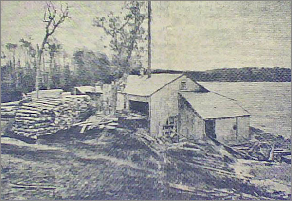 The sawmill on the edge of north shore of Lake Max, while it was owned by Mr. Morton. The machinery included a planer and shingle-mill. In about 1910 Harvey sold the sawmill to Fred McKinney, who moved it from Lake Max two miles north to his property. They used the mill to do a limited amount of custom sawing until the timber reserve was opened up again in 1930. Bill Eaket soon joined in the operation, lending the use of his gas-powered tractor to run the mill. Everything except for the actual sawing of the lumber was up to the customer to do. Trees were felled (by hand), trimmed and hauled (by horse) to the mill where they were sawed. The cost of this service was $10 to $12 per 1000 board feet. 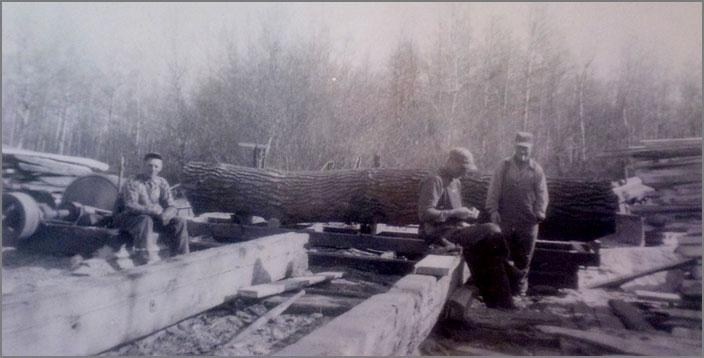 Sawmill in the Turtle Mountain region. Photo courtesy Charlie BaldockThe sawmill generated copious amounts of sawdust, which was put to use by the Municipality of Morton during the early 1930s. After being hauled to town the sawdust was mixed with arsenic and molasses and churned in a small cement mixer. This mixture was then spread along the road allowances to kill grasshoppers. In 1938 Bill Eaket dropped out of the operation and Bill and Doug took over the business from their father. They ran the mill for an additional 25 years. During this time they were mostly sawing for local farmers who needed lumber to construct buildings, corrals and hay shelters. |
Pre-Railway Communities / Turtle Mountain
| Old Deloraine In 1880, when the government decided to place a Land Titles Office along the Boundary Commission Trail in the Turtle Mountain district, it put the new village of Deloraine on the map. Settlers seeking homestead in a huge area we might now call Southwest Manitoba had to travel there to get title to their new homes. A village quickly grew and as was common with all new settlements, settlers soon wanted a mill. In November 1882 brothers William and Thomas Sheppard built one along Turtlehead Creek adjacent to the new and growing village. It also made use of a Gouldie-McCulloch steam engine. This enterprise supplied the flour and feed needs of both local and North Dakota residents. The region in 1884, with Postal and Stage routes. Waubeesh Another casualty of the Manitoba Boom was the settlement of Waubeesh, west of Boissevain. Settlers had big plans. A gristmill, whose wheel was to be turned by the water from Waubeesh Creek, was built by Robert John Hurt, and a huge celebration was held at its completion. Local histories tell us that, for unknown reasons the mill never ground a kernel of grain. A special edition of Northwest Farmer from 1883 indicates that: “The new grist mill at Waubeesh, Turtle Mountain, owned by Messrs. Brondgeest & Hurt, started up on the 19th of March, and is now in full operation. The mill structure in 36 x 64 feet, two storeys high, two run of stones, and is run by a twenty horse power engine.” (S: Nwfmm, Special Ed., 1883, p.20.) As often happened, especially in the era of the Manitoba Boom, the press tended to relate positive settlement stories, while lacking the resources, and sometimes the inclination, to fact check. We know for sure that the mill didn’t last long. Perhaps the progress in nearby Wakopa stifled the prospects of Waubeesh or the attention of speculators was turned towards the competing “Boom Town” of Turtle Mountain City, only a few kilometres away. Mr. Morton’s Sawmill (Max Lake / McKinney / Conroy Sawmill) The Max Lake Sawmill also known as the Bolton Sawmill, it was built on Lake Max in 1881. It was bought by George Morton, then later owned by Hugh McCorquodale and then Bill Harvey. Then in 1910 Fred McKinney decided to buy the mill for him and his sons Doug, Bill, and Elson to run. They ran the mill till 1968. There are stories of men from all over going to the mill to get wood, men willing to go through days of travel and fighting a battle with the furiously cold weather. There was a bunk house where they could stay at night with a fireplace in the middle to keep it warm. The mill sat on the northern end of the lake, just west of a stream that flowed into the lake from a slough a couple hundred metres back from the shore. Cut logs were dumped into this slough. Afterwards, they were sent down a man-made channel to the lake where they were chained at the entrance to the lake from the stream. They were held here until there was room in the mill for them to be cut. The mill’s boiler stack was guyed up to a majestic oak tree by a long bolt that went straight through the tree. The sawmill on the edge of north shore of Lake Max, while it was owned by Mr. Morton. The machinery included a planer and shingle-mill. In about 1910 Harvey sold the sawmill to Fred McKinney, who moved it from Lake Max two miles north to his property. They used the mill to do a limited amount of custom sawing until the timber reserve was opened up again in 1930. Bill Eaket soon joined in the operation, lending the use of his gas-powered tractor to run the mill. Everything except for the actual sawing of the lumber was up to the customer to do. Trees were felled (by hand), trimmed and hauled (by horse) to the mill where they were sawed. The cost of this service was $10 to $12 per 1000 board feet. Sawmill in the Turtle Mountain region. Photo courtesy Charlie BaldockThe sawmill generated copious amounts of sawdust, which was put to use by the Municipality of Morton during the early 1930s. After being hauled to town the sawdust was mixed with arsenic and molasses and churned in a small cement mixer. This mixture was then spread along the road allowances to kill grasshoppers. In 1938 Bill Eaket dropped out of the operation and Bill and Doug took over the business from their father. They ran the mill for an additional 25 years. During this time they were mostly sawing for local farmers who needed lumber to construct buildings, corrals and hay shelters. |
Pre-Railway Communities / The Souris River Communities
| By 1879 some Ontario settlers came by Assiniboine River steamboats and embarked where the Souris River entered near where Treesbank later was established. Two villages grew, one close to the Souris Mouth called Millford, and another near where Wawanesa is todayl, called Souris City. Both these settlement were important in that they were staging areas for settled venturing south to the Turtle Mountain region and south west to the Hartney area. Both places were surveyed as towns and lots were sold on the markets in Winnipeg. Both grew with confidence and established important business services. Both had stores, blacksmith shops and hotels as well flour mills and sawmills.The most unique flour mill wasn’t in a village at all. John Gregory bypassed the existing villages and selected what he thought was the best riverside location in terms of the potential for water power. MillfordThe town was the brainchild of a Major R.Z. Rogers from Grafton, Ontario. He happened to have a brother-in-law, Mr. E.C. Caddy who was to lead a team of Dominion Surveyors to southwestern Manitoba in 1879. He asked him to keep an eye out for a site for a sawmill and gristmill. His dream was to start a new community and to profit from the next wave of expansion to the west. [5]A warehouse constructed by Major Rogers near the junction of the Assiniboine and Souris met a similar fate. His plan to capitalize on the location and establish Millford as a trading centre for the region was underway quickly. His gristmill, which was once described as a “small portable” one, (2) was up and running, and farmers were hauling their grain to him. Percy Criddle thought his prices were a bit high compared to Brandon but appreciated the convenience of dealing locally. He needed storage near the waterway but high water carried it away in 1881. He rebuilt and in 1882 again lost it and it’s considerable contents down the river.  Millford as it looked in about 1883. Millford as it looked in about 1883.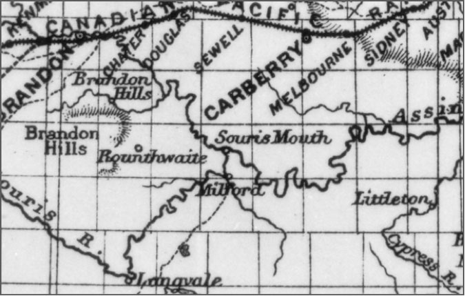 The Millford region. The Millford region.Souris CityAt its birth, Souris City was one of many speculative “cities” that came with the Manitoba Land Boom of 1881-82. In this case it almost paid off. 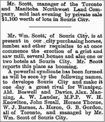 Winnipeg Daily Sun, Jan. 26, 1882 The survey plan, which was ambitious even for these times of wild speculation, included parts of to sections of land and planned lots on both sides of the river. but the actual settlement was in the southwest corner of that deep loop in the river, and at its best was a somewhat scattered village with its buildings strung out along the river bank.The gamblers in this case were William Scott and his son William J. They arrived sometime after October 1880 and bought land from the CPR. Early in 1882 the Winnipeg Daily Sun reports that, ”Mr. Scott, Manager of the Toronto and Manitoba Northwest Land Company, sold last evening by private sale $1100 worth of lots in Souris City.” The next month an ad offered 320 acres adjacent to Souris City for sale.The gristmill, which was steam powered, was located along the river on the east side of the flats. Local farmers had been hauling grain to Millford for this purpose, and for farmers to the southeast the trip to Souris City was shorter and over an easier trail. Some local histories speculate that this mill is one and the same with the Gregory Mill located a few miles upstream, but a report in the Brandon Sun in 1889 contains explicit references to both mills. The likelihood is that the mill at Souris City was not nears as large an operation as Mr. Gregory’s and served a purely local need.  The Souris City plan, as registered in 1881 The town is mentioned often in early newspaper reports, being on a well-used trail south from Brandon and Millford, and the site of a ferry crossing and later a bridge.When Northern and Pacific Railway completed their new line from Morris to Brandon, they decided to cross the river a few miles downstream. The new town of Wawanesa came into being without a great deal of fanfare. Home and business owners wasted no time. During the winter of 1890 most of the buildings were put on skids and dragged them to the new town of Wawanesa 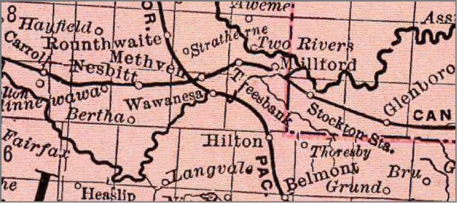 On this map from 1892 Souris City has disappeared and Wawanesa is well-established. On this map from 1892 Souris City has disappeared and Wawanesa is well-established.Gregory’s MillThe story of John Gregory’s mill is the story of a mill that wanted to be a town. It is a noteworthy story for several reasons. It was the most important mill south of the Souris River for over a decade. It was the most substantial industrial investment seen in the pre-railroad era in Westman. Although Mr. Gregory did install a steam engine to compensate for Manitoba’s season rivers, his design was the most ambitious attempt to harness the waterpower of the Souris River for industrial purposes.Fortunately, enough evidence of the site remains for one to visualize the whole operation. And we have a few photos. 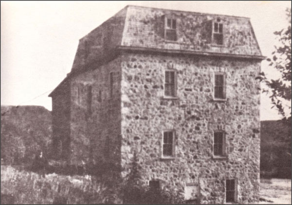 Gregory’s Mill (Photo scanned from “The Prairie W.A.S.P.) The story begins in 1882 when John D. Gregory, from Wingham, Ontario, came to Manitoba and began scouting locations for a mill site. In 1883 he took title and settled on a farm that straddled the Souris River about 8 kilometres upstream from were it now passes under Highway #2 near Wawanesa. He built a mud dam to back the water up to ensure a steady flow, erected an impressive stone mill building, set up the necessary equipment and opened for business. At that time he was 40 kilometres from the rail line but he hoped that it would come to him, or he saw the business as viable regardless. The first dam had a head of eight feet of water, and the mill building was said to have the “most improved machinery” and a capacity of 75 barrels per day.Newspapers of the mid 1880’s offer us more glimpses of Mr. Gregory and his mill and help to illustrate their respective places in the local community and its economy.A report from nearby Langvale in 1885 noted that the “flouring mill of Mr.Gregory” had been shut down due to low water, but that a “powerful engine” was being installed and that the mill would be running again in a “few days”. In June of that same year we note that Riverside Municipality had remitted Gregory’s taxes. This is something municipalities did as a way of supporting needed services. 1886 brought more expansion as a letter to the editor reported that ”the flouring mill at Whitehead is running full blast night and day” and that the “energetic proprietor” had just completed an addition to the facility. Also in 1886, rumours persisted that a rail line might cross the valley near the mill as Mr. Nichol of nearby Souris City reported that the railway engineer was coming back to ” try Gregory’s Mill crossing”.The Riverside History reports that the mill offered the latest in technology and that: “Customers had come to Gregory’s Mill from all directions, some as far south as the U.S. border. The flour, of superior quality, milled by the “Hungarian Patent Process,” was drawn to Brandon by mule team and horse teams, made three trips a week to the flour in a warehouse until a carload was gathered, to ship east by rail. On the return trip, they brought back provisions needed at the mill.” John MacAulay a member of the Crofter Settlement that arrived near Ninette in 1888 remembers that” At Gregory’s grist mill on the Souris the settlers received 40 pounds of flour to the bushel when their grain was gristed.” 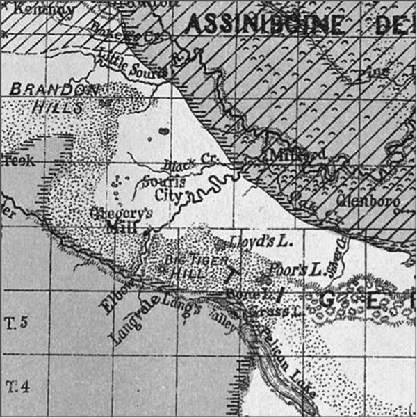 Warren Upham’s 1890 map of the Lake Agassiz is a rare map from the era showing the Gregory’s Mill location. Note that the main communities are Millford, Souris City and Langvale. Scanned from The Historical Atlas of Manitoba Expansion & Competition In about 1888 he began a considerable expansion. A higher dam was constructed about a kilometre upstream. The first attempt was cut short when high water “carried away a piece of the west bank” but the work was completed and certainly must have been the foremost feat of engineering in rural Westman at the time. A report in the Brandon Sun described it thus: “The dam, is 600 feet long, 160 feet wide at its base and 29 feet at the top, is 30 feet high from the bed of the river, and is composed entirely of trees, brush, boulders gravel and earth, intermixed, forming an impenetrable mass, capable of resisting almost any pressure. Behind the dam there is now a body of water with a head of 28 feet, covering 5000 acres, and extending for 6 miles to the south. The race is 4000 feet long and from 6 to 18 feet; much of the material taken from this was used on the dam.” (Brandon Sun, 1891) There was a moderately sharp bend across which he could construct a “millrace” or channel to direct the flow to the mill. That millrace is still visible today and must be seen to be appreciated. One has to marvel at the engineering, and just sheer work, that must have been required. What equipment would they have to move that amount of earth? Where would they get such equipment – before the municipalities had even begun to plan the grid of gravel roads that were to appear with the advent of the automobile? Some stretches are gouged out of the hillside, while in other places the sides are built up like dikes. The whole enterprise must have involved a substantial effort – in time and money. The cost was 15000 dollars, an amazing amount of money for a local enterprise, but Mr. Gregory projected that he now had enough water backed up to allow for three month of operation during times of low water flow, and could boost his capacity to 125 barrel per day in the winter. But this expansion came just as there was bad news on the railway front! The End of an Era By 1889 not one, but two railways were about to cross the district. One was angling up from Morris to Brandon, and destined to cross the Souris River at Wawanesa while the existing line from Winnipeg to Glenboro was finally to be extended to Souris. 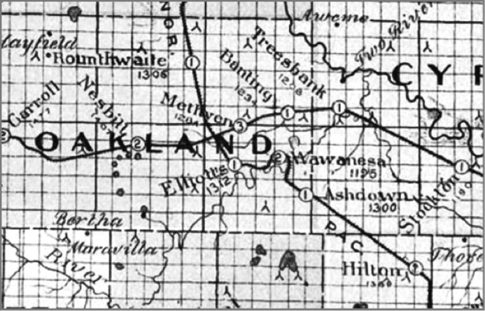 The region had two rail lines by 1891. The siding at Elliott’s was the closest railway link for Mr. Gregory’s flour, about eight kilometres away. The region had two rail lines by 1891. The siding at Elliott’s was the closest railway link for Mr. Gregory’s flour, about eight kilometres away. The mill race, a 1000 metre long ditch built to divert water from the Souris River to the mill wheel. 120 years after it was abandoned the mill race is quite visible today, even from Google Earth! 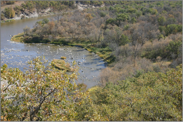 The mill was towards the bottom right corner of the picture and 10 metres up the bank. I believe that the first dam was here – likely designed to direct the flow to the right bank.Perhaps Mr. Gregory was going to remain viable. The mill was obviously thriving in 1891 when we see a report from Belmont where they were “agitating for a good grist mill” noting that “almost every day” teams passed through on their way to Gregory’s which was 40 kilometres away. Despite the fact that a closer rail line would have provided better access to export markets, the mill was providing a valuable service to locals who continued to patronize it.In 1892 a notice by the Oakland council appeared in the Sun advising that there would be a vote on a bylaw to “grant a bonus of $1000 to John Gregory’s mill”. The article notes that:“Mr. Gregory intends increasing capacity to…250 barrel during the next year if he succeeds in getting better shipping facilities. At present he is five miles from the nearest railway station, but he is confident that he will be able to overcome that difficulty before long.”Well that “difficulty” never was overcome. The site of the Gregory’s Mill, today, as it was then, is still eight kilometres from what is now an abandoned rail line.As it turned out it likely wasn’t the lack of access to the export market that sealed the fate of Gregory’s Mill. It was the establishment of mills in the new population centres that sprang up along the new railways that spelled the end.For example, Glenboro got its mill in 1994. At Holmfield to the south, a mill was serving the Killarney and Boissevain district. Wawanesa soon offered a bonus get one started in that new village.There were no notices in the media of the day regarding the closing of the mill. Reference to it just ceased to appear, in much the same way that references to the abandoned towns of the settlement era just disappeared. Instead, what we learn from the newspapers is that mills were springing up elsewhere. And so was Mr. Gregory.By 1895 both Nesbitt and Wawanesa were interested in having him relocate to their towns. Later that summer he was hospitalized for a problem with his foot, which eventually led to amputation, and June 21 of the following year he died.When John Gregory bought his riverside property and started his operation he must have been a wealthy man. He is said to have died broke, having lost a hundred thousand dollars. The sight is now difficult to find. Trees have surrounded what is left of the foundation making it virtually invisible to a passer-by on the river. The large stone that once served as a doorstep for the mill now rests in the Minnewawa Cemetery near the junction of Highways Two and Ten. A huge gear from the mill itself is in on display at the Sipiweski Museum in Wawanesa, and a few other scattered remnants of the machinery have found their way into private collections. Plum Creek and Souris The story of the mill at Souris is another example of a gristmill being the catalyst for the growth of a town. Long before the town of Souris got its long – promised branch line, it was a prospering village. In 1880 William Henry Sowden, Thomas Gillespie Kells and John Nesbitt Kirchhoffer, members of the Millbrook Colonization Syndicate, acquired the property on Plum Creek near where it enters the Souris River. They did this because of its suitability for a mill site. The mill would justify the establishment of a settlement at what is now the Town of Souris. During the spring of this year, some 14 men, including Arthur Rose, were employed building a dam at the proposed Mill site on Plum Creek. The first house in Souris was built to accommodate the men who built the first mill dam. G. McCulloch and William Herriot were co-owners of the 1882 mill on Plum Creek. They thus established Souris as a trading centre At one time grain was hauled from as far away as Estevan to the mill. The flywheel from that mill still runs in the museum at Austin, Manitoba The building was completed by December of 1882, the machinery installed in February of 1883, and their enterprise in operation cleaning seed for the settlers of a wide area by the spring of 1883. In 1898, McCulloch and Herriot had become so successful at milling that they opened Western Canada’s largest yellow brick flour mill. They shipped three brands of flour, independently, to eastern Canada and overseas: Ladies’ Choice, Prairie Lily and Strong Bakers.  The Souris, with the mill prominent in the centre. Photo available in the Prairie Towns Collection. 1903 World markets recognized the quality. Wheat became the economic driver of the prairies. “Prairie Lily” flour produced by the McCulloch and Heriot Mill was exported to Europe, was significant not only locally but also on the world market. |
| Railway Towns / BoissevainFlour Mills The story of milling in Boissevain begins shortly after the town was established as an important commercial centre on the new CPR line. In those days a progressive town needed a mill. In fact, smaller communities would often offer a “Mill Bonus” of several thousand dollars as an incentive to get one started. In 1889 Preston and McKay built a substantial structure of local sandstone on the west side of Mill Road just south of the CPR track. It housed the latest in mill technology; steel rollers rather than the large millstones, and a steam engine, which replaced reliance on waterpower.  The Preston / McKay Mill 1889 – 1902. Through the frequent downturns of the agricultural economy, a farmer could now at least use a portion of his crop to help feed his family by convert- ing wheat to flour. The mill kept a share of the grist and no money needed to change hands. The mill was soon also exporting flour. In 1894 four carloads were sent to Liverpool, England, and total pro- duction was 400 sacks per day. The First Fire In 1902, when the operation was consumed by fire there was no hesitation. By May of 1905 the Turtle Mountain Milling Co. Ltd., a consortium of local businessmen, had purchased the site and was beginning to erect a new building. By March of 1906, the new mill was in operation. This one had an electric generating plant, which also supplied the first electricity for a few businesses and the town’s street lights.  Turtle Mountain Milling Co. Boissevain: 1906 – 1925. But changes in commerce and transportation began to take effect, and after a few years, business declined. The mill had ceased operations when the onset of World War I revived it. Flour was urgently required for the war effort and a retired miller, George Dow, soon had the mill up and running again – with its entire production of 600 bags per day being shipped over- seas. This wartime use of Boissevain flour created a peacetime market and after 1918 most of the flour still went to England, Scotland, and Holland. The reprieve was short-lived how- ever, and by the 1920’s a network of roads was creating even stronger connections to urban centres. The second mill was still thriving when fire struck it down, but the writing was on the wall. Sources: Boissevain History Book Committee. Beckoning Hills Revisited. “Ours is a Goodly Heritage” Morton – Boissevain 1881 – 1981. Altona. Friesen Printing, 1981. Photos: Boissevain Community Archives. P64 A1, P69 A32 Natural Foods Miller George Dow may have an- ticipated today’s concern with the åœadditives and methods employed in modern food processing. He was an early advocate for un- bleached flour, believing that the bleaching process was harmful in that it removed the wheat germ oil. Although there was a strong demand for bleached flour locally, the government required that all flour for overseas should be un- bleached. Several chemicals used for bleaching have now been banned by the government as dangerous to our health. The Boissevain Roller Mills Building The main building is 30×40, 50 ft. high from the basement, built of stone, with cut stone corners, arches and sills. The engine room is also of stone, 20×30, finished off in the same manner as the main building. Both buildings are roofed with tin. The building cost over $5,000, and is said to be one of the finest mill buildings in Manitoba. The basement of the mill is 11ft. high, and is excavated about three feet, the other eight is above ground. It is largely used for bran, flour and wheat storage and contains the boots of the elevators, the line shafting for driving the rolls, and scouring machine. The grinding floor, also 11 ft. high, contains five double sets of Allis rolls 9×24 and 9×30, a wheat separator, power packer, chop roll and scales. Next is the purifier floor, on which are their Smith purifiers, one Richmond shorts duster, two gravity scalpers and three cyclone dust collectors. The wheat and flour bins are on this floor, the stone walls being lined with ceiling to protect the wheat from frost and damp. The next floor, called the rolling floor, 18 ft. high, contains ten No. 1 George T. Smith Centrifugal Reels and Inter. Elevator bolts, one Eureka Horizontal Scourer, the elevator line and heads, etc…. A Brown automatic cut off engine runs the 125 barrel mill without a tremor or jar. From— S.Kerry M. Abel, Morton-Boissevain Planning District Heritage Report, District Planning Study, November 1984, HRB, pp. 121-129, with sources. Some notes from the Northwest Farmer.. S: Commercial, April 20, 1886, p. 609. “The residents of Boissevain are raising a bonus to assist in the erection of a roller flour mill at that place.” S: Nwfmm, April 1889, p. 100. “The prospects for a mill at Boissevain, Man. Are good. The people have subscribed $1,500, Deloraine municipality gives $2,000, and it is expected to raise between $5,000 and $6,000 altogether.” S: Nwfmm, June 1889, p. 162. “Preston, of Stradford, Ont., will erect a 100 bbls. Roller mill at Boissevain, Man. It will be stone, 30 x 48, 40 ft. high.” S: Nwfm, December 1889, p. 340. “On recently leaving Stratford, On., to take charge of his mill at Boissevain, Man., Wm. Preston was presented with an address and purse. S: Nwfm, May 1890, p. . Sawmills The Fox Sawmill In 1880 the Fox family acme to the Wakopa area. Thomas and his oldest son Alfred set up a sawmill two miles northeast of Lake Max. People came from many miles around to use the lumber that was produced from this mill. In 1881 Tom decided to take a homestead nearby and settled (on 10-2-19) several miles west of Wakopa in the Adelpha area. In 1884 Tom moved his sawmill west where it was used to cut lumber for the growing CPR. The mill was dismantled and hauled to Brandon where it was shipped to Calgary. Tom went along with his mill while his family stayed behind and his son Frank took over the homestead. Private Operations It was not uncommon for a farmer to own a small portable mill. Such operations continue to this day. In the Mountainside area, Sam Smith had a steam sawmill operating In the fall of 1882. Mr. Morton’s Mill: Max Lake / McKinney / Conroy Sawmill. The Max Lake Sawmill also known as the Bolton Sawmill, it was built on Lake Max in 1881. It was bought by George Morton, then later owned by Hugh McCorquodale and then Bill Harvey. Then in 1910 Fred McKinney decided to buy the mill for him and his sons Doug, Bill, and Elson to run. They ran the mill till 1968. There are stories of men from all over going to the mill to get wood, men willing to go through days of travel and fighting a battle with the furiously cold weather. There was a bunk house where they could stay at night with a fireplace in the middle to keep it warm. The mill sat on the northern end of the lake, just west of a stream that flowed into the lake from a slough a couple hundred metres back from the shore. Cut logs were dumped into this slough. Afterwards, they were sent down a man-made channel to the lake where they were chained at the entrance to the lake from the stream. They were held here until there was room in the mill for them to be cut. The mill’s boiler stack was guyed up to a majestic oak tree by a long bolt that went straight through the tree. The sawmill on the edge of north shore of Lake Max, while it was owned by Mr. Morton.The machinery included a planer and shingle-mill. In about 1910 Harvey sold the sawmill to Fred McKinney, who moved it from Lake Max two miles north to his property. They used the mill to do a limited amount of custom sawing until the timber reserve was opened up again in 1930. Bill Eaket soon joined in the operation, lending the use of his gas-powered tractor to run the mill. Everything except for the actual sawing of the lumber was up to the customer to do. Trees were felled (by hand), trimmed and hauled (by horse) to the mill where they were sawed. The cost of this service was $10 to $12 per 1000 board feet. The sawmill generated copious amounts of sawdust, which was put to use by the Municipality of Morton during the early 1930s. After being hauled to town the sawdust was mixed with arsenic and molasses and churned in a small cement mixer. This mixture was then spread along the road allowances to kill grasshoppers. In 1938 Bill Eaket dropped out of the operation and Bill and Doug took over the business from their father. They ran the mill for an additional 25 years. During this time they were mostly sawing for local farmers who needed lumber to construct buildings, corrals and hay shelters. The Morton Dairy The most notable effort however was much more than that. George Morton was dreaming big when he purchased a large tract of land north of Whitewater Lake. He had his eye on a national market. He came with the right experience. He had earned the title Cheese King of Canada while working as a cheese factory owner in Kingston, Ontario. When he came to the Turtle Mountain area in 1878 he saw the potential for large-scale cheese production in this the rich hay land that borders the shoreline of the lake. 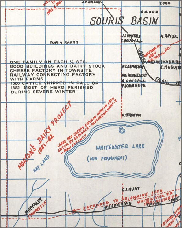 Map from Beckoning Hills He persuaded businessmen in Kingston to invest in the Morton Dairy Farm Company and received (via his business connections with John A. MacDonald) the right to purchase 72 square miles (184 kms2) of land west of Whitewater Lake. He also received a confirmation from the CPR that a railway would be built through his land. Each settler involved in the venture occupied one-quarter section of land with a small herd of dairy cattle supplied by the company. Morton bought the Lake Max Sawmill already in operation to supply lumber for his settlers, and he laid out a townsite on the northwest corner of Whitewater Lake to become a business centre and community base. It seemed that everything was in readiness and the venture was destined for success. There were two problems. He wasn’t the only investor to have made plans on the basis of the promise of a rail connection. The railway wasn’t built past Whitewater Lake until 1886, and then farther south than Morton had been told, missing his land by a few miles. And then there was the weather. Raising cattle through the vicious winter was trickier than expected. During the summer of 1882, dairy colonists brought 1,000 head of cattle from Emerson and Brandon and built corrals walled with tightly packed swamp hay, open to the sky. During the winter, instead of being let out to generate heat by movement, the cows were tightly packed in their corrals. As the sub-zero temperatures and storms of a prairie winter set in, hundreds of cows froze where they stood. Such a heavy loss ended the cheese project, but Morton had not lost faith in the agricultural potential of the area. He pressed on with his other enterprises and is now recognized of course as the founding father of Boissevain – Morton. Carriage Maker In Boissevain, Butler and Frith were carriage-makers and blacksmiths; Lime Kilns Angus McRuer describes one located near his Desford-area farm… “This kiln was on a rise of land sloped to the north. A hole eight feet deep by ten feet across was made at the top of the slope. A trench three feet wide by thirty feet long was dug, starting at the bottom of the hill, up into the bottom of the big hole. It was like a big clay pipe. The trench acted as a damper.” To prepare for a burn, stones were placed in the kiln leaving an arch at the bottom to hold the fire. The process took three days to reduce the limestone to powder. In addition to using it for making mortar, people used it to purify and freshen damp basements, and in cement and plaster and for whitewashing walls and ceilings. There were several of these small local enterprises in our region. Many are small and barely recognizable. They are usually on the side of a creek bed or hill to allow access to one side of the kiln to feed the fire and to provide the necessary draft to create a hot and steady burn. In the Beckoning Hills account of the history of the Johnstone family we learn that: “He built a log house, a log stable for his oxen and a dugout. Later he had a lime kiln on the bank of the creek where he slacked lime to white wash his house and those of his neighbors. “ Local histories give us glimpses of several sites… “At one time there was a lime kiln on the southeast corner of the Hicks homestead one mile south of the Ninga Cemetery. There was no building. It was just a stone structure set into the side of the hill, about eight feet deep and ten feet in diameter. Limestone was plentiful in the surrounding area. Once it was started, the fire in the kiln was kept going day and night. Wood was used for fuel. Once the man responsible for keeping the fire stoked got drunk and let the fire go out. That batch of lime was spoiled! The intense heat reduced the limestone to powder.” Concrete Block Construction At first glance this attractive house on a farm near Boissevain looks like it might be one of the many fieldstone homes in the region. A closer look tells us that those building blocks are concrete. For a few years in the early 20th century, many buildings in southern Manitoba were built with locally cast concrete blocks. Much larger than bricks, the blocks were hollow, and were typically flat on the interior face but variously patterned on the exterior face. Because these blocks did not require high-temperature firing like bricks, there was no need for the substantial infrastructure used in conventional brick-making. They could be made on the building site with portable equipment. Cement Block Manufacturing on the farm of W.J. McKinney, 1904 – Photo courtesy Mrs. Ina McKinney Beckoning Hills, page 73. |
Railway Towns / Deloraine
Flour Mill
The story of the flour-milling experience in Deloraine is representative of what occurred in many small villages and towns across southwestern Manitoba. The first village sites were bypassed by the railway, and re-established. Railway facilities made it possible for those new towns to expand the range of services they were able to provide to nearby farmers, but new businesses were not always successful.
When Old Deloraine’s buildings were moved to the railhead, it was proposed to move Sheppard’s mill as well. However, the lack of an adequate water supply at the new site made this plan unfeasible. The first settlements were located near water – they had to be. The railway companies made their decisions based on efficiency and cost of building the line. Eventually, the mill was sold for $150 to Messrs. Preston and McKay, who relocated the mill’s machinery to neighbouring Boissevain.
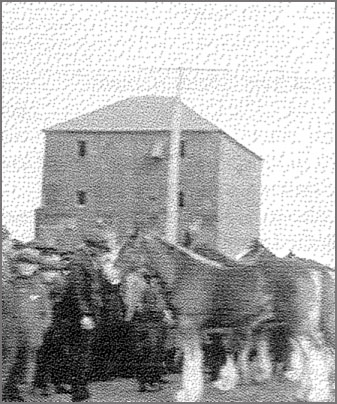
The first mill in the new town of Deloraine.
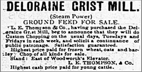
Deloraine TImes, May 9, 1889
An inquiry was received in November 1895 from the Ontario Milling and Manufacturing Company of Ottawa for a suitable mill site along the railway.
Mr. Hughes from Leeds County, Ontario arrived in Deloraine to oversee the construction of a 42-foot, three-story building. The business was not a success and the mill functioned intermittently. It seemed unreasonable to residents that “after putting up a bonus, farmers should have to drive to Boissevain or elsewhere to get gristing done as they have been doing all summer.”
The municipal council believed that they had spent enough on this disappointing venture and refused to pay the Ontario Milling Company their bonus in 1898. The mill ceased operations in February 1901.
Then, as now, the idea of offering incentives and tax exemptions, to attract businesses doesn’t always work as planned. The first mill never really became viable, but town fathers didn’t give up hope.
The Ontario Milling Company, as an absentee landlord, had never made the capital investments necessary to sustain it as a viable operation. The chronic water supply problem, which plagued the entire town of Deloraine, placed an extra strain on the mill operation. The Deloraine Board of Trade admitted that any plans for a new mill had to include financing to provide a water supply.
The mill was dismantled and local citizens, led by the Board of Trade and the Farmers Elevator Company, began making plans for the construction of a more reliable flour mill at Deloraine.
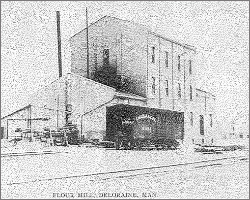
The second mill
In 1907 The Deloraine Milling Co. Pres. was formed. A committee was arranged to ask the Town Council for an exemption from taxes.
The formation of a joint stock company was an attractive alternative to the bonusing method used previously. Now the local investors had direct control over the operation of the firm and avoided a reliance on an unknown independent operator who might ignore local needs.
Contracts were let and the mill went into operation immediately
The flour mill, warehouse and power plant were completed in November 1908. The Deloraine Town Council passed a by-law granting the mill a five-year tax exemption.
For a number of years it did a good business in grinding flour and other products.
The Deloraine Milling Company began advertising in early December for good milling wheat. A year later the mill was providing same day service and offering its own brand of flour, “Deloraine’s Best, made from No. 1 Northern, at $2.75 per sack. This flour was described as, “unbleached and unexcelled, a strong glutinous patent flour.”
Despite patronage from the local market, making a profit was difficult. The mill operated only intermittently during 1909, but still showed a $500 profit. In 1910, the mill expanded, introducing its flour for sale in local stores and managing to turn a net profit of $27 dollars during that year. By spring 1913, carloads of flour were being shipped to other southern Manitoba towns, such as Lyleton and Crystal City. That fall the mill finally cleared its financial liabilities, and for the first time stockholders were issued stock certificates, an indication that the enterprise had finally achieved financial stability.
In fall 1914 the mill was shipping Gold Nugget Flour, not only to the local market but also to the Belgian Relief Fund. Business boomed during World War I due to demands for flour in war-ravaged Europe. However, shortly after the war, the mill struggled to compete with the emerging corporate flour mills who were rapidly taking over the local and regional markets. Companies such as Ogilvies and Lake of the Woods could produce and market their products more cheaply than locally-produced flour, thus putting less cost efficient local mills out of business.
The mill was not reopened until 1930, when the deepening Depression created a demand for custom milling from farmers who could no longer afford the fine varieties sold in local grocery stores. In that year the mill was renamed “Turtle Mountain Mill.” Soon the mill was producing and marketing Gold Nugget whole-wheat flour. The outbreak of World War II soon created a world-wide flour shortage. During the war and in the years immediately following, Deloraine flour was shipped to England, China and Italy. In 1947, the company had eight overseas contracts, shipping, through an export broker, flour in 25-car lots of 1000 bags each. This required the mill to operate 24 hours a day.
These lucrative contracts came to an end in 1950 when the Canadian Wheat Board, under lobbying pressure from the corporate milling concerns, refused to supply wheat for milling purposes to the small milling firms. This policy effectively drove most small milling firms out of business. The operation was sold to Squire Seeds of Bottineau, North Dakota, in spring of 1951.
The flour milling industry had once been the most important regional manufacturing business in Manitoba, but that was changing. Improved transportation links, competition from large national companies, and changing consumer habits were taking their toll on local businesses in general. Small-town mills were one of the casualties. The closure was a serious blow to the local economy.
Cheese Factory
Not much is known about the Deloraine Cheese Factory, but an item in the local paper in 1894 notes that: “5100 lbs. of milk were received at Deloraine Cheese factory on one day. Deloraine cheese was shown at the Winnipeg fair.”
It would appear that cheese making, which appeared to be a logical way to add value to local products, and which had seemed to work well in the Ontario homeland, was not a winning idea the southwest corner. As with other locally made products, improved transportation brought all kinds of competition.
Brickyard
The first brickyard in the Turtle Mountain region was located near Whitewater. W. Barker was the operator and employed between thirty and forty men. A fellow by the name of Hyman was foreman. The product was said to be of excellent quality
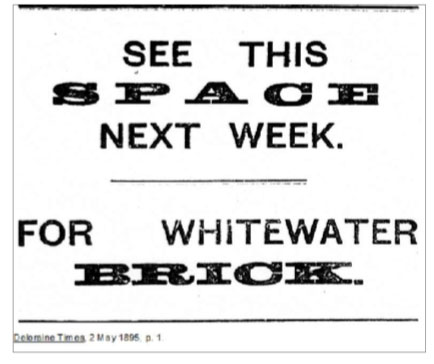
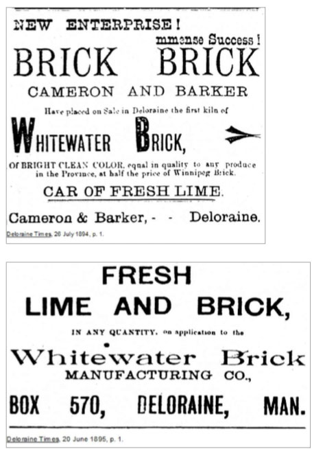
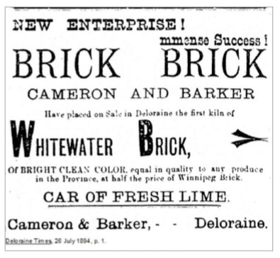
Several local buildings, including the Petersburg School, were built from these bricks. In 1894 the factory was sold to W. R. David and the brick machine moved to Deloraine next to the Racetrack. It was producing buy 1894, but once the initial settlement building boom was over was shut down.
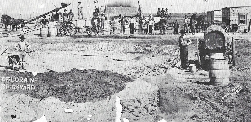
Brickyard in Deloraine
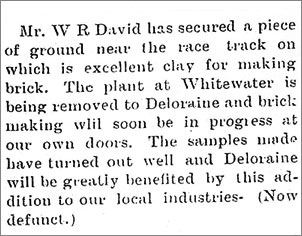
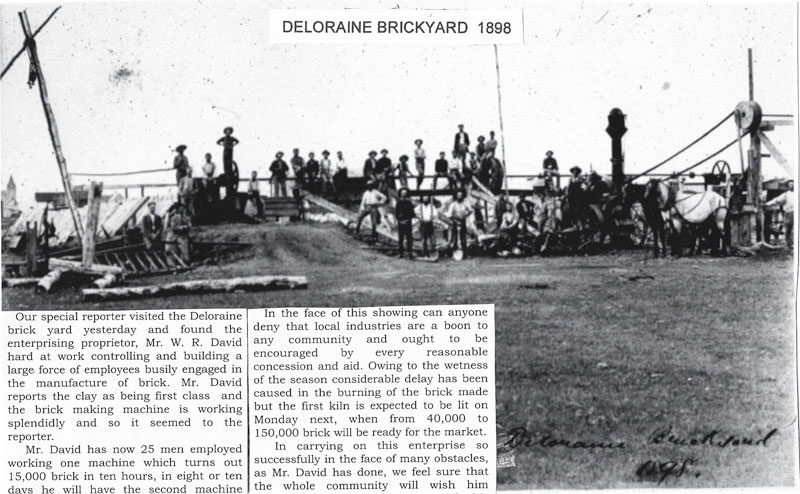 Carriage Makers
The Deloraine Carriage Factory run by Mr. B. Steele was for a short time “ one of the largest of its kind in the Province. Six men are employed, four blacksmiths, a woodworker and a painter. A second storey was added this spring to the shop for use as a carriage and paint shop. Trimming and leather work is done at Mr. Douglas’ harness shop. The painting is of the highest quality, and six rigs were in various stages of finish.”
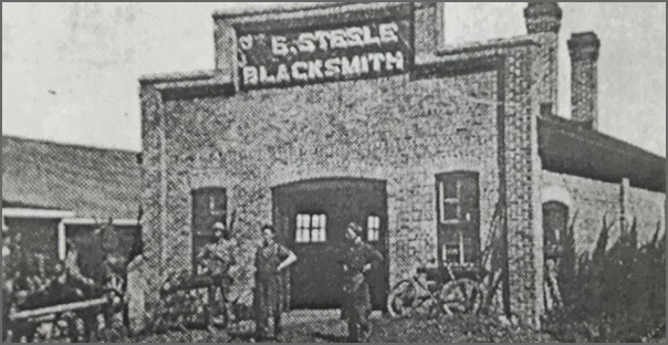
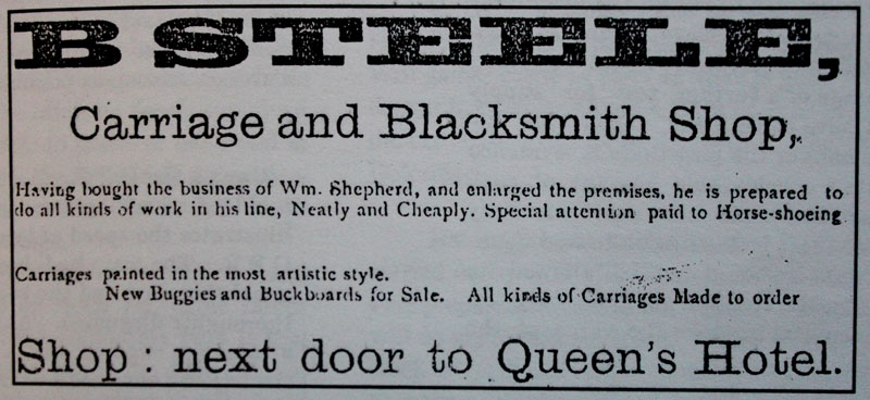
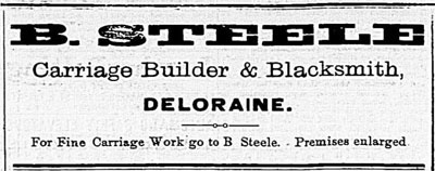
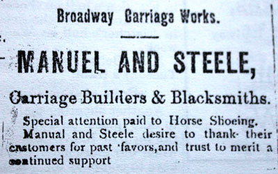
Deloraine Times, May 9, 1889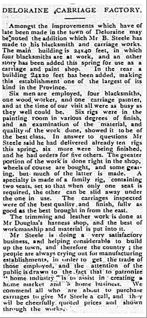
Deloraine Times, May 9, 1889
Clothing
In a recap of items from the 1907 Deloraine Times we learn of this ad: Wanted- 8 to 10 girls at Harris’ Clothing Factory to learn the tailoring business. Light work and learning free.
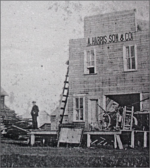
114 S. Railway (East)
Earlier, in 1904 we learn that, “The Harris’ Shoe Factory has been opened. “
Every village had a Tailor Shop and Millinery. Many of these businesses went far beyond mere alterations and fittings.
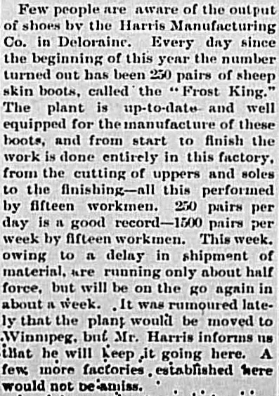
From the Deloraine Times in 1912.
Harness Maker
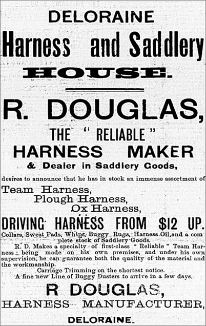
May 9, 1889 – Deloraine Times
Railway Towns / Hartney & Area
The Flour Mill
Hammond and Leckie, who operated a successful lumber yard and grain elevator in Hartney, entered the flour milling business. A substantial structure was erected, machinery installed and by 1894 it was in full operation. Coal from Estevan and water drawn by tank from the river, provided the steampower.
In 1896 the company they hires James Innes as miller. A pipeline to the river made the supply of water more easily obtainable. The mill produced high-grade flour and was a boon to the community. It purchased wheat locally as well as shipments from other areas. It attracted workers who made their homes in town and contributed to its life.
1n 1902 Innes and Frank Hill purchased the mill. They developed an overseas market for their flour and in 1905 selling their product as far away as Britain.
Through James Innes’ efforts a marketing agency was established for nineteen of Manitoba’s mills which became “The Canadian Consolidated Flour Mills”. Mr. Innes went to Glasgow to promote sales. Business prospects were bright.
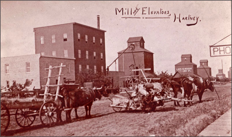
Photo from the Grassland Collection
All went well until 1907 when a Chicago grain merchant cornered the market. The western grain firms, including the Hartney Milling Co., had bought grain for delivery and found themselves short of funds to cover the purchases. The Union Bank, alarmed, gave Innes a few hours to pay off his grain loans. He had grain in storage but could neither sell the grain nor raise the necessary funds. The Bank seized the mill. It was closed in September, while the Hartney Board of Trade tried to find a solution and get the mill back in operation.
They formed a Joint Stock Company to buy the mill from the Union Bank with a provisional Board providing funds. By May 1908 the “Hartney Flour Milling Company” was formed. They offered the Union Bank $15,000 for the mill property. The Bank asked $18,000. No agreement could be made. The company then offered to rent the mill property from the Bank and hire a manager to operate it. The Bank refused to rent and the mill remained closed. James Innes found a position with another milling company and when, in 1912, no progress was made, he sold his home and moved his family to Brandon. Later the milling machinery was sold; the building torn down, leaving no trace in the town of the activity that held so much hope at the century’s beginning.
Bricks
The most extensive brick-making operations in the southwest corner were located in Hartney. The reason may lie partly in the quality and quantity of the clay deposits, but the dynamics of the community and the perseverance of some local entrepreneurs were also factors.
In any case it was important in Hartney and it involved three enterprises.
The most important operation was that of William Kirkland, who was actually the third individual to develop a brick operation near Hartney. From what we know he was certainly a typical businessman of the era: a hands-on industrialist with real skills and craftsmanship. At the height of his ten years of brick-making, in 1913, he was firing 10 million bricks for the new Saskatchewan Legislative Building. That contact alone likely brought in at least $80,000. He was able to build a grand house at the north end of town, with a prominent and stately view into the community. Brick, of course.
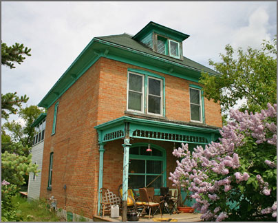
The Irene Hill house in Hartney was built by Harry Payne using bricks from his local brickyard.
Harry Payne was the first to make bricks in Hartney. He began in 1895, just west of town. Payne sold bricks to W. Hopkins for his new store, and was also shipping to many other places in southwest Manitoba. Payne’s reddish bricks were used in many local buildings, but by 1902 the operation was gone, either having depleted the clay bed or succumbing to the local competition.
He had made at least 3,500,000 bricks.
George Sackville opened his operation in 1898, and called it the Hartney Brick and Delft Company. Located east of town, the operation produced what was called a white brick (actually more of a buff colour). Sackville continued for three years to ship brick over the Northern Pacific and Manitoba Railway line to points throughout southern Manitoba.
William Kirkland, who had worked for Sackville since 1899, took over that yard in 1901. Kirkland`s first kiln of 80,000 bricks went into the new A.E. Hill and Company building then under construction. In May of 1905 the Star commented on the “fine and inexhaustible deposit of clay” that was being worked by Kirkland’s steam brick machine. The yard sat on 15 acres and produced 30,000 bricks per day, with 10 men employed.
The three Hartney operations—Payne’s, Sackville’s and Kirkland’s—describe the typical range of brick operations in rural and small-town Manitoba, with the Payne and Sackville yards on the small side and the Kirkland operation (the successor to Sackville) on the larger side.
The Lauder Cheese Factory
In May of 1892 a meeting of ratepayers took place to vote on the issue of bonds to raise money to assist the establishment of a mill in Lauder. In 1893 an agreement was signed between the Municipality of Winchester and Giddens and Campbell of the London Engine Supply Company. This agreement called for a fifty-barrel mill that was to run full time and be operational by September 15, 1893.
By mid September the second story was up but work did not progress as fast as planned. It was in operation part of the time in December but was having trouble getting enough water for the steam engine. The mill was not fully completed until January 1894.
On April 6, 1894 another new agreement was entered into and the next day a mortgage was given to Council on the mill and running machinery. The mill was to be kept running at Lauder for five years from January 1, 1894 and to be kept in operation 10 months of each year.
There were management and ownership problems that seemed to plague some rural milling operations
In 1895 Messrs Morrison and Reid of Brandon bought the mill and were keeping it running almost day and night. They installed a new engine in 1896 and everything appeared to go smoothly until some time in 1897. In 1898 the owners simply left town without notice.
In 1899 several carloads of machinerv from the mill left Lauder enroute to Headingly where the mill was to be re-erected.
The mill site came up for tax sale a bit later.
Manufacturing
As towns grew, both the demand for goods and thus the possibilities for industry expanded. For a short time Hartney had both a Pump Factory and a Sash & Door Factory.
The story of the pump factory illustrates both the possibilities and the limitations of local manufacturing.
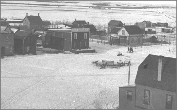
The building at the centre, where the Town Hall is now located, housed Mr. Pierce’s Pump Factory
On farms, water came from wells. Wells required pumps. Everyone need one…or two.
So in 1893, when H. C. Pierce began making pumps, he quickly supplied one thousand pumps for the local market. But soon everyone had a pump, and business slowed down pretty quickly.
On the other hand, when Alex Mains, and his brother set up a Sash and Door Factory, in 1900, and added a planing mill to provide materials for the many new homes which were built in this and other communities, the need for such materials was a little more ongoing. In 1904 it became a joint stock company called “The Hartney Manufacturing Co.” and prospered until 1908 when they shifted their business toward providing lumber. In this case not only had demand slowed down, but the economics of trying to compete with large operations elsewhere destroyed the viability. The same process repeated itself as small town manufacturing gave way to big city factories, which in turn has given way to offshore production.
Carriage Makers
Another common example of small town manufacturing focused on another vital need was the carriage maker.
Victor Duchesneau arrived in Hartney about 1901 and in 1904, along with his blacksmith business, he started a carriage and wagon factory. His advertisements at the time announced that he had “a new eight-horsepower engine, modern band-saw, a joiner, a fine ripsaw, a hawk-eye trip hammer, a fan blower and a fine grade emery polishing machine,'” and that he could turn out “buggies, wagons, carriages and all fine lumber work with city style and finish.”
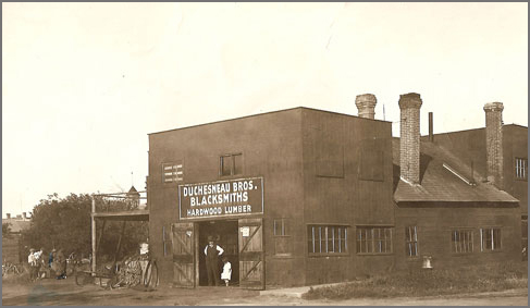
The Duchesneau shop – Carriage making meant working with both iron and wood.
Edouard Isabey, who opened a small machine shop in about 1893, also made and repaired carriages. He had apprenticed as a gunsmith and mechanic in France.
In a listing of Hartney’s early businesses we also find an entry for “Shore and Co. carriage makers.”
Clothing
Many Tailor Shops and Women’s Clothing retailers, did more than mere alterations and fittings.
In the A.E. Hill Store in Hartney, on the upper floor could be found carpets, linoleums and the millinery and dressmaking departments. Each season a milliner and assistant came from Toronto and made hats for the spring and fall. A head dressmaker was employed, also from the east, and local girls were hired to work as apprentices.
In 1894, the Edwards sisters were running a successful dressmaking shop in Hartney, offering the latest fashions, wedding gowns and party dresses, often paired with hats made by the milliner at A.E. Hill & Co. The girls had apprenticed with a dressmaker in Melita and were putting their skills to good use.
Lime Kilns
Near Lauder, a lime kiln was built on the high bank (the north west side) of the ravine on the SE corner of section 32-5-24 not far from Grand Bend school. It was likely in operation for a short time. Sometimes these small kilns were just used for a specific building project.
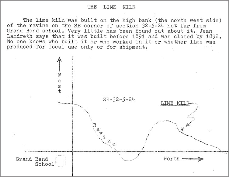
Gordon Phillips described the location of a Lauder area in “The Rise and Fall of a Prairie Town: A History of Lauder Manitoba and The Surrounding District, Volume # 1.”
Like so many of these local initiatives, with the improved train service, the availability of a reliable and ready source of products in the local lumberyard saved local builders a lot of time. Most kilns had ceased operations by about 1900.
Cheese Factory
In 1895 the farmers of the Lauder area met to discuss the idea of a cheese factory. June 1 was set for the start of production. The factory was located just east of the village.
Hobert Sibald was paying daily visits to the farmers for milk in June of 1895
The milk was gathered large barrels and the whey returned to the farmers for feeding pigs. Henderson Directory for 1897 lists W. Brigden as manager. The factory became a Saturday night gathering place for locals and several others who sat around eating cheese and soda biscuits and discussing the events of the
week. It did not last for any great period of time probably not more than a year, In any case, it was gone by the summer of 1897.
Railway Towns / Melita
The settlement pattern in Manitoba’s extreme southwest corner followed the pattern established as settlement moved westward from Winnipeg. Settlers came, post offices were established, and they all waited for a railway to enter the district. Small villages and speculative towns appeared, but none of them decided to build a grist mill.
Why?
It is possible that they had looked at the experiences in Wakopa, and Deloraine and decided to just wait?
In the meantime they would make the long trek to (Old) Deloraine.
The establishment of the Melita Mill was voted on December 17, 1891, and first annual meeting of the Melita Milling Co. was held on January 26, 1892.
The building was 36′ x 48′ in size and was four stories high. The engine house, also 36′ x 48′ was a solid structure to be lighted with electricity and fitted with all modern conveniences.
The Melita Mill
The establishment of the Melita Mill was voted on December 17, 1891, and first annual meeting of the Melita Milling Co. was held on January 26, 1892
The building was 36′ x 48′ in size and was four stories high. The engine house, also 36′ x 48′ was a solid structure to be lighted with electricity and fitted with all modern conveniences.
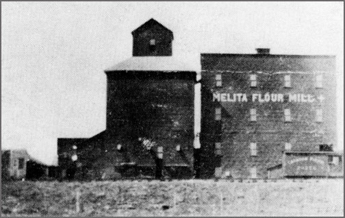
The building was 36′ x 48′ in size and was four stories high. The engine house, also 36′ x 48′ was a solid structure to be lighted with electricity and fitted with all modern conveniences.
By 1900 the mill adopted a 24 hour system for a time at least. Mr. Powell engaged a night miller. T. Bulloch & Son built on an addition to the mill, as flour storage, (24 x 48 ft) to hold sixteen carloads of flour.
In 1903 the entire plant was sold to Lamont and McDonald. The demand for Melita flour was great and the mill running day and night the year around.
The enterprise saw the same ownership changes and problems that other mills faced, and various efforts to upgrade it and keep it operations.
In 1913 the Melita Flour Mill, being thoroughly overhauled. The property was taken over by a local stock company, the capital being subscribed by townspeople and farmers in the district. This was typical of effort in other communities. Inevitably the mill was shut down but in this case the infrastructure continued to be used electric power generation
Napinka Mill
In 1892 the booming town of Napinka offered a $5000 bonus to start a mill. Someone took the offer, built the mill then skipped town. (Sun April 26, 1975)

While we have little information about the Roblin & Armitage mill in Napinka, we do have this photo from Bridging Brenda.
The Melita Brick Co.
In 1905 Mr. John Dobbyn (80 years of age) discovered a red brick clay just west of the river and south of today’s #3 highway. He purchased the land (31-3-26) and ordered a modern brick making plant.
The Melita Brick and Tile Co. was formed in April 1905. This consisted of John Dobbyn and son Richard, Charles D. Lamont and Johnston and Pope with manager of the brickyard being Richard. Dobbyn.
In June the kiln was being built and great interest was taken in the result of the first kiln of brick, “fired”. The bricks turned out a pretty shade of red. More than $10,000 had been invested in this project by July.
In April of 1907, The Melita Brick Co. was making 20,000 bricks a day under manager D. Morrison. They had delivered a million bricks to Regina.
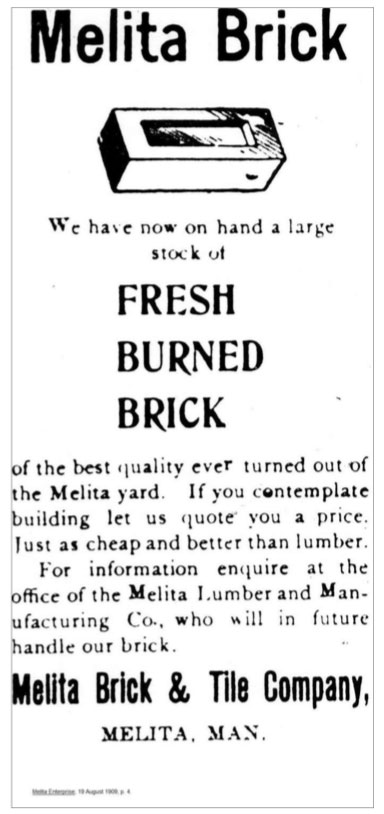
In 1909 these bricks were sold at Melita Lumber & Manufacturing Co.
The yard closed in about 1910 as the clay bed had run out and the business had not proven to be a financially successful venture. However, many houses and buildings in the town and surrounding area stand today as proof of a very substantial “red brick” that was manufactured locally.
Lime Kiln
Along the Souris River, near Napinka, stonemason L.J. Phinney operated a kiln that likely supplied the mortar for the beautiful stone school that still stands in the village.
Antler River Steel Works
In pioneer farming communities, blacksmiths were indispensible. Untrained novice farmers could learn to build sod and log houses. They could learn to plant and reap. They proved up to the task of surviving in a harsh climate.
But fixing broken machinery was a little more difficult for the do-it-yourself homesteader. When something broke on the farm, you needed it now.
Blacksmiths often went far beyond repairs. It seems some of them were of an inventive, even creative turn of mind, and they just couldn’t resist making stuff. As we have seen many turned to making buggies. Others developed other interests.
In 1908 “Captain” Hunt Johnston Rolston Large, a blacksmith from Coulter, Manitoba, got it into his head that he would build a steamship.
From 1909 to 1910 the Empress of Ireland, his paddle-wheel steamship, plied the waters between Napinka, Manitoba (north of Melita) and Scotia, North Dakota on the Souris River.

The Empress of Ireland in Coulter, Manitoba – ready to launch in 1909.
Large built his ship mostly out of recycled materials: a dismantled boxcar and the inside of an old house provided most of the wood he used in construction. The metal parts of the boat were made by Large himself in his little workshop, South Antler Steelworks.
In the summer of 1910 the Empress left the Souris River to ply more lucrative waters: those of the Assiniboine near Brandon. She was transported by train and used as an excursion boat during the Brandon Fair. At the end of the summer she was tied down for the winter.
An unfortunate accident caused her to burn down to the ice. All that was left was a portion of the hull, her two big boilers and the paddlewheels. Large reinvented her as a coal barge the next spring, but couldn’t bear to paint the word “Empress” on a barge, so renamed her the Assiniboine Queen. Severe floods in the spring of 1913 finally sank the craft.

Overviews & Locations
Flour Mills | Sawmills | Food Processing | Brickyards | Manufacturing | Lime Kilns
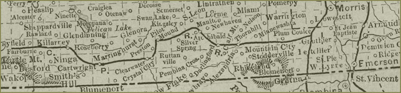
| In this general overview we have mapped the locations and listed the enterprises. For an introduction to the general nature of each industry see, Part 2 For more information on the individual enterprises, presented by Community, see Part 3 Flour Mills Pembina Region – East  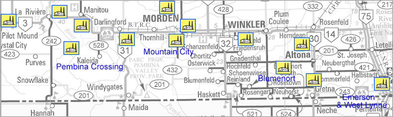 Altona Mill owners Isaac and David Fehr Blumenort: 1877 Darlingford Findlay Brothers Emerson Charles Borrow – 1876 Gretna David Peters – 1889 LaRiviere Flour mill started by Cary and Grant, burned. Ca. 1887 Manitou / Manitoba City Manitou Roller Mills 1883 In about 1885, the McIntosh Mill from the abandoned village of Norquay Morden 1885 – Ritchie and Lundy’s completed a flour mill and had it in in full operation. 1890 Morden Flour Mill established Mountain City Nelson Milling Co. moved from Nelsonville Nelsonville Adam Nelson – 1879. Nelson Milling Co. – 1879 Mr. Fraser – renamed Belmont Mills. Pembina Crossing 1882 William P. Hutchinson Pilot Mound George White operated a grist mill and McDonald and Band built another mill. Cheese Factory West Lynne 1883 – HBC & Stuaffer’s Flour Mills, Winkler Dyck and Peters built the Winkler Grist Mill. Winkler Roller Mills replaced that service. Flour Mills Pembina Region – West 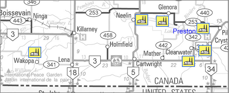 Cartwright In 1889 R.A. Sheppard, John Gimby, John Wallace, George B. Wray, A. Davidson, T.S. Mennary and E.D. Coates, planned to build a small mill at Cartwright, Manitoba.” Clearwater William Coulthard and his brothers John and Tom came to “Old” Clearwater in 1881, and built a gristmill on the river Crystal City 1883 Crystal City mills commenced operations Glenora In 1882 by Blaine & Reid were operating a busy flour mill at the “old” site of Glenora Holmfield The Harrison Mill opened in 1897 and thrived for decades Killarney Finlay Young and Tom Buck built a flour mill in Killarney in 1893 Neelin The short-lived Pembina Crossing mill was given a new life in Neelin, at the western edge of Rock Lake. Watson and Cowie, set up both a sawmill and a gristmill in the valley. Preston Between Rock Lake and Pilot Mound a saw and grist mill was built by James Preston in 1879. Wakopa The Harrison Brothers opened the first Flour Mill in the Turtle Mountain region in 1879. Sawmills Pembina Region – East 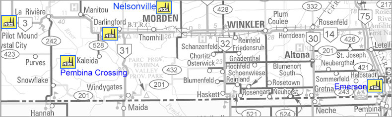 Darlingford Bolton’s Mill and Woodwork Emerson 1881 Carney & Watson Noble and Follis Pembina Crossing Watson’s Mill 1882 Pilot Mound George White – 1881 Sawmills Pembina Region – West 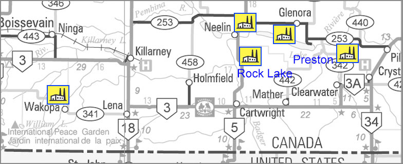 Cartwright (Rock Lake) – Jim Waugh Glenora 1882 by Blaine & Reid – 1882 Neelin The Pembina Crossing flour mill was moved to Neelin by Watson and Cowie, Preston In 1879 a saw and grist mill was built by James Preston Wakopa Harrison Brothers 1879 Food Processing Pembina Region – East 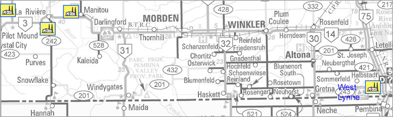 Pilot Mound Oatmeal Mill -0 George Dow Manitou Creamery and Cheese Factory Soda Water Works, Oatmeal Mill, pump factory LaRiviere J. Rockett – cheese factory beside Mary Jane Creek. West Lynne Brewery, Pop Factory, Cheese Factory Food Processing Pembina Region – West 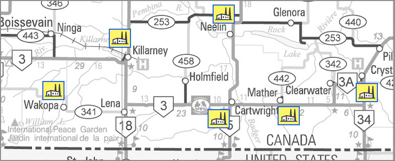 Cartwright CartwrightBefore the 1900’s, a cheese factory was started by W.G. Robinson it operated for only a short time. Oscar Beach began making cheese at his farm home. Crystal City Alexander Taylor managed a cheese factory at Crystal City. Killarney 1889 Cheese factory – Isaac Wood manager. Nathan Clark also had a Cheese Factory. Mather Soft Drink Factory Mather was one of a few communities that produced soft drinks. John Davie and Walter Small had a soft drink factory beginning in 1913. The product was called “Jersey Cream”. They started on their farm, but moved in to Mather. Neelin William Coutts promoted a Cheese Factory which operated successfully in the district for several years. Wakopa John Hettle – Cheese Factory – 1885 Brickyards Pembina Region – East 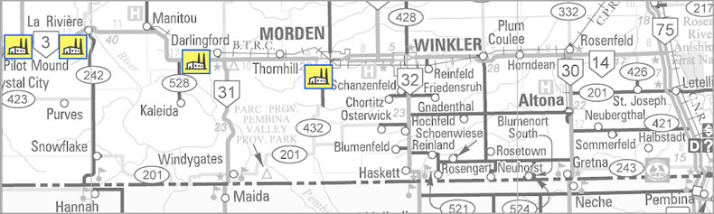 Darlingford About 1898 Whalen’s Brick & Tile Darlingford Brick & Tile Co. Ltd. ca. 1910 LaRiviere About 1902 a brickyard was established with a payroll of about thirty men, including W. Carmichael as manager. He was followed by G.W. Dellar. The brickyards stayed in business for about five years. Morden MacGregor’s brickyard was south of the townsite and its products were used to erect several substantial brick buildings, including the Dominion Post Office. Pilot Mound East of the Mound ca. 1880 Brickyards Pembina Region – West KillarneyChurch’s Brickyard 1884- 1903Manufacturing Pembina Region – East 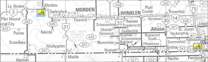 Manitoba City / Manitou Pump Factory, Carriage Maker, Sash & Door Factory Emerson Noble and Follis manufactured common lumber, doors, sash, blinds. They employed about twenty-five hands. Edward Sabin & Co. were general carriage, sleigh and cutter manufacturers. Manufacturing Pembina Region – West CartwrightThe Lightning Rod Factory This flourishing industry was started by Munro Brothers and Ferris in 1910. Pump Factory Patrick Crawford McKibbin started a pump factory using logs from the area. Albert Stillwell blacksmith and carriage maker. Lime Kilns Pembina Region – West 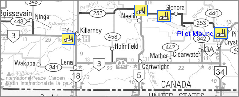 Glenora Preston Lime Kiln Killarney A lime kiln operated one mile south of the Ninga Cemetery. Neelin Several lime kilns in the region Pilot Mound There was a lime kiln on the east side of the mound. |
Varieties of Industry
| Introduction First… a word from wikipedia… A gristmill (also: grist mill, corn mill, flour mill, feed mill or feedmill) grinds cereal grain into flour and middlings. The term can refer to either the grinding mechanism or the building that holds it. Grist is grain that has been separated from its chaff in preparation for grinding. We will use the terms gristmill, grist mill and flour mill interchangeably because all three are used in the source material. ……… A Trip to Gregory’s Mill Cartwright pioneer, A.E. Steel, writing in the Cartwright local history, Memories Along the Badger Revisited, tells us this story of a trip he took in the early 1880’s. The mill in question was some distance away, outside of the Boundary Trail region, but we include as an illustration of the forces that prompted the establishment of local mills, and as a slice of life from the times. Our first grist of wheat was taken to the flour mill at Glenora and a farmer got his own wheat ground into flour and got all the flour, bran and shorts that he owned. After that we went to Wakopa flour mill owned by Harrision Bros., and again I have made a number of trips to the Souris mill. The mill was equipped with the Hungarian Patent process and made an excellent grade of flour. Each round trip took four long days to go and return with oxen. The mill was kept running day and night, and if we were fortunate our gristing was done right away and we would be able to start for home without losing any time. The mill was owned by a man by the name of Gregory, and anyone that had to stay overnight was accommodated at his house. He had plenty of stable room and feed for the teams and the charge for man and beast was very reasonable. I remember Bob Blackwell and myself going with our grists to the Souris mill with the oxen and wagon after the freeze-up. The weather was lovely so we travelled until quite late the first day and then camped out for the night. We had plenty of with which to keep us warm. The next morning we hitched up early and got to Dunlop’s for breakfast. (The town, Dunrea, is situated on that place now, or at least part of it). The townsite is on part of two farms that were owned by Dunlop and Ray so the town was named after the two farmers. Leaving Dunlop’s, we entered Lang’s Valley and travelled it for a few miles, then crossed up the other side and the next valley we entered was the Souris and then on across the river to the mill. This time there were a lot of grists ahead of us and that meant staying at the mill two nights instead of one. We could get our meals at the house but there wasn’t sleeping accommodation for all, so a number of us slept at the mill above the engine room which was nice and warm. We got loaded up and started for home before daylight on Saturday morning and travelled a good distance be- fore we stopped to feed our teams. After giving them a good feed we got going again. Bob said he intended to stay that night at a friend’s and he would not resume the journey until Monday morning, but I decided to go on home after feeding and resting the oxen. I passed through the north end of Killarney late at night, and after a while began to feel sleepy so I wrapped a quilt about me and lay between the bags. I knew the oxen would keep to the trail so I dropped off to sleep. I don’t know how long I slept, but when I awoke, I found the oxen both laying down. I got them going again and finally reached home before daylight on Sunday morning. *Cartwright & District History Committee, Memories Along the Badger Revisited, 1985 p4 Mills Were a Priority The European settlement of Southwestern Manitoba followed a process that had already been established elsewhere, across North America. People were here before services, before roads, before stores and towns They really were starting from scratch. Slow transportation and long distances made self-sufficiency a must. They came to farm, and they already knew that wheat and other grains were to be the primary crops. The prairies were opened to agricultural settlement for one main economic purpose – to grow wheat. The problem with that was that it was so far to market that there was little profit to be made. That was okay, they all knew that. Eventually rail lines would cross the land and everything would fall into place. In the meantime, subsistence was a starting point. Wheat and oats and barley were edible, even sought after, as a food supply… with a little processing. Many of the settlers from Ontario and Britain had no farming experience. Many were especially unprepared for the difficulties prairie farming would present. That wasn’t their fault – even for those with agricultural expertise, prairie farming was a whole new game. But most of the newcomers were pretty smart and self-sufficient. All of them kniew where flour came from, and that it could be used to make bread. The same with oats and oatmeal. They knew about flour or grist mills. Every community back home had one. Quite a few of them even knew how they worked. Having a gristmill nearby, where one could at least exchange wheat for flour was a crucial advantage in making a homestead sustainable until a railway would arrive. Turning wheat into flour represented Manitoba’s first step in becoming an industrialized society. Flour milling was practised by the province’s aboriginal peoples long before Lord Selkirk’s settlers engaged in the activity. When Manitoba gained provincial status in 1870, most flour mills were concentrated in the vicinity of the rapidly emerging city of Winnipeg. Flour mills supplied flour for the practical consumer needs of the district residents. The First Mills – Pre-Railroad Settlements In a sense the early mills were services that hoped to become towns. With the coming of the railway links we saw the creation of more lasting towns. These towns wanted a gristmill and would often offer what was called a Mill Bonus to attract such a business.  This map shows postal routes and pre-railroad communities as of about 1884. This map shows postal routes and pre-railroad communities as of about 1884.The period from 1881 and 1882, known as the “Manitoba Boom”, saw intense speculation in land sale – especially in town lots. Everyone knew that the population of rural western Manitoba was going to explode. Towns would be built, businesses established, and money would be made. The problem was that nobody was sure where all these new towns would be located. It all depended on where the railway lines would run, and where the railway company would decide to put a station. Although some railway surveys had been undertaken and some lines had been planned, no one knew where the stations would be. So some enterprising landowners decided that a piece of land they owned might just be a good spot for a town Speculating in town lots was a bit like participating in a gold rush. You stake a claim and hope it pays. Exaggerations and outright lies were the tools of that trade. To sell the lots the promoter had to assure prospective buyers that the rail line was a sure thing. Another selling point was having a mill. Conclusions The establishment of the rural milling industry was a direct result of the confidence demonstrated by those entrepreneurs and farmers who invested their fortunes, toil, and tears in the development of the province’s agricultural resources. The conversion of wheat into flour for practical consumer purposes provided evidence to investors that the region was worthy of future development. The agricultural sector provided the engine for the growth of the entire province. Four milling played an important role in this achievement. Even though many settlers had milling experience, and there was a definite need for the service, they weren’t prepared for the seasonal nature of prairie rivers and soon learned that water power wasn’t reliably available. Thus it was more costly here than in the east, and making a profit was more difficult. The decline and extinction of small independent flour mills across Manitoba can be largely attributed to the uncompetitive position in which these mills were placed by the large milling companies after the first World War. Consumers of flour gravitated toward the more inexpensive product produced by the large mills. Lack of business suffocated the independent millers and most were driven out of the business. The large milling concerns could not only undercut the price of flour that independent millers offered, but they operated at a distinct advantage because of their large reserves of capital. The large mills also had greater funds at their disposal for advertising. Over the course of the twentieth century, Manitoba’s rural population base began to decline; rural residents migrated to urban centres. All these factors played a part. Although the flour milling industry in rural Manitoba faced its perhaps inevitable decline, the role it played in that short period of transition to an agriculture based economy was both important and interesting. Sawmills After treking half way across a continent in crowded lake boats, slow river boats, poorly appointed trains; after finishing the journey in ox carts, open wagons, or even on foot; the thought of building your first home on the prairie must have been appealing, to say the least. If the recent stretch of your long journey took you through the thriving town of Emerson or the well-populated city of Winnipeg, both appearing to have been visited by civilization, you might have some expectations that your new home might be similar to the ones you stopped in along the journey. Welcome to the prairies. Even if you could afford a nice frame home, perhaps forgoing the picket fence, the building materials were hard to come by. This new country didn’t seem to have lumberyards. Shipping lumber from the bigger centres was expensive and time-consuming. In much of southern Manitoba, timber was scarce. The scarcity of trees meant that the open prairie was easy convert into productive cropland. The downside was it was a long way even to get firewood, let alone building materials. The Pembina – Manitou area was a bit of an exception in that, the along the Pembina Escarpments and along the Pembina River and Rock and Swan Lakes, there were well-wooded spots. That allowed early settlers in that vicinity the option of using locally sourced wood. If there was timber nearby, one of the first businesses set up in those pre-railroad settlements was a sawmill. Some of those sawmills were small and temporary, not necessarily designed for commercial use, but set up to get a few buildings up. Pioneer J.E. Parr describes the first sawmill in the Rock Lake area… “Two posts were out in the ground about twelve feet from the precipitous bank, with timbers from the top of the bank to each post, far enough apart to roll logs out on. “ The saw mill machinery consisted of a long pit-saw and two men. When a log was placed over the pit, the bark roughed off, and chalk-lined from end to end, with lines one inch apart, one man would stand up upon the log and the other in the pit , and operate the mill. Mr. Thos. Sandow’s house, built on section 18-2-11, was the first raised in the district, and the roof was sheeted with lumber from this mill” (McKitrick)  An unidentified sawmill site The era of locally milled lumber was short, but important. Most of those first sawmills were in villages that would disappear when the railway arrived and new towns were born. That rail service also allowed for an easily accessible supply of milled lumber in most areas. Brickyards Manitoba is geologically blessed with thousands of clay deposits, hundreds of which have been exploited over the past 150 years for brick manufacture. The “Golden Age” of this aspect of Manitoba’s building history was from 1880 to 1912. There were about 60 major clay sites and about 175 brick manufacturing plants that provided the billions of bricks that were required for Manitoba’s major building boom of the late 19th and early 20th centuries. The details of industrial operations were not often covered in local newspapers and so it is only possible to provide a sense of typical operations. The work was hard and the days were long. The pay was modest, about $2 a day, but it was steady, at least for the duration of the season, usually from May (when the frost left) till August or September. Even small yards had up-to-date technologies such as steam-power. A typical operation featured the large covered drying sheds that new bricks were laid into. It was the final stage of the brick-making operation that usually distinguished a major from a minor yard: whether the brick was fired in a scove or beehive kiln. The scove kiln. Most likely used in most operations in the southwest corner, was a less sophisticated technology, but one that was still effective enough to produce good quality brick. Burnings lasted about seven to eight days, and when the outer shell of bricks on a scove kiln was removed, workers discarded the disfigured and discoloured bricks nearer the fire source. The Brick House The first settlers often built a sod hut for those first few years. Logs were hard to find on the open prairie, but those living along near the Pembina Escarpment or in the vicinity of Rock Lake might start with a log house. Settlers who arrived with a bit of cash in hand might opt to bring in building supplies, but many had to wait for that first frame dwelling. Brick was desirable as a building material, but was even more expensive to ship than milled lumber, so it was some time before brick buildings became popular. What helped that process along was the fact that some of those new settlers came with some experience making bricks, and they kept an eye out for deposits of clay that would serve that purpose. Food Processing In the same way that grist mills or flour mills were an obvious way to convert local product into food, butter and cheese factories were an early attempt to process milk locally. Several of these were small operations focusing on the local market. In the same way that grist mills or flour mills were an obvious way to convert local product into food, butter and cheese factories were an early attempt to process milk locally. Several of these were small operations focusing on the local market. 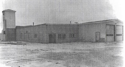 The Archives of Manitoba has this photo of a Cheese Factory in Pilot Mound Other less common enterprises include S.S. Mayers Stock Medicine Company started in Cartwright. It was so successful that he moved to operation to Winnipeg in 1910. A rather unexpected initiative was the establishement of soft drink manufacturing in Manitou, Mather, and West Lynne. Then, as now, there were obstacles to overcome in trying to operate a manufacturing enterprise in small town. The bottom line was that many of these enterprises were just getting underway when the explosion in transportation technology, the extension of rail lines, and beginning of the automobile age, changed everything. Lime Kilns Some years ago, while walking along the high riverbank, I found what appeared to be an old well lined with fieldstones. I gave it little thought until I learned about the small lime kilns that settlers often constructed to make mortar for the many stone buildings that dot the southwestern corner. They are another example of small, local, do-it yourself, prairie enterprises.  The remains of a small kiln. Early settlers used it to purify and freshen damp basements, in the henhouse, in cement and plaster and for whitewashing walls and ceilings. Part of the spring housecleaning ritual was the whitewashing of the interior of the little building with the half moon cut in the door. The only “accessory” in that little building was a nail and string to hold the previous year’s Eaton’s catalogue, which was used to the very last page. Angus McRuer describes one located near his Desford-area farm… “This kiln was on a rise of land sloped to the north. A hole eight feet deep by ten feet across was made at the top of the slope. A trench three feet wide by thirty feet long was dug, starting at the bottom of the hill, up into the bottom of the big hole. It was like a big clay pipe. The trench acted as a damper.” To prepare for a burn, stones were placed in the kiln leaving an arch at the bottom to hold the fire. The process took three days to reduce the limestone to powder. In addition to using it for making mortar, people used it to purify and freshen damp basements, and in cement and plaster and for whitewashing walls and ceilings. There were several of these small local enterprises in our region. Many are small and barely recognizable. They are usually on the side of a creek bed or hill to allow access to one side of the kiln to feed the fire and to provide the necessary draft to create a hot and steady burn. “This kiln was on a rise of land sloped to the north. A hole eight feet deep by ten feet across was made at the top of the slope. A trench three feet wide by thirty feet long was dug, starting at the bottom of the hill, up into the bottom of the big hole. It was like a big clay pipe. The trench acted as a damper.” To prepare for a burn, stones were placed in the kiln leaving an arch at the bottom to hold the fire. The process took three days to reduce the limestone to powder. In addition to using it for making mortar, people used it to purify and freshen damp basements, and in cement and plaster and for whitewashing walls and ceilings. There were several of these small local enterprises in our region. Many are small and barely recognizable. They are usually on the side of a creek bed or hill to allow access to one side of the kiln to feed the fire and to provide the necessary draft to create a hot and steady burn. Once it was started, the fire in the kiln was kept going day and night. Most of these operations ceased in the early 1900’s as commercial building supplies became more readily available. |
Communities – Pre-Railroad
Pre-Railroad Communities
Nelsonville & Mountain City
Glenora
Pilot Mound
Wakopa
Pembina Crossing
Clearwater, Neelin & Preston
Cartwright
Crystal City
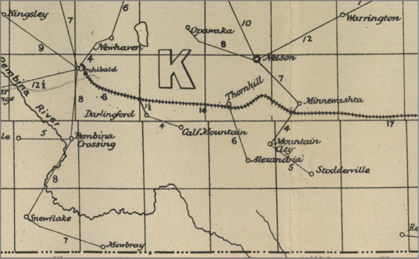
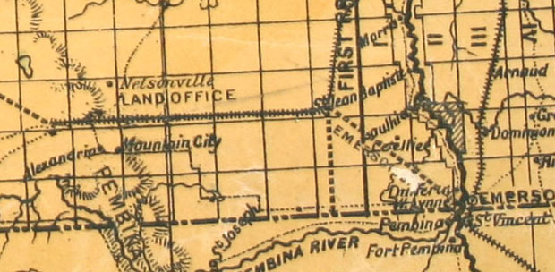
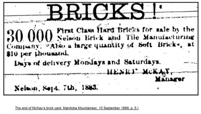
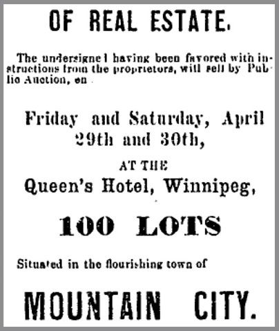
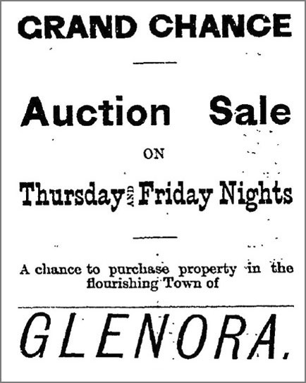 Winnipeg Daily Sun – Sept. 13, 1881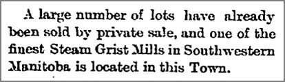
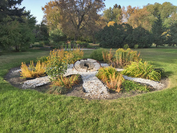
 Small kilns are common throughout the region but the Preston kiln was larger than most.
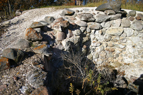 The view from below.
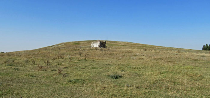 The mound and the vault left behind when buildings were moved to the “new” village of Pilot Mound.By 1879 there were quite a few homesteads being taken in the area and a spot on the eastern slope of what was then known as “Little Dance Hill” was chosen for a village. The first general store came in 1880, and was followed by more stores and services. One of those services was a gristmill built on the banks of the nearby creek by T.P. and Ben White. There was a sawmill on the east side of the mound run by McIntosh and McKenzie, by the brickyard At first a Mr. Carson made bricks by hand. Later Harry Steadman operated the yard, and later still Tom Dearlove provided a horse-power machine. R.J. Duncan provided a steam engine in trade for bricks.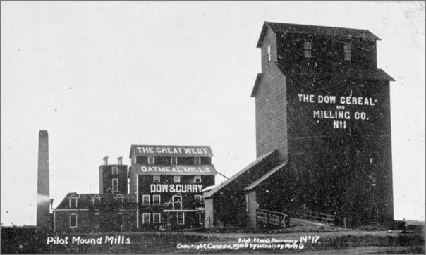
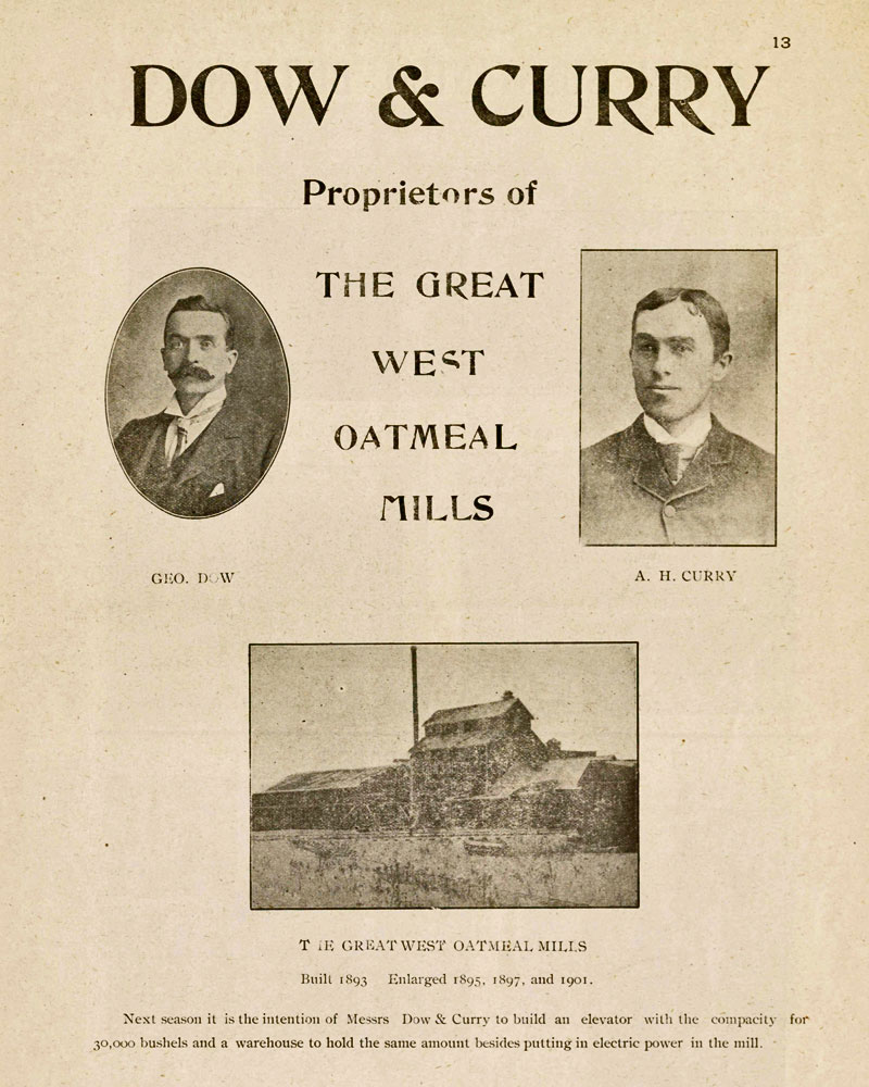
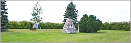
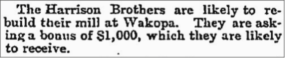 Winnipeg Daily Sun, April 28, 1884The coming of the railway to Killarney doomed this busy centre. The brothers disassembled their mill and built Killarney’s first grain elevator. Later they built a gristmill at Holmfield that would serve the area for many decades.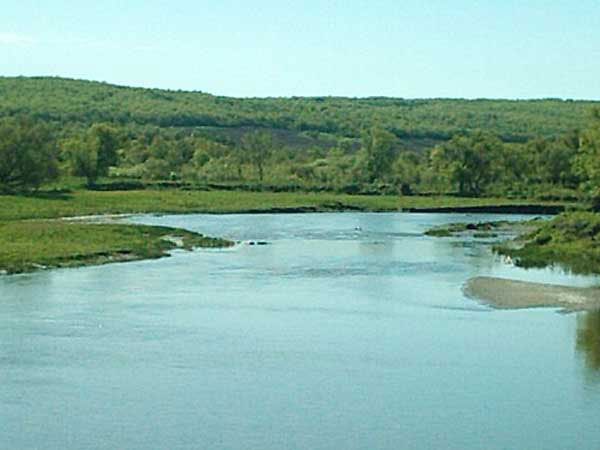
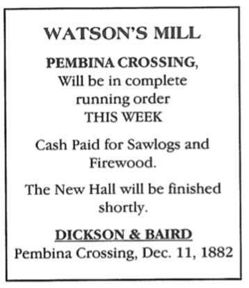
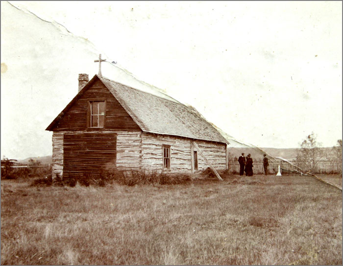
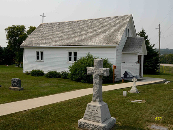
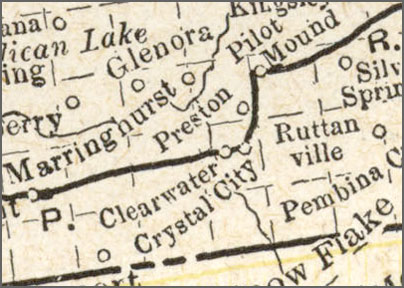 At the time this map was drawn in the early 1890’s, Neelin (near the site of Roseberry) was not yet created, an Glenora was just a Post Office south of where the town would be located.
 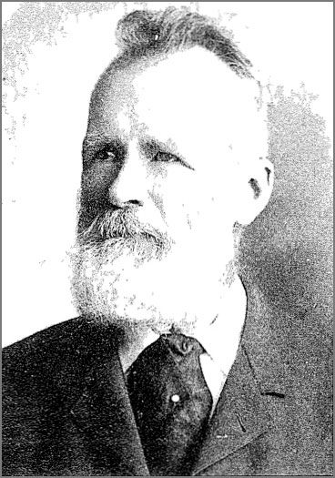 R.S. Preston During 1881 the mills were burned down. The sawmill was later rebuilt in the valley, but only operated for a short time as Mr. Preston had the misfortune of having his arm cut off by the saw.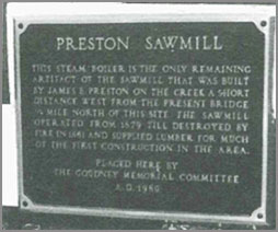
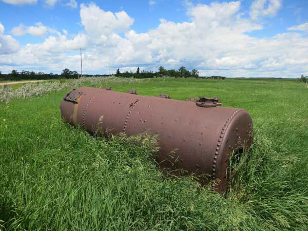
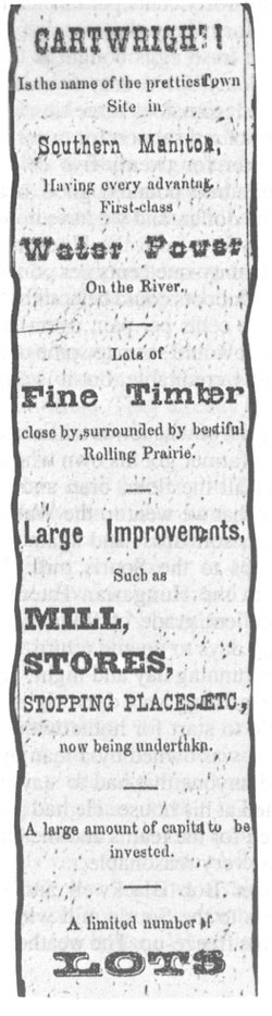 Cartwright
Railway Towns
Emerson / West Lynne
Manitoba City / Manitou
Darlingford
Morden, Winkler & Altona
La Riviere
Killarney
Holmfield
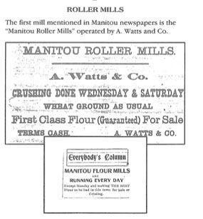 This ad appeared in the Manitou paper in 1885. We don’t know if John McIntosh bought it, or whether it had already ceased operation. Either way, the name lived onThe Manitou Creamery and Cheese Factory CompanyThe cheese factory was managed by Mr. Story and Mr. Boyle. After initial reluctance of Winnipeg outlets to pay a fair price, the superior quality of the product was eventually recognized in Winnipeg and good prices were offered.Pump FactoryIn January 1885, the Manitou Mercury reported that Mr. Lane had a pump factory, which had been a successful operation for some time.In 1889, H. C. Pierce also opened a pump factory. He sold out to C. R. Gordon in 1891 and went to Hartney to set up another pump factory.In the fall of 1888, John C. Findlay opened a wagon shop on Ellis, adjacent to Waldie and Scott’s implement business. It became a steam pump factory for which he imported Tennessee white wood, apparently, the best material to use.Sash and Door FactoryTwo sash and door factories once operated in Manitou.Carriage MakersAlfred Morris and Jonathan Hughes were both carriage makers who operated out of Manitoba City, after starting out in Archibald.In 1908 Joe Cumberland has opened a general carriage and repair shop.Allan and Pilgrim Soda Water Works;Messrs. Allan and Pilgrim began the bottling of Cream Soda 1885. Mr. Pilgrim died in December of that year while Mr. Allan continued to operate the factory until April of 1887.ArchibaldOne route settlers might follow to get to the area near Manitou, was the Brandon House Trail, one used by fur traders at based a Pembina. In 1878 Alexander Bethune travelled this way to his homestead. He opened a store and a Post Office was opened in the home of neighbour, Mr. Davidson. Although that was the extent of the buildings in the “village” of Archibald, there were a few businesses nearby, including a second store. J. Hughes was listed as a carriage maker, as was A. Morris.Press ClipsS: Commercial, April 8, 1884, p. 545.
“Mr. W. Thompson and Mr. Brown, have undertaken to erect an oatmeal mill, at Manitou, of 125 barrels capacity, for a bonus of 10,000 bushels of oats, to be completed and running by the 1st of November next.”S: Nwfm, December 1889, p. 340.
“A meeting was recently held at Manitou to discuss the advisability of trying to induce A. Watts and Company, of Brantford, Ontario, to move their grist mill from Norquay to Manitou. After discussion and conference with the representatives of A. Watts, and Company, a committee was appointed to canvass the town and district for subscriptions for a bonus of $600 to pay the expenses of moving the mill. The mill can be in running order by May 1 next.”S: Nwfm, March 1890, p. 433.
“The building at Manitou, into which the machinery of the Norquay Grist Mill is to be removed, is about completed, and the mill will soon be running.”S: Nwfm, April 1890, p. 461.
“The boiler for Manitou, Manitoba grist mill has arrived there from Brantford. Work on the Mill is progressing rapidly under the management of George Ullyott.”S: Nwfm, June 1890, p. 522.
“The new mill being built at Manitou will have five set of rolls. J.D. McIntosh has purchased an interest in the mill and with his brother will manage the business.”
This ad appeared in the Manitou paper in 1885. We don’t know if John McIntosh bought it, or whether it had already ceased operation. Either way, the name lived onThe Manitou Creamery and Cheese Factory CompanyThe cheese factory was managed by Mr. Story and Mr. Boyle. After initial reluctance of Winnipeg outlets to pay a fair price, the superior quality of the product was eventually recognized in Winnipeg and good prices were offered.Pump FactoryIn January 1885, the Manitou Mercury reported that Mr. Lane had a pump factory, which had been a successful operation for some time.In 1889, H. C. Pierce also opened a pump factory. He sold out to C. R. Gordon in 1891 and went to Hartney to set up another pump factory.In the fall of 1888, John C. Findlay opened a wagon shop on Ellis, adjacent to Waldie and Scott’s implement business. It became a steam pump factory for which he imported Tennessee white wood, apparently, the best material to use.Sash and Door FactoryTwo sash and door factories once operated in Manitou.Carriage MakersAlfred Morris and Jonathan Hughes were both carriage makers who operated out of Manitoba City, after starting out in Archibald.In 1908 Joe Cumberland has opened a general carriage and repair shop.Allan and Pilgrim Soda Water Works;Messrs. Allan and Pilgrim began the bottling of Cream Soda 1885. Mr. Pilgrim died in December of that year while Mr. Allan continued to operate the factory until April of 1887.ArchibaldOne route settlers might follow to get to the area near Manitou, was the Brandon House Trail, one used by fur traders at based a Pembina. In 1878 Alexander Bethune travelled this way to his homestead. He opened a store and a Post Office was opened in the home of neighbour, Mr. Davidson. Although that was the extent of the buildings in the “village” of Archibald, there were a few businesses nearby, including a second store. J. Hughes was listed as a carriage maker, as was A. Morris.Press ClipsS: Commercial, April 8, 1884, p. 545.
“Mr. W. Thompson and Mr. Brown, have undertaken to erect an oatmeal mill, at Manitou, of 125 barrels capacity, for a bonus of 10,000 bushels of oats, to be completed and running by the 1st of November next.”S: Nwfm, December 1889, p. 340.
“A meeting was recently held at Manitou to discuss the advisability of trying to induce A. Watts and Company, of Brantford, Ontario, to move their grist mill from Norquay to Manitou. After discussion and conference with the representatives of A. Watts, and Company, a committee was appointed to canvass the town and district for subscriptions for a bonus of $600 to pay the expenses of moving the mill. The mill can be in running order by May 1 next.”S: Nwfm, March 1890, p. 433.
“The building at Manitou, into which the machinery of the Norquay Grist Mill is to be removed, is about completed, and the mill will soon be running.”S: Nwfm, April 1890, p. 461.
“The boiler for Manitou, Manitoba grist mill has arrived there from Brantford. Work on the Mill is progressing rapidly under the management of George Ullyott.”S: Nwfm, June 1890, p. 522.
“The new mill being built at Manitou will have five set of rolls. J.D. McIntosh has purchased an interest in the mill and with his brother will manage the business.” 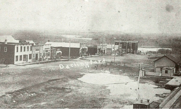 Darlingford 1909The new site of Darlingford grew quickly along the railway line. Along with the usual stores and services there were two brickyards. About 1898 Whalen’s Brick & Tile operated just west of the village. It must have been quite an operation for the CPR ran a spur out to the site, and he employed about ten people for a time. Although the bricks were of a good quality, the operation didn’t last.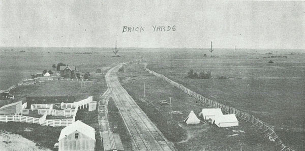
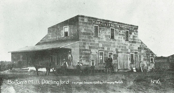
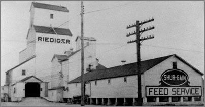
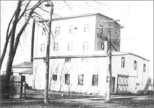 The mill in Winkler
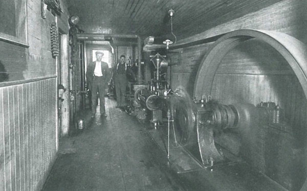 Mill owners Isaac and David Fehr in the ”machine room”, which housed a steam engine and this large pulley which drove the mill’s various cleaning, grinding, and other machinery.
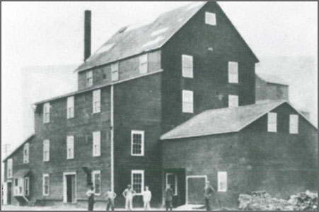 The Altona mill in its heyday in the 1905 was the town’s main industry. This photo shows the mill built by Peter Braun before the turn of the century, when it was owned by David and Isaac Fehr, after the large three-storey addition had been built.
 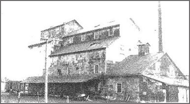 Friesen Flour Mill around 1900. Owned then by Jacob. P. FriesenA report in the Altona History tells us that:“Activity around the Friesen & Sons Flour mill was hectic. Around the clock shifts were needed to keep up with the demand placed on the mill by farmers and others who were getting ready for winter. Up to 3300 bushels of Wheat were ground daily.”
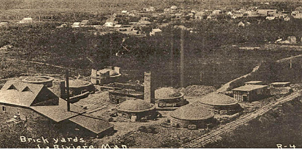 A view, ca. 1903, looking west showing the mixing and pressing building on the left and the kilns of La Riviere’s Press Brick & Tile Company. (Courtesy Turning Leaves. A History of La Riviere and District, frontispiece)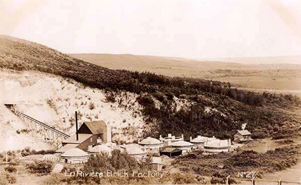
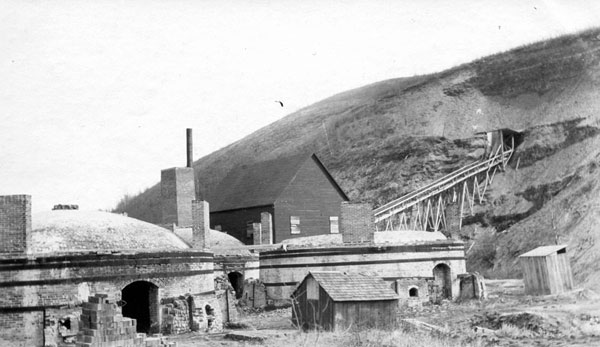
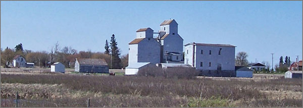 The Harrison Mill, prominent on the skyline of the small village of Holmfield.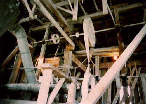
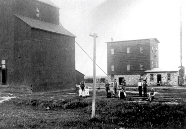
Conclusions
| And in summary…. As the population of rural Manitoba grew rapidly in the 1880’s, thousands of small businesses, designed to service their needs, sprang up across the province. Many of these efforts were very useful in the conditions prevalent in those days when importing goods was expensive and, perhaps, not even an option. In an era, and in a geographical situation, whereby a homemade product was the natural answer to a shortage of consumer goods, it was only logical that those with an entrepreneurial turn of mind would venture into manufacturing. Many of those ventures failed to turn a profit, many others existed only for a short time. Is that any different from the world of small business today? The first big change happened very soon. By 1900 the larger share of communities were serviced by a railway. With this came increased consumer choices and lower prices for many goods. Improved transportation brought convenience. When you could just ship your wheat crops to the elevator and pick up a sack of flour at the grocery store, you saved time, as well as money. Then, as now, consumers gravitated toward the more inexpensive product produced by the large urban factories. The large urban companies also had the advantage of large capital reserves, greater access to credit, and greater marketing budgets. Brand names became a thing. At present, the same forces of economy of scale and cheap transportation have changed manufacturing across Canada. In addition to those forces, rural Manitoba faced another challenge. In a process that continues to this day, in many regions population is in decline. The twin forces of faster transportation and ever improving, labour-saving technology, meant that the family farm kept growing in size, while even the size of the farm family kept shrinking. There weren’t enough customers to go around. What seems interesting today is that there is a new-found interest in local production that echoes the forces that made it necessary in 1880. Concern about climate change leads to concern about the effects of our long supply chains on carbon emissions. Concern about standards and about quality is reviving an interest in knowing where our food is produced, and how it is produced. Events like the pandemic we are currently facing renew an interest in food security. Artisans and craftsmen sometimes find a niche in small towns where the lifestyle reflects their values. Who knows where it might lead? |
We have a selection of Local History Projects available as pdf files, free upon request.
Some projects are also available through the website of the Manitoba Historical Society as well.
1000 Words: Pioneer Photographers in the Southwest Corner
Shelterbelts in Manitoba
Cherry Point
Brenda – Waskada
Schools & Heritage Sites in Brenda-Waskada
Local History Handouts – Brenda-Waskada
Boissevain – Morton
Special Places in Boissevain (An Inventory of Heritage Sites)
Grassland
We Made Hartney (Short Bios)
Grassland – An Overview of Our History
Pivotal Events in Hartney – A Timeline
Hartney’s Notable People – An Inventory
Special Places in Grassland Municipality (An Inventory of Heritage Sites)
Schools in Grassland Municipality
Local History Handouts – Elgin Area
Melita
We Made Melita – Short Bios
Special Places in Melita – An Inventory
Melita’s Notable People – An Inventory
Killarney-Turtle Mountain
Killarney Stories
Killarney’s Notable People (An Inventory)
Special Places in Killarney (Highlights)
School Sites in Killarney-Turtle Mountain
Two Borders Municipality
The Captain Large Story – A Steamboat Built in Coulter?
Sourisford
Special Places in Two Borders – An Inventory