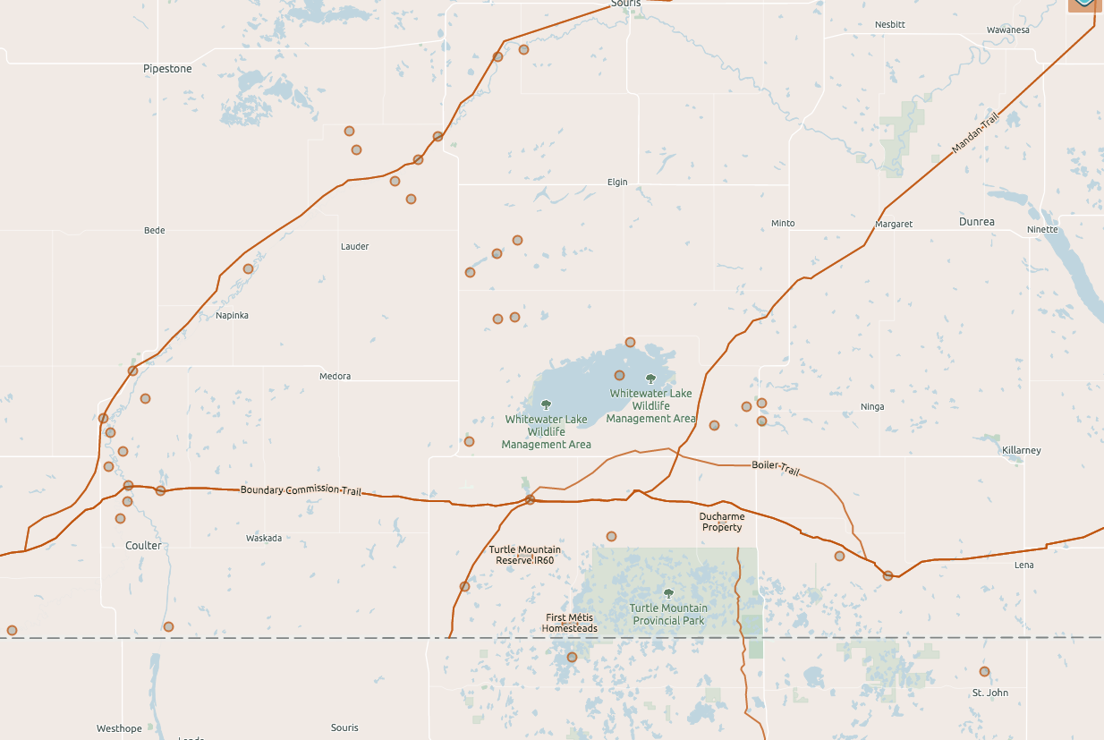
Explore the Interactive Map to discover the history of southwestern Manitoba like never before. The map is a tool that helps the user explore human occupation and development in southwest Manitoba. It is also a guide to the heritage sites in the region and can help you plan a visit or day out.
The map is the main entry point to our online Heritage Explorer database which also includes additional details about geographic features shown on the map and a collection of text and audio stories.
Interactive Map Guide
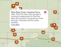
We have created a database of heritage sites that appear on the map based on the Themes and Categories you select, and in the future where you place the Time Slider. Clicking on a site will bring up a balloon, offering a date range for that particular site and a sentence-long description. Click on the “More” button at the bottom of the balloon to read the article associated with the site. (Note: not all sites have stories attached to them.) Clicking on the “More” button will also provide further information about the site, such as its physical status (whether or not there is anything to see at the site) and accessibility.
Some explanatory notes about how the Interactive Map has been designed:
Themes
Sites with common cultural or time-specific qualities have been grouped together. Choose between the following themes (or click on several of them): European Settlement Post Railroad, European Settlement Pre Railroad, First Nations Activity, Fur Trade, Metis Activity, Railways, Trails.
Categories
Sites that fall into easily defined categories have been grouped together. Any item that does not fall into a specific category is referred to as a “Generic Item.” The Categories are: Post Offices, Archaeological Sites, Embryo Towns (towns that existed for a few years before the railway came but no longer exist), Cemeteries, Schools, Hamlets and Churches.
Accessibility
Plan a visit to any of the sites on the map by selecting this field to find out what is accessible to the public. Click on each site to find out if anything remains to be seen there. Sites that appear when the Present Day Attraction option is selected indicates that the site is open to the public and may have been developed as a tourist attraction. There are likely services such as restrooms, easy parking, informational signage etc. Publicly Accessible indicates that the site is available to be visited, but has not necessarily been developed for that purpose. Publicly Visible indicates that the site is visible from the road, but is located on private property. Visitors are asked not to trespass. No Public Access indicates that the site is located on private property and cannot be visited by the public without permission from the landowner. Please respect private property and do not trespass.
Local Services
Take advantage of this feature to find out what local services are nearby the heritage sites you want to visit. Find out where the Museums, Gas Stations, Grocery Stores, Restaurants and Accommodation options are in the region.
Time-Sliding Scale – Coming Soon!
We are developing a time-slide scale that will be located at the bottom of the map. This will allow users to select a slice of time from history to see what the landscape looked like then. The time slider is in it’s “off” position when it is at the far left side of the slide bar (beyond “BC”). Make sure that all Menu options (Themes, Categories, etc) are unchecked before using the slider.
Start exploring the Interactive Map now!
Note: Points on the map are concentrated inside the boundaries of the Municipalities of Two Borders, Grassland, Brenda-Waskada, Deloraine-Winchester, Boissevain-Morton and Killarney-Turtle Mountain. These Municipalities, along with the town of Melita, lend us their support and research has been focused on these areas. Some site information, trails and railways have been continued outside of these boundaries for contextual reasons.