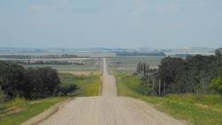
A Landmark
The geographic feature known as Turtle Mountain has long been noted and referred to in the diaries and maps of early explorers as a major landmark and important landform of this corner of the prairies. It rises from a smooth plain 1,500 feet above sea level, to an elevation that varies between 2,200 and 2,400 feet above sea level (660m and 720m). What is known as the Turtle's Head at the western end of Turtle Mountain is the second highest point in all of Manitoba at 2,450 feet (735m).
There is a Dakota legend that describes the formation of Turtle Mountain. It goes like this: Once a great turtle began on a long journey from the Big Water (Atlantic Ocean) to the western ocean (Pacific Ocean). Just before the turtle reached the Souris River it grew too tired and died. It's body grew and grew into the formation we now know as Turtle Mountain.
Geology
In geographic terms, the topography of Turtle Mountain is due in part to erosion and in part to glacial deposition. There is also a theory that volcanic activity played a part in Turtle Mountain's formation, and warm springs on the mountain form the basis of this belief. Approximately two kilometres of sediment and sedimentary rocks overlie the Precambrian “basement” beneath Turtle Mountain. This overlay consists of layers of sand, silt and seams of lignite coal. Erosion over millions of years reduced the height of the mountain before glacial ice covered it.

As the ice thinned and melted with rising temperatures, debris that was carried by the glaciers was deposited over Turtle Mountain. These deposits measure about 150 meters in thickness and sit atop older deposits and the eroded base. By about 12,800 years ago Turtle Mountain was free of ice. As the glacier retreated it carved many shallow lakes and wetlands into the mountain and sculpted the gracefully rolling hills and dales. Ravines were carved by streams of rain and run-off waters flowing from the high forested altitudes to the low pasture plains.
Human Use
Credible evidence suggests human occupation or use of Turtle Mountain dating back 10,000 years. First to walk the area was the hunter-gatherer Clovis and Folsom peoples. They passed through while hunting the mammoth in the wake of the ice age. Following First Nations hunting groups subsisted on herds of plains bison, an economy that lasted hundreds of years. About 1,000 years ago the mysterious Mound Builders left their mounds as the only evidence of their passing.
Pierre de LaVérendrye is the first known European to cross the plains between Turtle Mountain and the Souris River. He made his first journey in 1738 and upon seeing Turtle Mountain described it as the “Blue Jewel of the Prairie”. During his visit to the area he found it occupied by Assiniboine First Nations. Later, in the 1860s, some Dakota moved north across the border from Minnesota and North Dakota to escape conflict with the American cavalry. They made their home on Turtle Mountain. The Red River Métis hunted on the plains to the north of Turtle Mountain (Metis Bison Hunts) and settled in the bush of the mountain itself (The Metigoshe Metis Community). Fur traders set up posts near and on the sides of the mountain long before European settlement exploded in earnest after 1880.
A series of forest fires have swept through Turtle Mountain's bushland, leaving behind a wasteland of charred scrub. After the fire of 1898, Arbor Island in Max Lake was the only portion of the mountain to escape unscathed. Today, the forest and bushland of Turtle Mountain and its escarpment offer a safe refuge for a vibrant ecosystem made up of a variety of plants, animals, birds, insects and prospering farms and homesteads.
. . . . .
Author: Teyana Neufeld, 2009.
Sources:
Ens, Gerhard. Killarney Area Planning District Heritage Report. Historic Resources Branch. 1982. Turtle Mountain Conservation District.
Wright, Norman E. “In View of Turtle Hill.” Norman Wright Fonds MG8 / A4. Boissevain Community Archives.
